Pam Hawley Marlin
June 2024
"Through the fair primeval forest we wandered, following the old Alachua Trail, the very name of which enhanced the charm of the present scene by calling up thrilling fancies of the past; for this is the famous Indian war-path from the hunting-grounds of the interior to the settlements on the frontier, and may well be the oldest and the most adventure-fraught thoroughfare in the United States." -Lippincott's Magazine (1880)
 Country Road 234 stretches south from State Road 26,
traversing Windsor, Rochelle, and Micanopy. This road is the best
preserved segment of the Alachua Trail in Florida. P. Marlin 2024
Country Road 234 stretches south from State Road 26,
traversing Windsor, Rochelle, and Micanopy. This road is the best
preserved segment of the Alachua Trail in Florida. P. Marlin 2024
Prior to European settlement in Georgia and Florida, the "Alachua Trail" held significant historical importance as a key pathway for early Native American hunting and trading expeditions. Originating at the Altamaha River in Georgia, this sandy trail wound its way through swamps, pine barrens, and sandy ridges before reaching the level green plain of the Alachua Savanna (Paynes Prairie) and the Seminole settlement of Cuscowilla (Micanopy) in Florida. The "Trail Ridge," an extensive elevated stretch of sandy terrain extending from the Altamaha River to the Santa Fe River in Florida, provided a natural path for the trail, avoiding coastal lowlands.
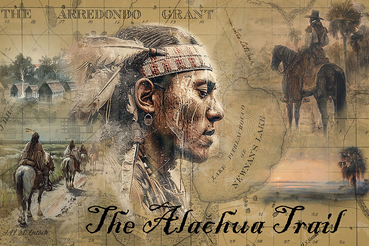 The Alachua Trail. P Marlin 2024
During the early European and American periods, the Alachua Trail held considerable importance for pioneering settlers as a cart-road, highlighting its status as a well-established route. Despite being well-established, travelers faced various challenges with dry stretches of soft sand as well as wet areas that proved difficult for horse-drawn vehicles. Throughout its existence, the trail was a frequent target for Native American raids and skirmishes, reflecting the conflicts between indigenous tribes and European settlers in the area. Additionally, the trail became an escape route for runaway slaves in search of refuge with Native Americans, as well as fugitives fleeing justice. During the Seminole Wars, the trail became an important military route. Through this era of change, the Alachua Trail emerged as both a vital lifeline for some and a perilous route for others, profoundly influencing the lives and interactions of people throughout the Southeastern United States.
My recent research into the history of the Providence Methodist Episcopal Church in Windsor, Florida, revealed references to the "Old Alachua Trail," which passed within a short distance of the church. Unfamiliar with the trail, I was intrigued to discover that the trail's most intact segment passed through Windsor, a route I travel frequently. This revelation directed me towards the work of Burke Vanderhill. Vanderhill, a professor of geography at Florida State University, was challenged with the task of locating what remained of the original Alachua Trail in the 1970s.
In April 1977, Vanderhill's research was published in the Florida Historic Quarterly titled, The Alachua Trail: A Reconstruction. According to Vanderhill, European colonialists and American pioneers often followed established Native American paths and adapted them for wheeled traffic. Some of these paths later became wagon roads and, eventually, motor roads. Through Vanderhill's examination of maps and historical references, he discovered that portions of the old trail did indeed survive into the 20th century.
 The Bowen Map
Digital Library of Georgia
The Bowen Map
Digital Library of Georgia
In his publication, Vanderhill states that "The earliest cartographic portrayal of the Alachua Trail was on the Bowen map of 1748, which shows a trail leading in a southerly direction from the Altamaha River, within the "lands of the Yamacraw and the Yamassee," and terminating vaguely along the St. Johns River of Florida. Following the British aquisition of Florida, John William Gerard de Brahm and Samuel Savery were commissioned for surveys of Florida. DeBrahm's 1766 survey referred to the route to Alachua as the "Latchokowae Path," while Savery's 1769 map indicated the same path to Alachua as "Latchaway Path."
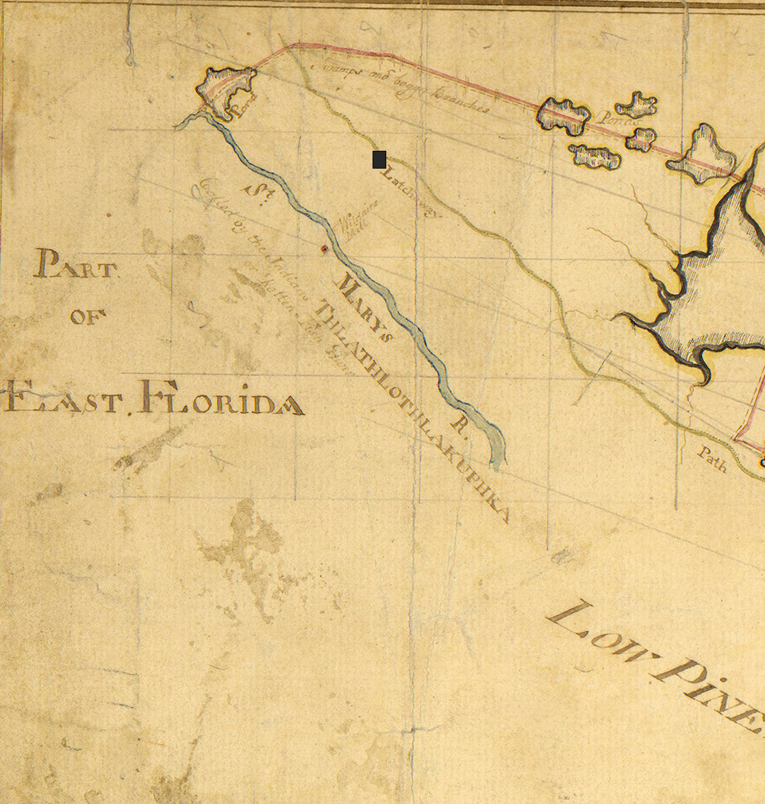 A section of the Samuel Savery Map of 1769 illustrates "Latchaway Path"
near the St. Mary's River.
The St. Mary's River, serving as today's border
between Florida and Georgia, was once called "Thlathlothlakuphka" a Native
American name meaning "rotten fish."
University of Michigan Library
A section of the Samuel Savery Map of 1769 illustrates "Latchaway Path"
near the St. Mary's River.
The St. Mary's River, serving as today's border
between Florida and Georgia, was once called "Thlathlothlakuphka" a Native
American name meaning "rotten fish."
University of Michigan Library
Inspired by Vanderhill's research, my husband and I embarked on a journey to trace the remnants of the Alachua Trail as it exists today. Our exploration of the trail commenced in Doctortown, Georgia. From Doctortown we journeyed south through Penholoway Creek, Atkinson, Burnt Fort, Coleraine, and Camp Pinckney, with the latter two located on the St. Mary's River. The original trail crossed the St. Mary's River near Coleraine, passing through Florida near Hilliard, Brandy Branch, and Macclenny before arriving at Kingsley Lake along Florida's Trail Ridge.
From Kingsley Lake, the trail led south to Waldo, intersecting with the old Newnansville road. Heading further south, the trail wound its way through forests until reaching North East State Road 26, where it connected with Florida's best-preserved trail segment known as Country Road 234. Country Road 234, a picturesque paved route, traverses the quaint towns of Windsor and Rochelle before skirting the southern edge of Paynes Prairie on its journey toward its ultimate destination in Micanopy.
Following Vanderhill's narrative, our journey along the Alachua Trail visually captures his initial findings. The exploration of the trail takes one on a journey into the heart of Florida and Georgia's earliest history. Though it is impossible to track the earliest traces of the trail, historic maps provide a general idea of the trail's original path.
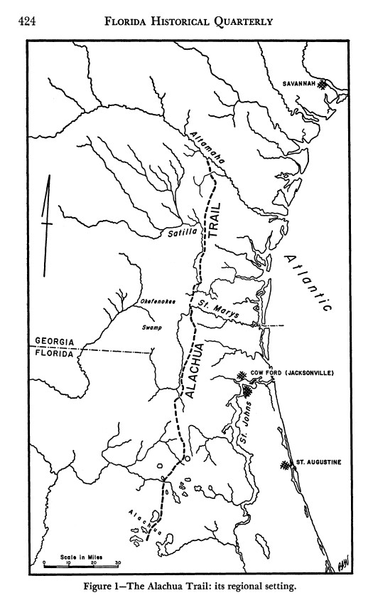 Burke Vanderhill's map of The Alachua Trail sourced from
"The Alachua Trail: A Reconstruction"
Burke Vanderhill's map of The Alachua Trail sourced from
"The Alachua Trail: A Reconstruction"
An 1818 map displayed below depicts the path of the Alachua Trail traversing Georgia. Beginning at an original Native American settlement at Doctortown, the trail extends southward along a prominent sandy ridge, east of the Satilla River, reaching the St. Mary's River Crossing near Coleraine. Along the route, notable stops include (1) Doctortown on the Altamaha River, (2) Penholoway Creek Crossing, (3) Gardi and Pendarvis, (4) Trail Ridge, Atkinson, and Old State Route 259, (5) The Old Post Road / Mid River Road (Road 27), (6) Burnt Fort, (7) St. Mary's River Crossing at Coleraine and the King's Road, (8) St. Mary's River Crossing at Camp Pinckney.
 The first eight stops of the Alachua Trail are indicated
on the State of Georgia map (1818). Dave Rumsey Maps
The first eight stops of the Alachua Trail are indicated
on the State of Georgia map (1818). Dave Rumsey Maps
VANDERHILL: "By the time of the Savery survey, an Indian settlement called Doctor's Town had been established on the south bank of the Altamaha opposite the point where "Doctor's Path" reached the river from the north. The site is a short distance down stream from the present U.S. Highway 25 bridge on the out skirts of Jesup in Wayne County. It was from Doctor's Town that the trail to Alachua plunged across the wilderness of the upper Satilla River area to reach the St. Marys. There is no sign of the old Indian trail along the Altamaha today, but a Doctortown remains, presently a railroad yard office and bridgehead." 1
---------------Doctortown (Doctor's Town) traces its origins to a former Native American settlement where a significant chief, Captain Aleck, once made his home. In the Creek language, "Aleck" carries the meaning of "doctor," possibly indicating his esteemed role within the community. This settlement grew alongside a centuries-old crossing site on the Altamaha River, depicted on the 1818 map as "an old Indian Chief's hut," likely Captain Aleck's residence. The establishment of Doctortown bears witness to the historical significance of the indigenous presence in the region.
Following the Civil War, Doctortown emerged as a pivotal industrial hub in South Georgia, particularly within the timber and paper sectors. The area saw the establishment of extensive sawmills and eventually became home to the world's largest pulp mill, Rayonier Mill, in 1992. The mill stands as the sole remaining feature in the town today.
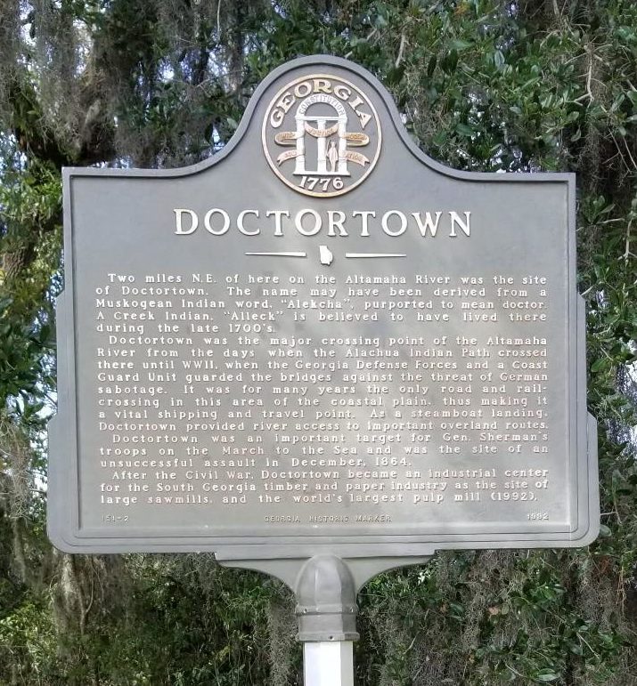 Doctortown, Georgia Historic Marker
 A view of the Altamaha River crossing at Doctortown.
P Marlin 2024
A view of the Altamaha River crossing at Doctortown.
P Marlin 2024
 Doctortown, Georgia. P Marlin 2024
VANDERHILL: "The Alachua Trail, upon leaving the Altamaha, skirted Penholloway Swamp to reach Penholloway Creek several miles above its mouth where low bluffs approached the stream on either side. The name Penholloway is thought to derive from a foot-log (log bridge) once located at this point. There is little doubt that the position of the present bridge near Bethlehem Church closely approximates the former Indian crossing place. Early nineteenth-century sources such as the Sturges and Bonner maps show a wagon road connecting Doctor's Town with Coleraine on the St. Marys, generally adhering to the route of the Alachua Trail. This road crossed the Penholloway at or near the modern bridge site." 1
---------------Departing from Doctortown, we proceeded south on Highway 301 to Bethlehem Church Road. Vanderhill notes that Bethelehem Church Road likely parallels the Alachua Trail. Driving past the Bethlehem Baptist Church, we crossed the John Henry Lane Jr. Memorial Bridge spanning Penholoway Creek. For the past two centuries, Penholoway has been spelled in various ways, including Finn Halloway, Finhalloway, Phaenhalloway (Savery), and Phennohaloway (DeBrahm). This area would have been a busy crossing point along the Alachua Trail.
 A section of the 1769 Samuel Savery Map illustrates the "Phaenehalloway Swamps."
University of Michigan Library
A section of the 1769 Samuel Savery Map illustrates the "Phaenehalloway Swamps."
University of Michigan Library
 The Bethlehem Baptist Church is located on Bethlehem Road, near the Penholoway Creek bridge. P Marlin 2024
 Penholoway Creek Bridge. P Marlin 2024
VANDERHILL: "The trail must have passed north of the present community of Gardi, thence roughly along the route of U.S. Highway 25 to a point still locally identified as Pendarvis. This was called Pendarvis Store on maps of the mid-nineteenth-century and was established on the wagon road out of Doctor's Town. Pendarvis is now only a railroad siding, but a woods road running for several miles in a southerly direction from this point may represent a vestige of the former trail route."
---------------Continuing our journey, we traveled south from the Penholoway Creek bridge toward the quaint community of Gardi, located on Highway 341. The Alachua Trail extended into the woods east of Gardi. From Gardi, we continued three miles east on highway 341 to the location of Pendarvis, once the site of the "Pendarvis Store," a remote trail stop. The Pendarvis Store, owned by Caleb Pendarvis, was established as a Post Office in 1849. For many years, the Pendarvis Store remained a solitary landmark on maps, serving as a pivotal rest stop for countless travelers. However, by 1876, the Jesup Sentinel reported that "Mr. G.W. Horton announces his intention to discontinue the Post Office at Pendarvis, with no one slated to take his place, leaving little doubt that the office would soon cease operations."
Today, nothing remains at this site save a sign marking "Pendarvis Road" and railroad tracks. Potentially, the trail continued south on Pendarvis Road (indicated as a woods road by Vanderhill) to the vicinity of Atkinson and Old State Route 259.
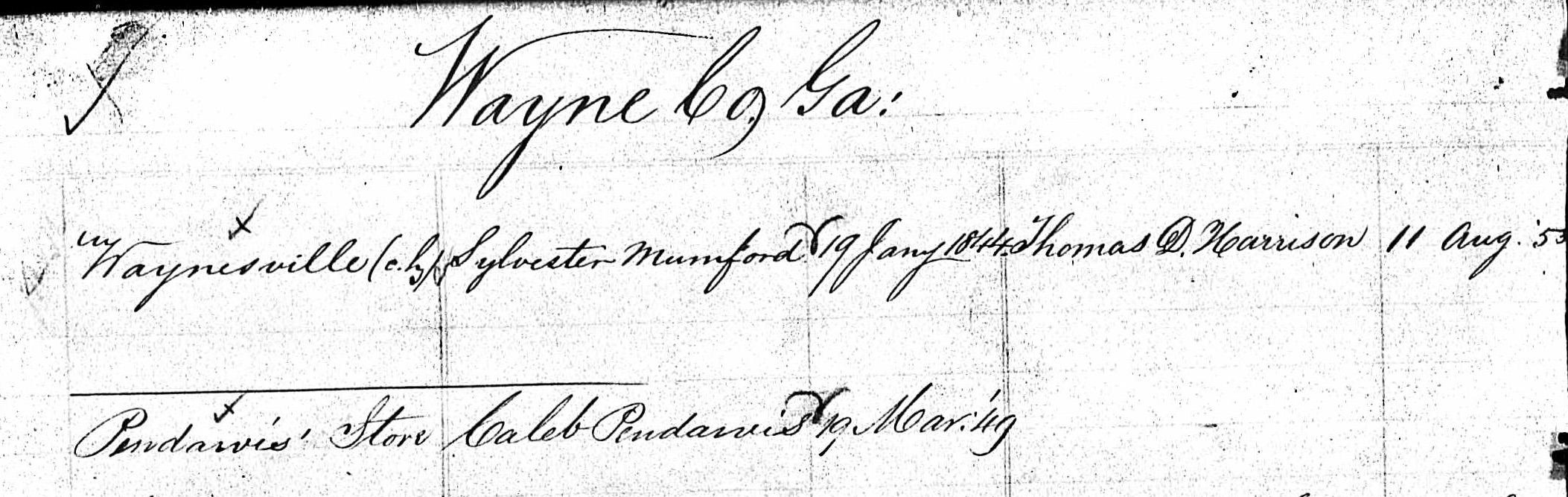 Appointments of US Postmasters 1832-1971. Ancestry.com
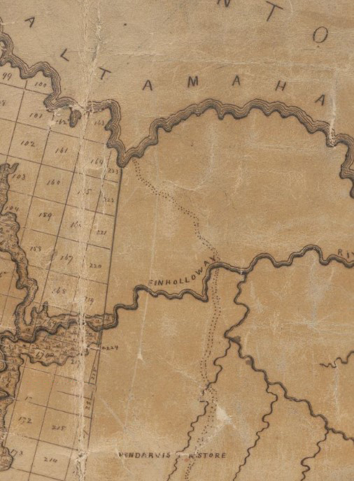 An 1867 map of Wayne County, Georgia, illustrates the Alachua Trail
as a dotted line through the Finholloway Swamp southward to the Pendarvis Store.
Georgia Archives
An 1867 map of Wayne County, Georgia, illustrates the Alachua Trail
as a dotted line through the Finholloway Swamp southward to the Pendarvis Store.
Georgia Archives
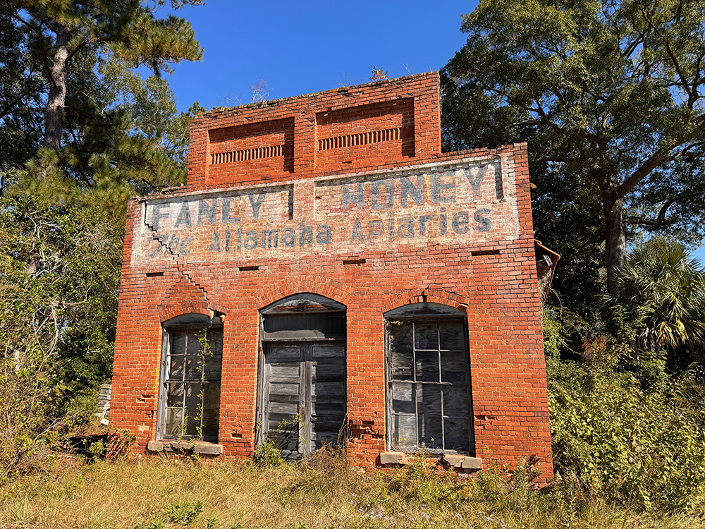 An abandoned building in Gardi from a later time period. P Marlin 2024
 The Pendarvis Road sign. P Marlin 2024
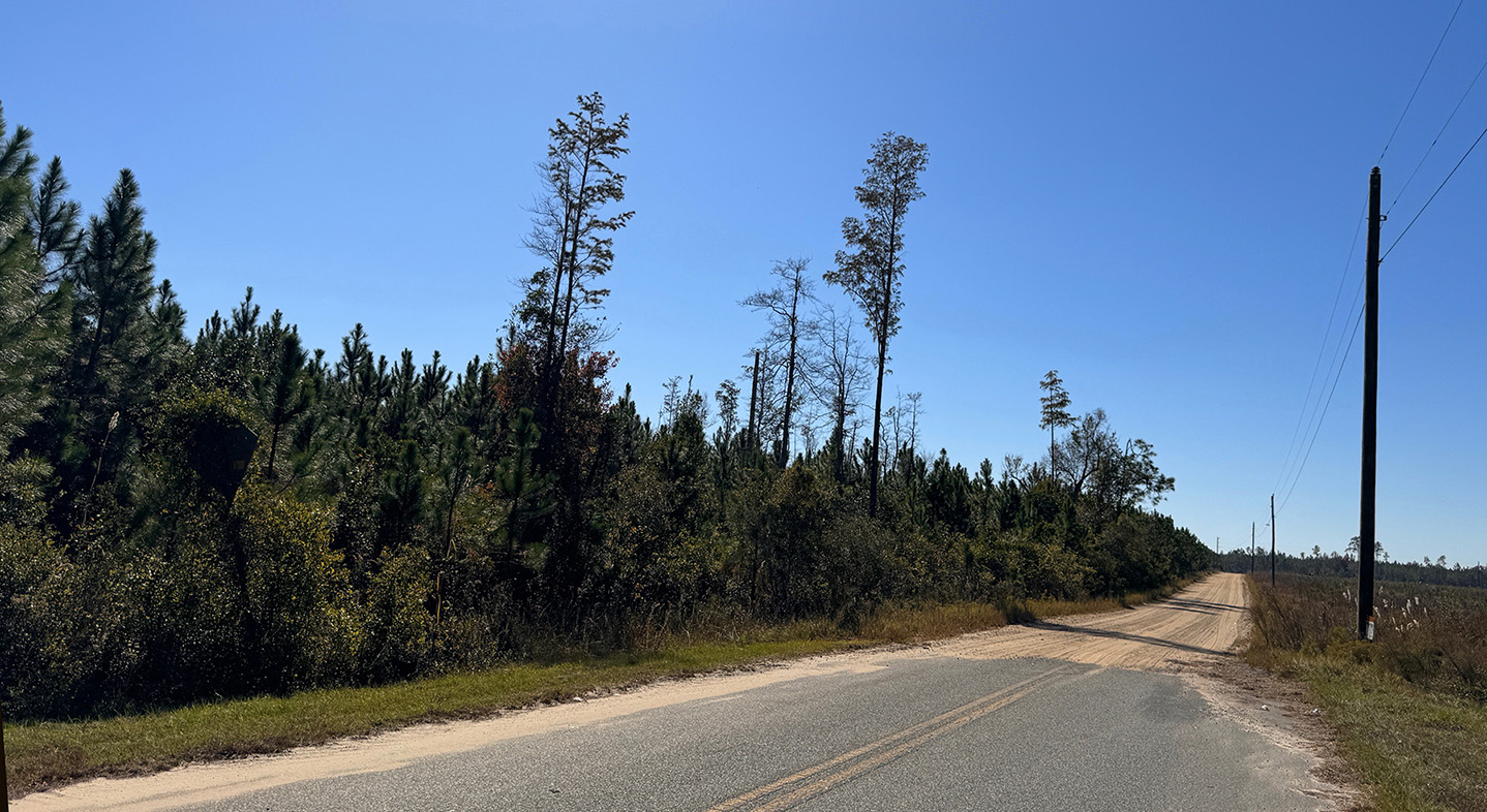 The Pendarvis Road traverses south, aligning with the original Alachua Trail. P Marlin 2024
VANDERHILL: "From the Pendarvis area the Alachua Trail followed a course avoiding most of the eastern feeders of the upper Satilla. The river ultimately makes a great bend to the east, and the trail reached a convenient fording place at what was identified, at least by the late eighteenth century, as Burnt Fort. While some of this portion of the Alachua route has been abandoned in the last fifty years, a segment about twelve miles in length remains in the form of country road 259 running from the village of Atkinson, in Wayne County, south into neighboring Camden County. Road 259 finally veers eastward toward Tarboro and forsakes the Indian Trace, but a lane providing access to a landing on the Satilla River extends the trail alignment a short distance."
---------------As we approached Old State Road 259 at Atkinson, we ventured a short distance west to the "Trail Ridge" historic marker. Stretching from the Altamaha River to the Santa Fe River in Florida, the "Trail Ridge" is a lengthy expanse of sandy terrain, sitting at an elevation of 160 feet above sea level. This elevated terrain served as a natural route for travelers on the trail as it avoided the coastal lowlands.
Returning to Old State Route 259, we continued south until we intersected with the "Old Post Road," and the Bickley Chapel. Highway 259 continues east, however, the Alachua Trail likely heads south closely aligning with the "Old Post Road" and Mid River Road (Road 27) until it intersects with Highway 252 (Burnt Fort Rd) as it heads west toward Burnt Fort and the Satilla River crossing.
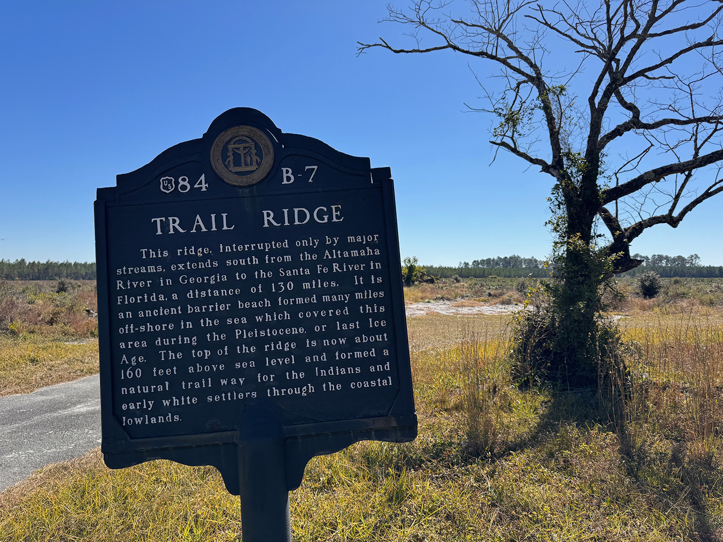 The "Trail Ridge" Historic Marker. P Marlin 2024
 Old State Road 259 south of Atkinson (photo through car window). P Marlin 2024
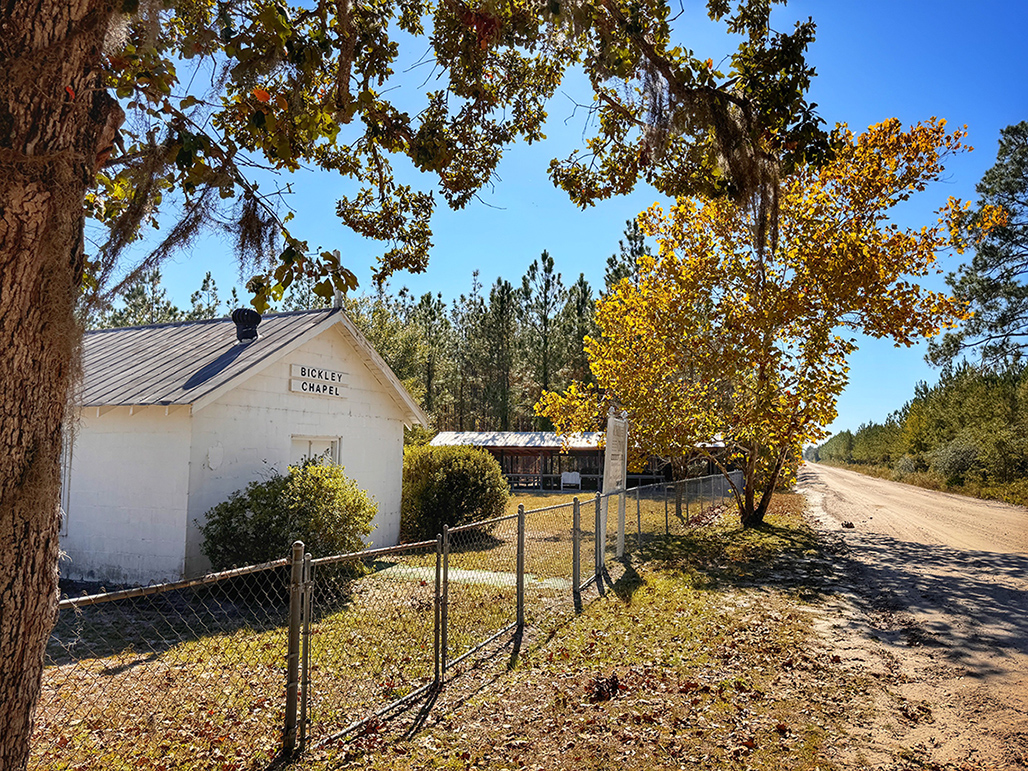 The Bickley Chapel at the intersection of Old State Road 259 and the Old Post Road. P Marlin 2024
As mentioned prior, the Old Post Road continues as a dirt road eventually transitioning to Mid River Road (Road 27). It's likely that the Alachua Trail aligned with the Old Post Road until it intersected with Highway 252, also known as the old Burnt Fort Road. At Burnt Fort Road, the original trail turned west toward the Satilla River crossing.
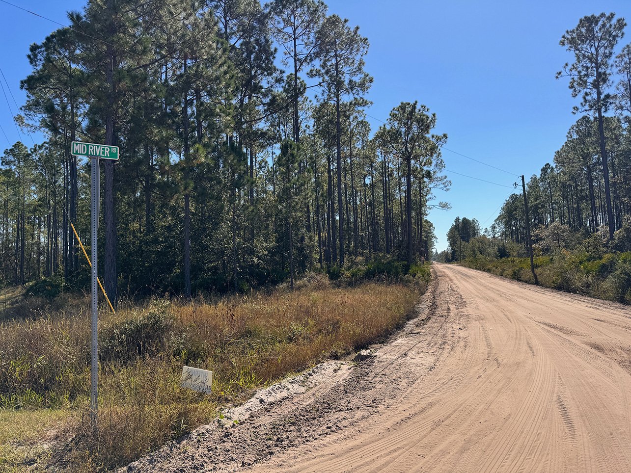 The intersection of Mid River Road and Burnt Fort Road. P Marlin 2024
VANDERHILL: "The origins of Burnt Fort are obscure but it may have been a Spanish outpost. Its site atop a bluff overlooking the Satilla indicates that this point was perceived to have strategic value and suggests that the river crossing was a well-established one. The swamp which occupies the floor of the incised valley of the Satilla narrows at Burnt Fort, thus facilitating the crossing here. State highway 252 presently bypasses Burnt Fort on the south, its bridge no more than a few hundred feet downstream from the old trail crossing. Burnt Fort remains as a tiny relict community whose single street, now deadending at the river bank, must closely approximate the alignment of the former Indian trail."
"The transfer of Florida from Spanish to British control in 1763 was followed by the construction of the Kings Road from St. Augustine to the St. Marys and on to Fort Barrington on the lower Altamaha. Its route utilized the Burnt Fort crossing of the Satilla and very probably followed the Alachua Trail between the Satilla and the St. Marys. Today highway 252 follows the general alignment of the Kings Road from Burnt Fort to the area of Folkston in Charlton County and thus marks the approximate route of the Alachua Trail as well."
---------------Departing from Mid River Road, we traveled westward on Highway 252, also known as Burnt Fort Road. From Highway 252 we turned on "Old Burnt Fort Road." Accessed from Burnt Fort Road, the Old Burnt Fort Road is a route that leads directly to the Satilla River. This crossing point on the Satilla is likely the original Alachua Trail crossing. In the vicinity of Burnt Fort Road lies the Burnt Fort Cemetery and Chapel, established in a later era. Today, abandoned buildings from the 19th century dot the landscape. Notably, the original "Burnt Fort" was once located across the Satilla River on the west side.
Historical sources indicate that Burnt Fort was among the earliest settlements in this region. Established by Edmond Gray and his group of debtors and outlaws called "Gray's Gang," this group aimed to settle the "Neutral" zone between the Altamaha and St. Johns Rivers. In April 1755, they founded a town, New Hanover, despite objections from British authorities. Some members of Gray's Gang resisted eviction attempts, resulting in the settlement's destruction. Leaving only the fort and trading post, the site was eventually burned down.
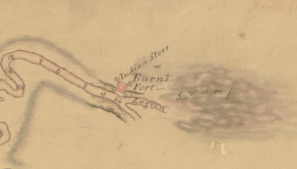 Burnt Fort illustrated on the Map of the Coast of Georgia (178?).
Library of Congress
Burnt Fort illustrated on the Map of the Coast of Georgia (178?).
Library of Congress
 The 1907 Buie-Littlefield general store is located on the Old Burnt Fort Road near the
Satilla River crossing. A ferry crossing existed here until the 1920s.
The actual "fort" was located across the river likely in the vicinity of Burnt Fort landing. P Marlin 2024
The 1907 Buie-Littlefield general store is located on the Old Burnt Fort Road near the
Satilla River crossing. A ferry crossing existed here until the 1920s.
The actual "fort" was located across the river likely in the vicinity of Burnt Fort landing. P Marlin 2024
 The back view of the old store with the Satilla River in
the distance. P Marlin 2024
The back view of the old store with the Satilla River in
the distance. P Marlin 2024
 Burnt Fort Cemetery. P Marlin 2024
 A view of the Satilla River crossing from Highway 252 (Burnt Fort
Road). The Burnt Fort abandoned store and cemetery are on the right.
The original fort was across the river on the left likely near
Burnt Fort Landing. P Marlin 2024
A view of the Satilla River crossing from Highway 252 (Burnt Fort
Road). The Burnt Fort abandoned store and cemetery are on the right.
The original fort was across the river on the left likely near
Burnt Fort Landing. P Marlin 2024
VANDERHILL: "After the coming of British rule in Florida, the Kings Road made its crossing a short distance downstream from Traders Hill at what later became Camp Pinckney. Lastly, prior to 1790, Coleraine was developed below the Kings Road crossing on an unattractive site but one permitting the interception of upbound river traffic. Although the Indian trace is obscured here, and it is probable that the choice of crossing place varied with the purposes of later travelers, it is evident that for a number of years Coleraine served as a focal point on the route to Alachua."
---------------Departing Burnt Fort, our journey continued along Highway 252, where we crossed the Satilla River before heading southward towards Folkston. At Folkston, we turned east on Highway 40 toward Coleraine. Founded around 1796, Coleraine flourished as a vibrant hub and trading post for Native Americans along the St. Mary's River, serving as a crucial stopover as they traversed into Florida via the Alachua Trail.
In 1765, under British controlled Florida, Governor James Grant approved the construction of the "King's Road," closely aligning it with the Alachua Trail crossing at Coleraine. In 1823, Charles Vignoles' notes in his book, "Observations Upon the Floridas," that "A large road, formerly kept in excellent repair leads from the Cowford (Jacksonville) on the St. John's River, to Coleraine and Camp Pinckney on the St. Mary's: it is part of what was once called the King's Road and is the only direct outland by land from St. Augustine. Near Coleraine another path diverges southwardly leading to the Alachua country."
Notably, Vignoles' 1823 map of Florida provides the first depiction of the entire Alachua Trail within Florida (see map below), showing the King's Road and the Alachua Trail diverging several miles south of the St. Mary's River. Certainly, this site on the St. Mary's River stood as a crucial crossing point for Native Americans, Spanish explorers, European settlers, as well as American pioneers, maintaining its significance well into the 19th century.
Solidifying Coleraine's significance, a "peace and friendship treaty" known as the Treaty of Coleraine (Articles, journal, and archived document) was established near this site in 1796. Aimed at fostering peace and friendship with the Native Americans, the treaty was signed by the President of the United States, John Adams, US representatives, and the chiefs and warriors of the Creek Nation of Indians. The treaty articles delineated precise borders between the United States and the Creek Nation, with the Creeks ceding a portion of their land to the U.S. government to be used for outposts.
Amendments to the treaty specified that control over the outposts would belong to the United States, but if they ceased to be needed, ownership would revert back to the Creek people. In 1814, the United States government erected a fort on the northern bank of the St. Mary's River in Coleraine to provide protection for settlers against potential Native American threats. Potentially named Fort Pickering, the remains of the fort were still visible in 1912.
Unfortunately, the original location of Coleraine and its once vibrant river crossing has now faded into obscurity and private ownship. In an article dated 1912, The Atlanta Constitution indicated that the meeting place for the Treaty of Coleraine was situated in an "oak grove" near the St. Mary's River. In the same year, The Daughters of the American Revolution (DAR) erected a stone marker at the oak grove spot to commemorate the event.
Despite efforts to reach the vicinity of the former vibrant Coleraine river crossing site, neither the original crossing point nor the 1912 DAR stone marker could be found. The Georgia-Florida Boulogne quadrangle map indicates dwellings still existed at Coleraine as late as 1917. It's remarkable that a site of such historical significance for both Georgia and Florida lacks virtually any access today except by boat.
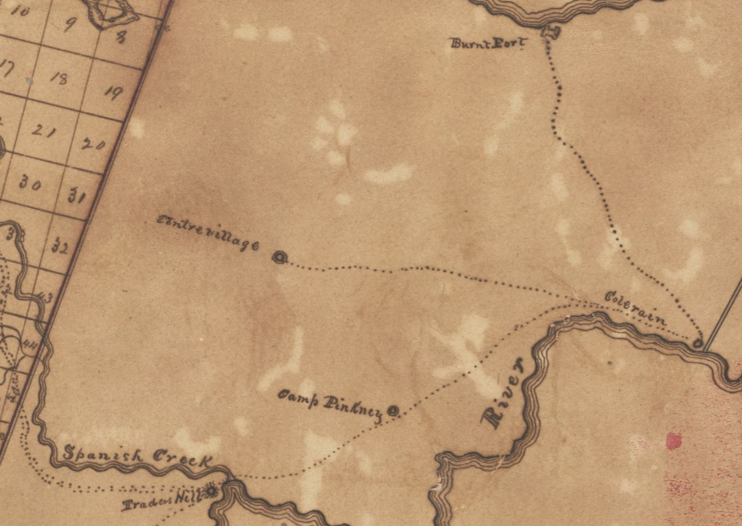 As late as 1867, all trails led to Coleraine.
Georgia Archives Virtual Vault
As late as 1867, all trails led to Coleraine.
Georgia Archives Virtual Vault
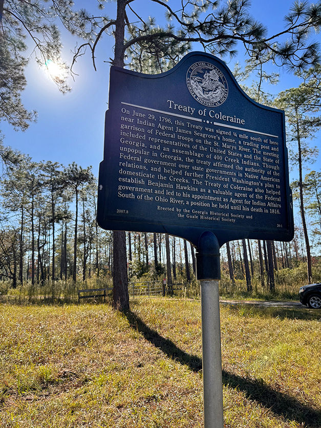 Treaty of Coleraine Historic Marker on Highway 40.
P Marlin 2024
Treaty of Coleraine Historic Marker on Highway 40.
P Marlin 2024
 In search of old Coleraine. P Marlin 2024
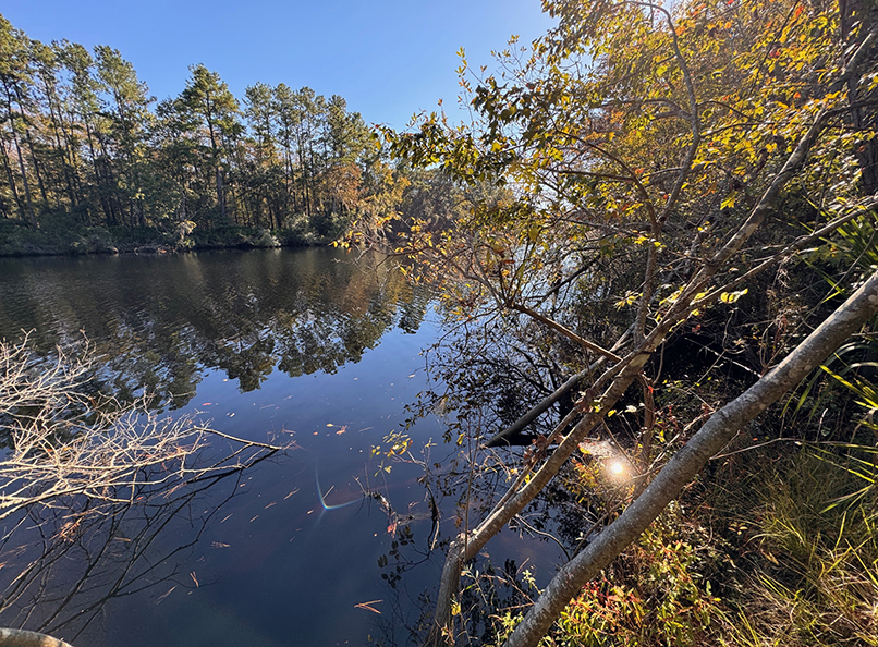 Gazing across the St. Mary's River towards Florida,
this location marks the nearest point to the
original trail crossing site near
Coleraine Bluff. P Marlin 2024
Gazing across the St. Mary's River towards Florida,
this location marks the nearest point to the
original trail crossing site near
Coleraine Bluff. P Marlin 2024
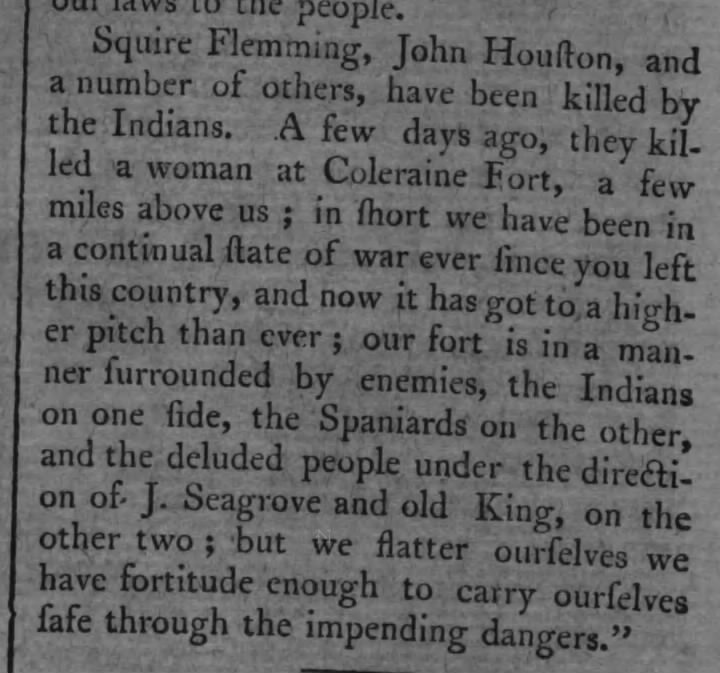 The Philadelphia Inquirer May 24, 1794. The Old King
reference may indicate Seminole chief King Payne of the Florida Seminoles.
The Philadelphia Inquirer May 24, 1794. The Old King
reference may indicate Seminole chief King Payne of the Florida Seminoles.
VANDERHILL: "A trading post had been located at Traders Hill possibly as early as 1755, accessible except for times of low water to small vessels warped up the winding river. After the coming of British rule in Florida, the Kings Road made its crossing a short distance downstream from Traders Hill at what later became Camp Pinckney."
"The only locally identified historic crossing of the St. Marys is that of the Kings Road at Camp Pinckney. This may reflect the fact that the American army chose to rebuild the Kings Road during the late 1820s, thereby stimulating a new cycle of use. There is no evidence of a crossing place at Traders Hill, which is a residential outlyer of Folkston. Coleraine remains, but there are only a few dwellings along a country lane, and its original waterfront site is abandoned. The lane leads to the river's edge less than two miles above Coleraine, opposite Flat Landing. Early travelers would have crossed there or farther upstream at the Kings Road, since the south bank opposite Coleraine is low and swampy."
---------------Continuing our journey, we departed Coleraine and headed westward on Highway 40 until we arrived at Camp Pinckney River Road. Positioned close to Coleraine toward Trader's Hill, Camp Pinckney presumably functioned as a military outpost. According to the article referenced below, Camp Pinckney was a pivotal gathering and river crossing point for military personnel during their expeditions into Native American-controlled regions in Florida. The article referenced below demonstrates the military's use of the Alachua Trail from Camp Pinckney into Alachua.
In 1778, American Major General Robert Howe "cut" a road at the St. Mary's River (see map) as part of the American campaign to seize British-held Florida in the vicinity of Camp Pinckney. By 1850, this crossing at Camp Pinckney was labeled the "King's Road" (see map) on early Florida land record maps. Over time, the Camp Pinckney crossing likely emerged as a more convenient passage across the St. Mary's River, contributing to the decline of Coleraine.
Today, one can easily observe a distinct crossing point into Florida at the Camp Pinckney St. Mary's River crossing site. From the St. Mary's River, the Camp Pinckney "King's Road" extended southward into Florida, passing through what is now recognized as the Ralph E. Simmons Memorial Forest.
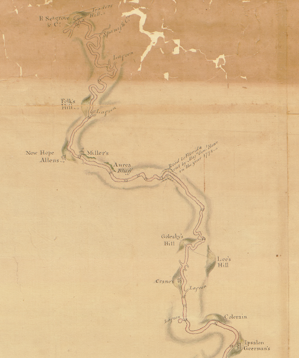 Major General Robert Howe carved out a road along the St. Mary's
River between Trader's Hill and Coleraine, clearing the path
for the American assault on British Florida in 1778.
Library of Congress
Major General Robert Howe carved out a road along the St. Mary's
River between Trader's Hill and Coleraine, clearing the path
for the American assault on British Florida in 1778.
Library of Congress
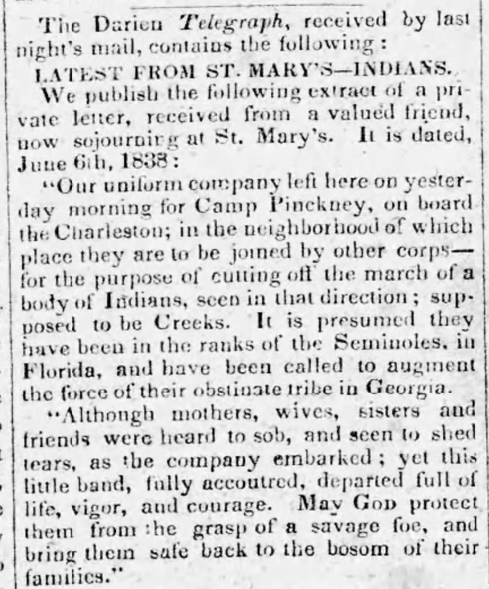 Savannah Georgian. April 13, 1826
 A Camp Pinckney road sign. P Marlin 2024
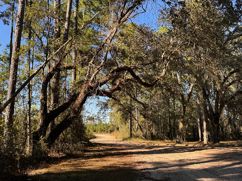 The Camp Pinckney Road aligns with the "King's Road" at the St. Mary's River
crossing as indicated in the 1850 Florida survey. P Marlin 2024
The Camp Pinckney Road aligns with the "King's Road" at the St. Mary's River
crossing as indicated in the 1850 Florida survey. P Marlin 2024
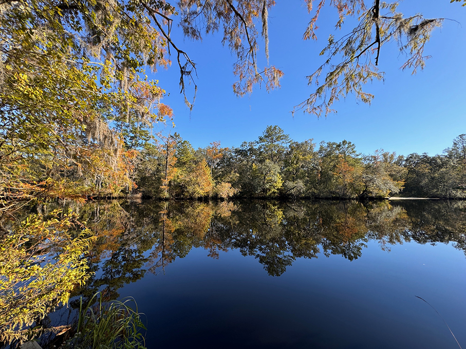 The Camp Pinckney crossing point
on the St. Mary's River. Florida's Ralph E. Simmons
Memorial Forest is visible on the other side of the
river. P Marlin 2024
The Camp Pinckney crossing point
on the St. Mary's River. Florida's Ralph E. Simmons
Memorial Forest is visible on the other side of the
river. P Marlin 2024
VANDERHILL: "From the St. Marys River the Alachua Trail led to the southern edge of the Alachua savanna, today's Paynes Prairie in Alachua County. This was a focus of Indian settlement long before Bartram's visit in 1773, and trails converged upon it from several directions. With American accession in 1821, a trading post, Wanton's, was established here. The village of Micanopy developed around the post, and references to the Alachua route tend to recognize either Wanton's or Micanopy as its southern terminus."
"The first map to identify the Alachua Trail south of the St. Marys was the Purcell strip map of 1778. Purcell's survey transect crossed the "path to Alachua" at a point some distance northeast of present-day Gainesville. Other notations of portions of the Alachua Trail may be found, but it was not until the appearance of the Vignoles and Tanner maps of 1823 that the entire length of the route within Florida was portrayed. Ironically, by this time sections of the trail were falling into disuse."
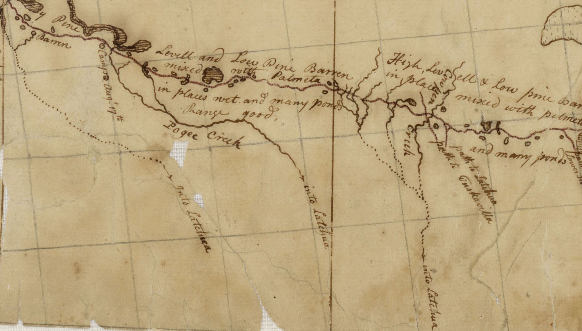 Noted as the earliest map
to show the Alachua Trail in Florida, the
"Sketch of country between Pensacola and Saint Augustine, Florida,
showing route followed July to September, 1778," map illustrates the path
"Into Latchua" several times. The National Archives
Noted as the earliest map
to show the Alachua Trail in Florida, the
"Sketch of country between Pensacola and Saint Augustine, Florida,
showing route followed July to September, 1778," map illustrates the path
"Into Latchua" several times. The National Archives
"Whatever may have been the aboriginal route in the vicinity of the St. Marys, after the middle of the eighteenth century many travelers took advantage of the cleared swath of the Kings Road for some distance south of the river. The course of the road is confirmed by maps of the initial federal land survey. It led from the river bank opposite Camp Pinckney southeasterly about two miles, then generally south along the margin of a land grant which by that time occupied the space between the road and the river. It is probable that an alternative path from Coleraine left the St. Marys at Flat Landing. On the Boulogne Quadrangle of the United States Geological Survey, issued in 1917, a road from this landing is shown joining the former Kings Road where it turns south."
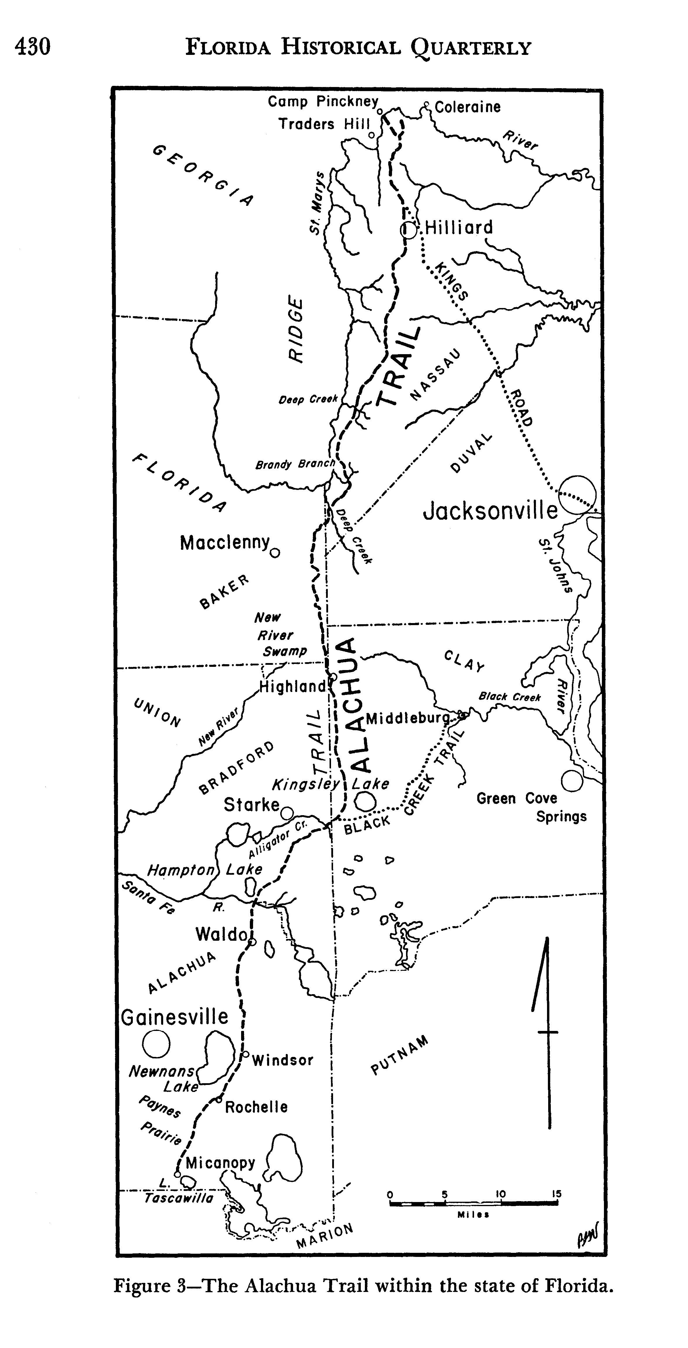 Burke Vanderhill's map illustrates the Alachua
Trail from the St. Mary's River to Micanopy.
Burke Vanderhill's map illustrates the Alachua
Trail from the St. Mary's River to Micanopy.
The 1823 Tanner map seen below illustrates both the King's Road and the Alachua Trail crossing the St. Mary's River near Coleraine before diverging a few miles southward. Today, these historic routes have vanished into the pine forests and marshes south of the St. Mary's River. From this point, the King's Road extended eastward toward Jacksonville and St. Augustine as the Alachua Trail journeyed southward toward the Alachua Savanna and Micanopy.
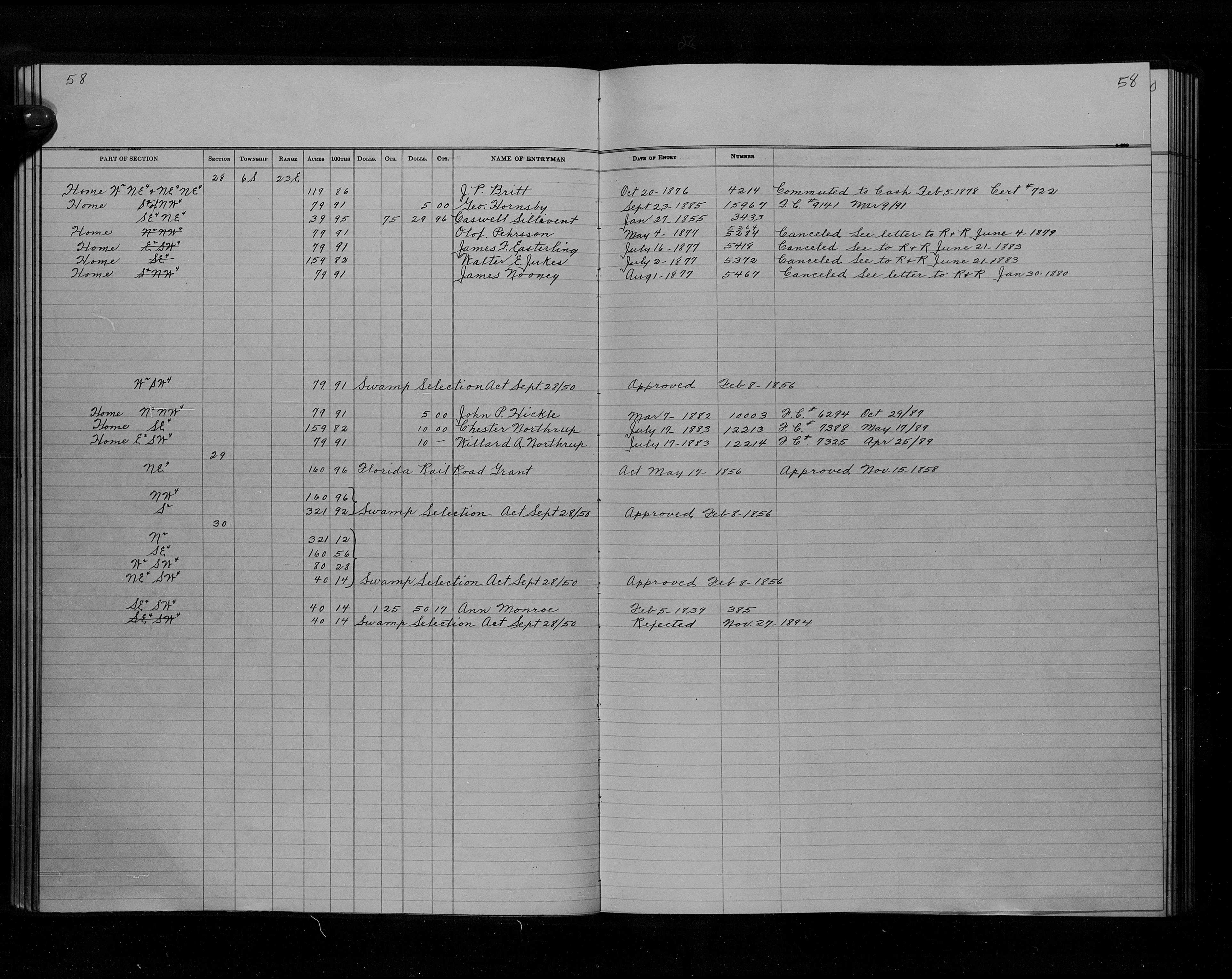
Using Vanderhill's resources, US General Land Office Florida District Surveys from 1824 - 1853, and quadrangle maps, the following stops are indicated along the Alachua Trail in Florida:
Notable stops through Florida include (9) Ralph E. Simmons Memorial State Forest, Hilliard, and Kent, (10) Deep Creek and Brandy Branch, (11) The Trail Ridge: Maxville-Macclenny Road and Highland, (12) Camp Blanding, Kingsley Lake, and Mrs. Monroe's, (13) Fort Harllee (Waldo) on Old Newnansville Road, and NE State Road 26 crossing, (14) NE Country Road 234, Newnans Lake (Lake Pithlachocco), and Windsor, (15) Rochelle and Fort Crane, and (16) The Great Alachua Savanna and Micanopy
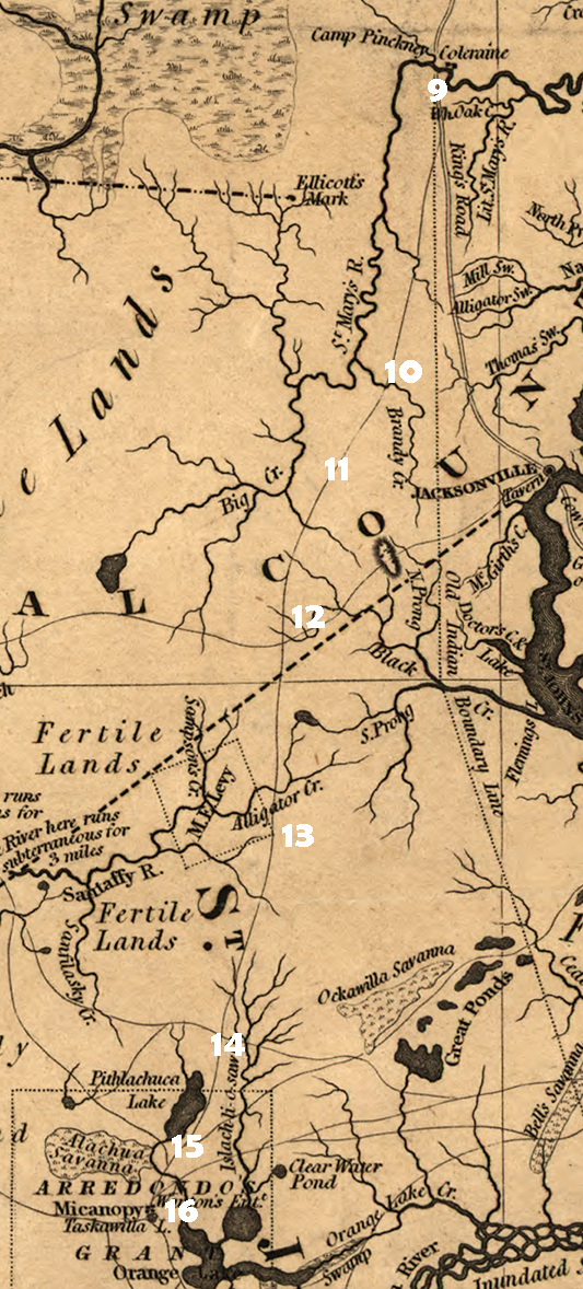 The 1823 Tanner map, indicating the Alachua Trail stops in Florida, illustrates the original King's Road
extending east toward Jacksonville, as the Alachua Trail continues
southward to Micanopy.
Library of Congress
The 1823 Tanner map, indicating the Alachua Trail stops in Florida, illustrates the original King's Road
extending east toward Jacksonville, as the Alachua Trail continues
southward to Micanopy.
Library of Congress
VANDERHILL: "Vignoles noted that the path "leading to the Alachua country" diverged from the Kings Road several miles from the river. Army engineer Daniel Burch, reporting on his survey for a military road from Wanton's to Camp Pinckney, stated that the point of departure was ten miles from the St. Mary's. Assuming reasonable accuracy for the Burch report, the Alachua Trail would have branched from the Kings Road at or near what is now Hilliard, although the exact point has not been established. By the time of the federal land surveys this portion of the Alachua Trail must have been abandoned or had but limited use, since only the Kings Road appears on the survey plats of northwestern Nassau."
"The Alachua Trail, upon leaving the Kings Road, led in a generally southwesterly direction around or across the heads of numerous feeders of the St. Marys, finally reaching Trail Ridge east of the present community of Macclenny in Baker County. While the route in the immediate vicinity of Hilliard is conjectural, much of the remainder can be reconstructed. The 1917 edition of the Hilliard Quadrangle identifies about ten miles of country road in western Nassau County with the Alachua Trail, and its alignment is consistent with that shown in a general way on early nineteenth century maps. The Alachua Trail thus portrayed approached the St. Marys just north of Deep Creek, a small tributary. Today only two or three short lengths of country road appear to represent the alignment of the old Indian pathway between Hilliard and Deep Creek.
---------------Departing the St. Mary's River crossing on Camp Pinckney River Road, our journey returned to Folkston via Highway 40, then continued southward on Highway 301. Upon crossing the St. Mary's River into Florida, we proceeded eastward along Lake Hampton Road, toward the Ralph E. Simmons Memorial State Forest. Notably, US Surveyor General maps for Florida depict the "King's Road" crossing the St. Mary's River at Camp Pinckney and extending into Florida. This suggests that the Camp Pinckney "King's Road" traversed today's Memorial Forest.
 The Camp Pinckney, St. Mary's River crossing / "King's Road" alongside the
Randy Majors township
and section maps (2024) provide then and now
perspectives of the St. Marys crossing into Florida and
today's Memorial Forest.
The Camp Pinckney, St. Mary's River crossing / "King's Road" alongside the
Randy Majors township
and section maps (2024) provide then and now
perspectives of the St. Marys crossing into Florida and
today's Memorial Forest.
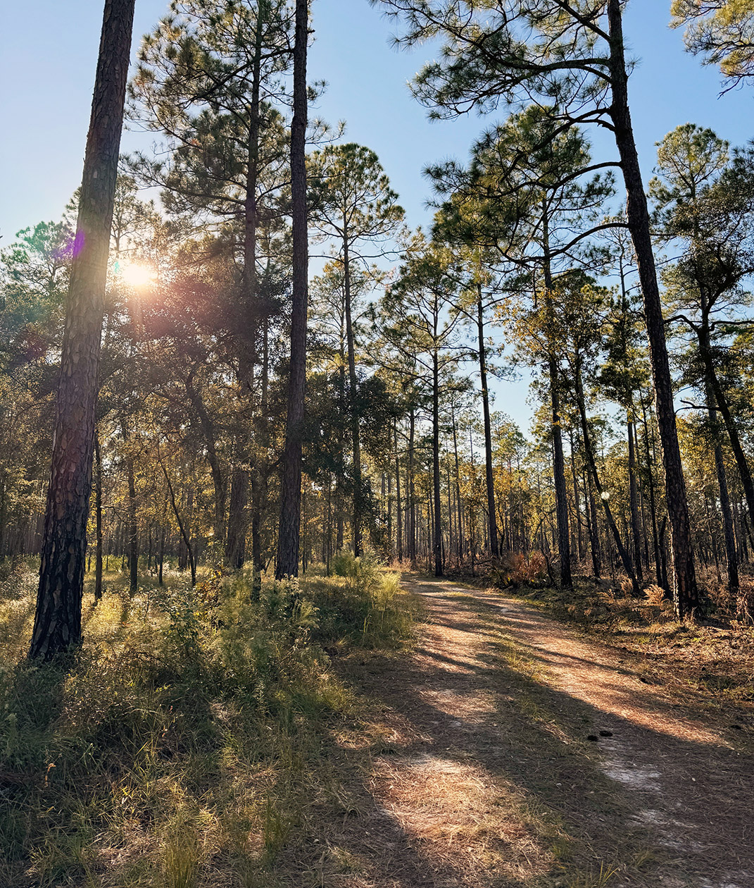 The entrance to the Ralph E. Simmons Memorial State Forest in Florida
with hikes to the St. Mary's River. P Marlin 2024
The entrance to the Ralph E. Simmons Memorial State Forest in Florida
with hikes to the St. Mary's River. P Marlin 2024
The 1917 Hilliard Quadrangle map indicates that the Alachua Trail crossed Highway 108 near Hilliard. From Highway 108, the trail extends southward through today's Broomsage Quail Plantation, before continuing further south to intersect with Crawford Road near Kent. Though the route varies slightly, this segment of the old trail is recognized as the "Old Alachua Trail" on present-day Google maps.
The Highway 108 (near Hilliard) crossing was not accessible, so we journeyed south on Highway 108 to the Broomsage Quail Plantation southern entrance at River Road (Highway 108). Traversing the plantation's tall pines and sandy roads, we were oblivious to the site's designation for quail hunting. Shortly afterward, for our safety, we were cautioned to depart the area. Nevertheless, we caught a glimpse of the original trail as it stretched northward through the pine forest toward Highway 108 near Hilliard.
The following maps provide a comparison between the 1917 Hilliard Quadrangle map and a modern day Randy Majors map (with township and section numbers). Both maps trace the Alachua Trail, with the Randy Major map indicating photo points.
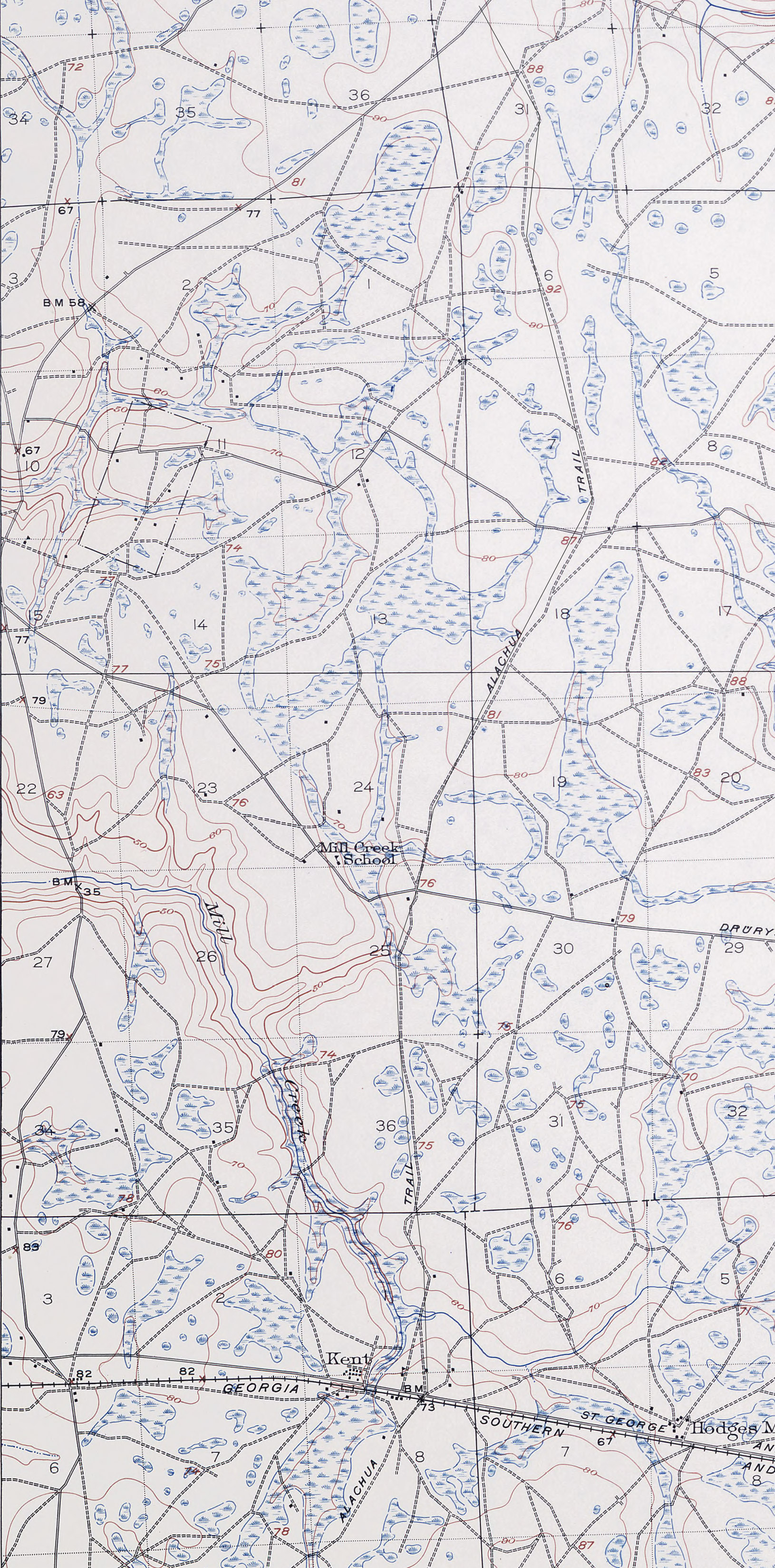 The 1917 Hilliard Quandragle map illustrates the Alachua Trail
between Hilliard and Kent.
University of Florida Digital Collections
The 1917 Hilliard Quandragle map illustrates the Alachua Trail
between Hilliard and Kent.
University of Florida Digital Collections
 Based on the Hilliard Quandrange map above, a 2024 Randy Majors map highlights the trail
from Hilliard to Kent
with photo points. P Marlin 2024
Based on the Hilliard Quandrange map above, a 2024 Randy Majors map highlights the trail
from Hilliard to Kent
with photo points. P Marlin 2024
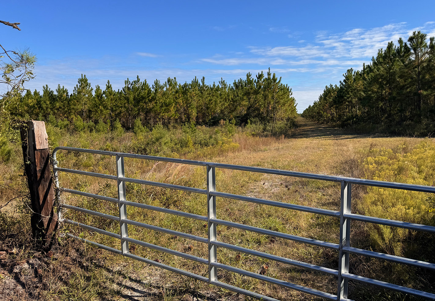 Photo 1: Highway 108 (near Hillard) entrance where the Alachua
Trail continues through the Broomsage Quail Plantation.
P Marlin 2024
Photo 1: Highway 108 (near Hillard) entrance where the Alachua
Trail continues through the Broomsage Quail Plantation.
P Marlin 2024
 Photo 2: The Alachua Trail continues north through the Broomsage Plantation
to the no access point at Highway 108 (near Hilliard). P Marlin 2024
Photo 2: The Alachua Trail continues north through the Broomsage Plantation
to the no access point at Highway 108 (near Hilliard). P Marlin 2024
 Photo 3: The Alachua Trail traverses the Broomsage Plantation.
Alligator Creek flows to the east. P Marlin 2024
Photo 3: The Alachua Trail traverses the Broomsage Plantation.
Alligator Creek flows to the east. P Marlin 2024
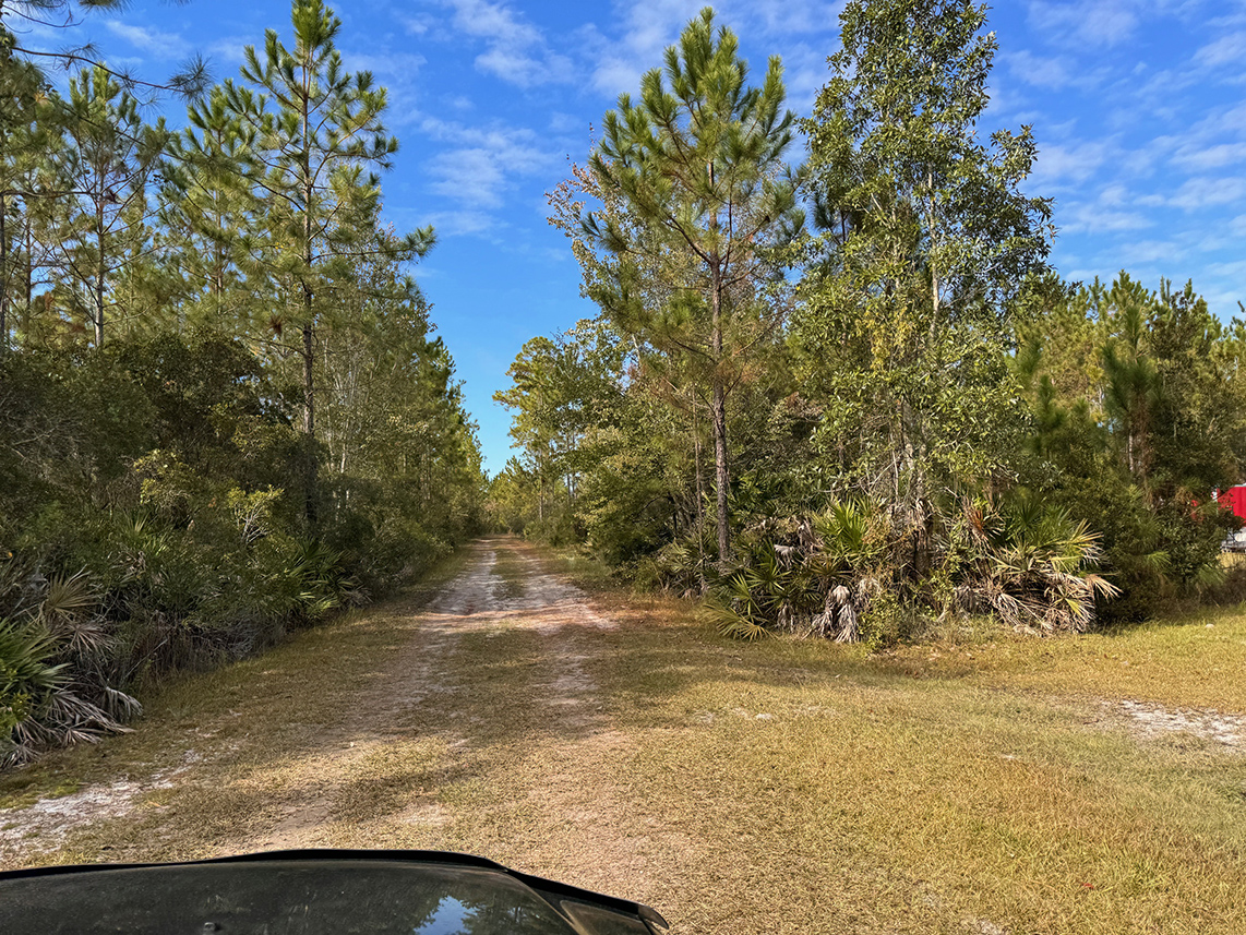 Photo 4: Continuing through the Broomsage Plantation. P Marlin 2024
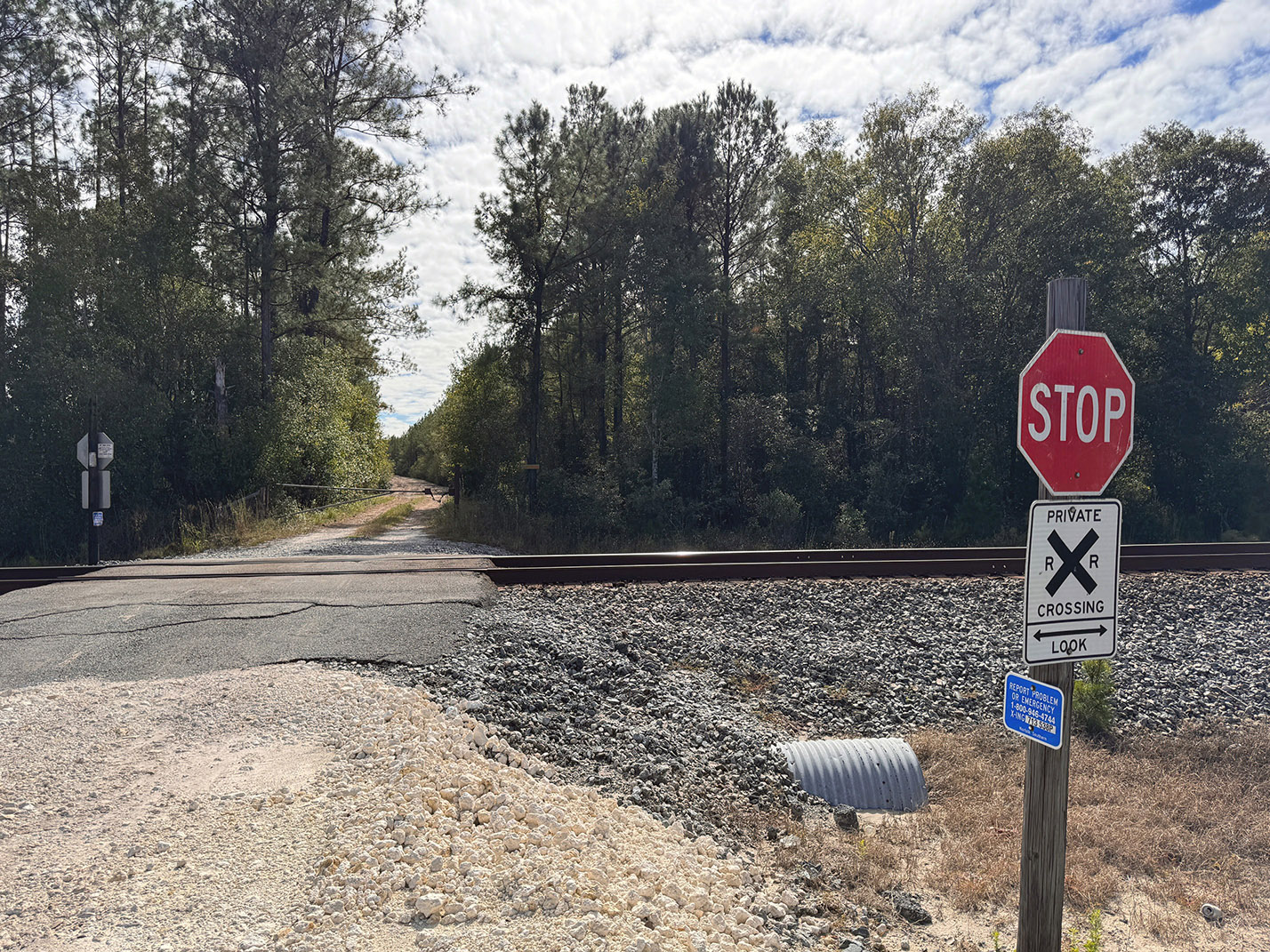 Photo 5: The Alachua Trail heads southward
as it crosses Crawford Road near Kent. P Marlin 2024
Photo 5: The Alachua Trail heads southward
as it crosses Crawford Road near Kent. P Marlin 2024
VANDERHILL: "The trail's proximity to the St. Marys near Deep Creek can be substantiated. The federal canal survey of 1827 placed the "Alachua Road" about one and one-fourth miles from the river where the survey line intersected it a short distance north of Deep Creek. Further, the records of a Spanish land grant on Deep Creek include the notation that the "road to Alachua runs through it north and south." This trail alignment conforms closely to that of present State Highway 121."
"From Deep Creek, the Alachua Trail led southward Brandy Branch, another tributary of the St. Marys, along a course essentially that of Highway 121 today. The land survey of 1830 identified this stretch of the route as the "road from Alachua to St. Marys Town." Brandy Branch, also, was spanned by a Spanish land grant. Among the documents relating to the grant are maps which show the "Camino para Alachua" and, on the English language copy, the "Alotchua Trail." The Deep Creek and Brandy Branch crossings must have seen long use prior to the date of the land grants."
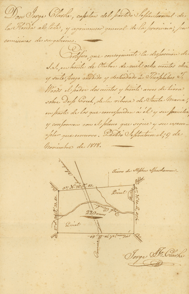 An example of Vanderhill's "Camino para Alachua" reference is
indicated on this drawing of Theophilus Woods' 1818 Spanish Land Grant.
Florida Memory
An example of Vanderhill's "Camino para Alachua" reference is
indicated on this drawing of Theophilus Woods' 1818 Spanish Land Grant.
Florida Memory
"The Indian trace led in a southwesterly course from Brandy Branch and, after crossing another Deep Creek near the present Baker County line, reached that long zone of sandhills known as Trail Ridge. This section of the route has been abandoned and no sign of it now remains, but as recently as 1917, when the Macclenny Quadrangle was issued, an "Alachua Trail Road" from Brandy Branch to Macclenny represented the old route alignment as far as Trail Ridge."
---------------Leaving Crawford Road, our journey veered westward towards Highway 121, also recognized as the Baldwin and St. George Road. Traveling south on Highway 121, the original trail wound through the wooded expanse to the east, crossing Deep Creek as it continued south to Brandy Branch Creek. Upon reaching the Brandy Branch Creek crossing, the trail meandered close to the vicinity of the present-day Brandy Branch Baptist Church and the Brandy Branch Cemetery. A glimpse behind the cemetery fence indicates a pathway continuing south to the Brandy Branch Creek crossing.
Following Vanderhill's account, I mapped the Alachua Trail through Brandy Branch Creek, utilizing the Florida Survey maps and the 1917 Macclenny Quadrangle map which lists the trail as the "Alachua Trail Road." Traversing sections 3, 10, 16, 21, 29, and 37 within Township 1 South and Range 23 East, the Alachua Trail intersects with the path from St. Mary's town (to the east), at John Mizzel's property in section 37. The unmarked path from the north potentially corresponds with the other King's Road crossing at Camp Pinckney or a path from Trader's Hill.
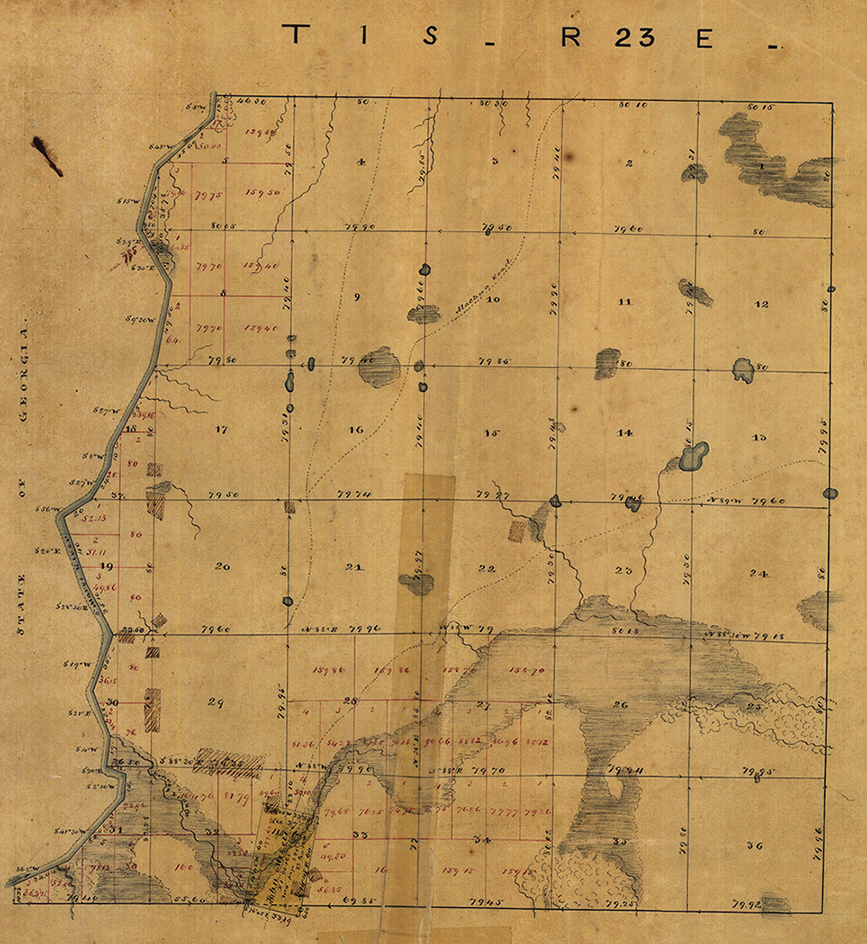 The Alachua Trail traverses sections 3, 10, 16, 21, 29,
and 37 of Township 1 South and Range 23 East on this Florida Survey map.
This map corresponds with the illustrated
"Road to St. Mary's Town"
on
Florida Survey Township 1 North and Range 23 East map.
The Alachua Trail traverses sections 3, 10, 16, 21, 29,
and 37 of Township 1 South and Range 23 East on this Florida Survey map.
This map corresponds with the illustrated
"Road to St. Mary's Town"
on
Florida Survey Township 1 North and Range 23 East map.
 This 2024 Randy Majors map features the same
region depicted in the preceding Florida Survey map,
along with designated photo stops. P Marlin 2024
This 2024 Randy Majors map features the same
region depicted in the preceding Florida Survey map,
along with designated photo stops. P Marlin 2024
 Photo 1: Brandy Branch Cemetery. P Marlin 2024
 Photo 2: The path on the back side of the Brandy Branch Cemetery closely
aligns with the original trail as it approaches Brandy Branch Creek. P Marlin 2024
Photo 2: The path on the back side of the Brandy Branch Cemetery closely
aligns with the original trail as it approaches Brandy Branch Creek. P Marlin 2024
 Photo 3: Highway 121 crosses Brandy Branch Creek. P Marlin 2024
 Photo 4: Brandy Branch Creek. P Marlin 2024
From Brandy Branch Creek, the trail traverses through the general vicinity of a residential area crossing Horseshoe Circle and then Horseshoe Circle W south of Old Drew Road. Continuing across St. Mary's River big bend area, the trail crossed Deep Creek, east of Macclenny on today's Highway 90. The Florida Survey and Randy Majors maps below outline the trail through sections 5, 8, 7, and 18 of Township 2 South Range 23 East.
Within this vicinity, the Alachua Trail intersects with what became known as the St. Mary's-Alachua Road (as depicted in the Florida Survey maps above). After the United States acquired Florida in 1821, mentions of the Alachua Trail route were referred to as the "Road to St. Mary's" which connected the Alachua region to the port town of St. Marys along the lower St. Marys River.
 The Alachua Trail traverses sections 5, 8, 7, and
18 of Township 2 S Range 23 East on this Florida Survey map. Though not explicitly
labeled, this map corresponds with the prior "Alachua Road" survey map.
The Alachua Trail traverses sections 5, 8, 7, and
18 of Township 2 S Range 23 East on this Florida Survey map. Though not explicitly
labeled, this map corresponds with the prior "Alachua Road" survey map.
 This 2024 Randy Majors map features the same region depicted in the preceding Florida Survey map, along with designated photo stops.
P Marlin 2024
This 2024 Randy Majors map features the same region depicted in the preceding Florida Survey map, along with designated photo stops.
P Marlin 2024
 Photo 1: The Alachua Trail travels southwestward toward the Deep Creek crossing along
the St. Mary' River bend.
P Marlin 2024
Photo 1: The Alachua Trail travels southwestward toward the Deep Creek crossing along
the St. Mary' River bend.
P Marlin 2024
VANDERHILL: "The Indian trace led in a southwesterly course from Brandy Branch and, after crossing another Deep Creek near the present Baker County line, reached that long zone of sandhills known as Trail Ridge. This section of the route has been abandoned and no sign of it now remains, but as recently as 1917, when the Macclenny Quadrangle was issued, an "Alachua Trail Road" from Brandy Branch to Macclenny represented the old route alignment as far as Trail Ridge."
"Trail Ridge, formed as an offshore bar during the geologic past when the sea covered parts of Georgia and most of Florida, is traceable for approximately 200 miles in these two states and terminates in central Alachua County. It is a low divide averaging two to four miles in width which provided a relatively drier pathway between great tracts of wet land on either side. The Alachua Trail was developed along this divide and must have served as the inspiration for its name, which came into use during the colonial period. Burch, however, described Trail Ridge as a pine barrens, empty of people and incapable of supporting them, and as "flat pondy country," thereforerecommending that an alternative route be selected for the proposed military road from Wanton's to Camp Pinckney."
---------------Following Highway 90 to Macclenny, we traced the original trail using the Florida Survey maps to a crossing on the Maxville-Maclenney Road (Highway 228). Although the trail is not explicitly marked on the Township 3 South Range 22 East map, the path is labeled "Alachua Road" on the Township 4 South Range 22 East map (these maps correspond). From this location, the trail traverses what is known as the "Trail Ridge" in Florida. At an elevation of 210 feet above sea level, Trail Ridge stands as a sandhill expanse known as the "geological backbone" of North Florida. Extending from southeastern Georgia, this sandy ridge served as a natural pathway for the Alachua Trail, avoiding low lying areas.
Driving along the Maxville-Macclenny Road, we proceeded southward on Highway 301 toward Highland, which sits atop the Trail Ridge. The original Alachua Trail paralleled Highway 301 on the west before it intersected at Highland. Before its transformation into a stop along Florida's railroad (Trail Ridge stop), Highland served as a layover point for travelers journeying by wagons, stages, and horseback on the Alachua Trail. Positioned midway between the St. Mary's River and the pioneer settlements of Newnansville and Micanopy, it provided a crucial waypoint for weary travelers. Today, the mining of Trail Ridge has removed any existence of the original trail in this area.
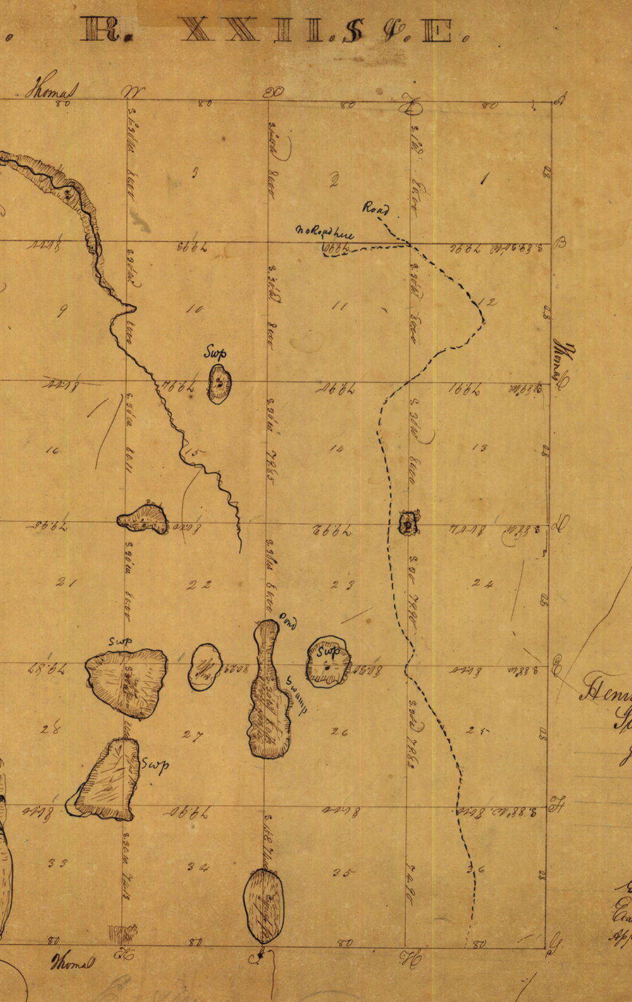 The Alachua Trail traverses sections 2, 12, 14, 23, 25 and 36 of
Township 3 South Range 22 East on this Florida Survey map north of
the Maxville-Maclenney Road.
The Alachua Trail traverses sections 2, 12, 14, 23, 25 and 36 of
Township 3 South Range 22 East on this Florida Survey map north of
the Maxville-Maclenney Road.
 This 2024 Randy Majors map features the same region
depicted in the preceding Florida Survey map, along
with designated photo stops. P Marlin 2024
This 2024 Randy Majors map features the same region
depicted in the preceding Florida Survey map, along
with designated photo stops. P Marlin 2024
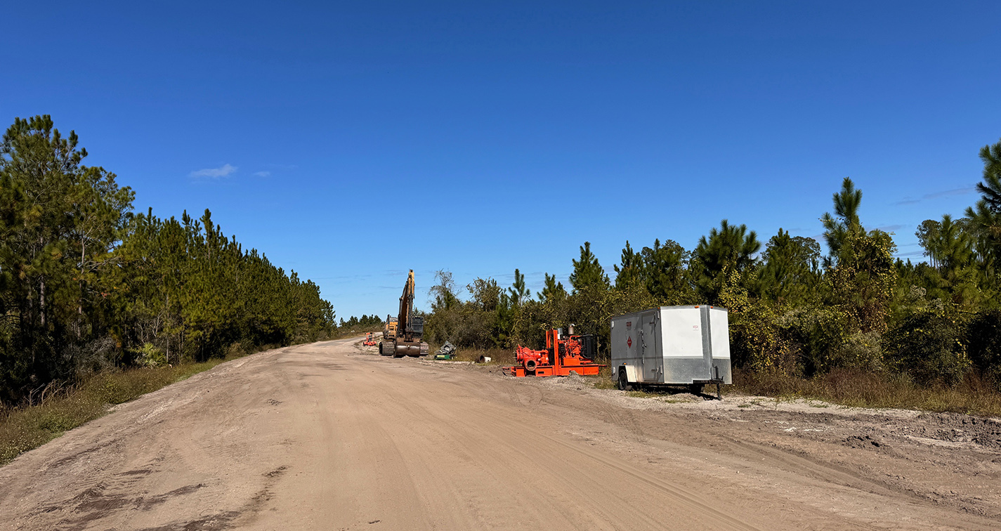 Photo 1: The Alachua Trail crosses Maxville-Macclenny Road from the north.
P Marlin 2024
Photo 1: The Alachua Trail crosses Maxville-Macclenny Road from the north.
P Marlin 2024
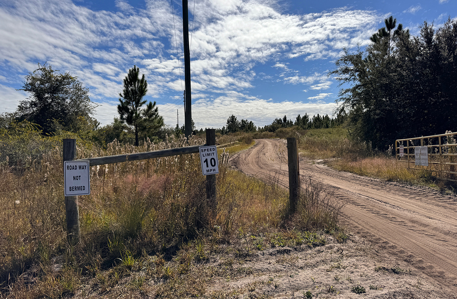 Photo 2: The Alachua Trail continues southward after crossing
the Maxville-Macclenny Road (Deerfield Circle).
P Marlin 2024
Photo 2: The Alachua Trail continues southward after crossing
the Maxville-Macclenny Road (Deerfield Circle).
P Marlin 2024
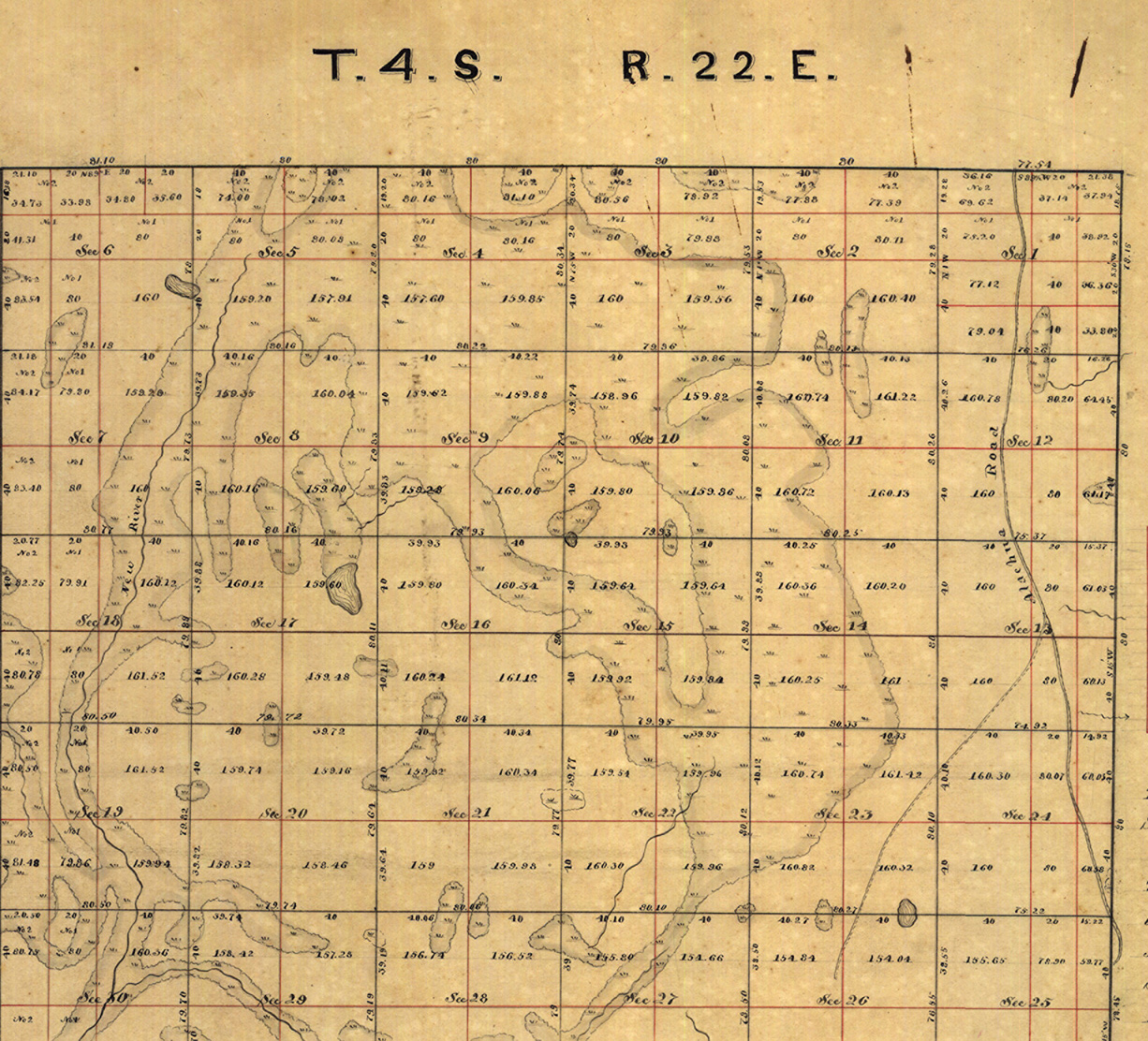 The Alachua "Road" traverses sections 1, 12, 13, 24 and 25 of
Township 4 South Range 22 East on the Florida Survey map before
it crosses today's Highway 301.
The Alachua "Road" traverses sections 1, 12, 13, 24 and 25 of
Township 4 South Range 22 East on the Florida Survey map before
it crosses today's Highway 301.
 This 2024 Randy Majors map features the same region depicted in
the preceding Florida Survey map. P Marlin 2024
This 2024 Randy Majors map features the same region depicted in
the preceding Florida Survey map. P Marlin 2024
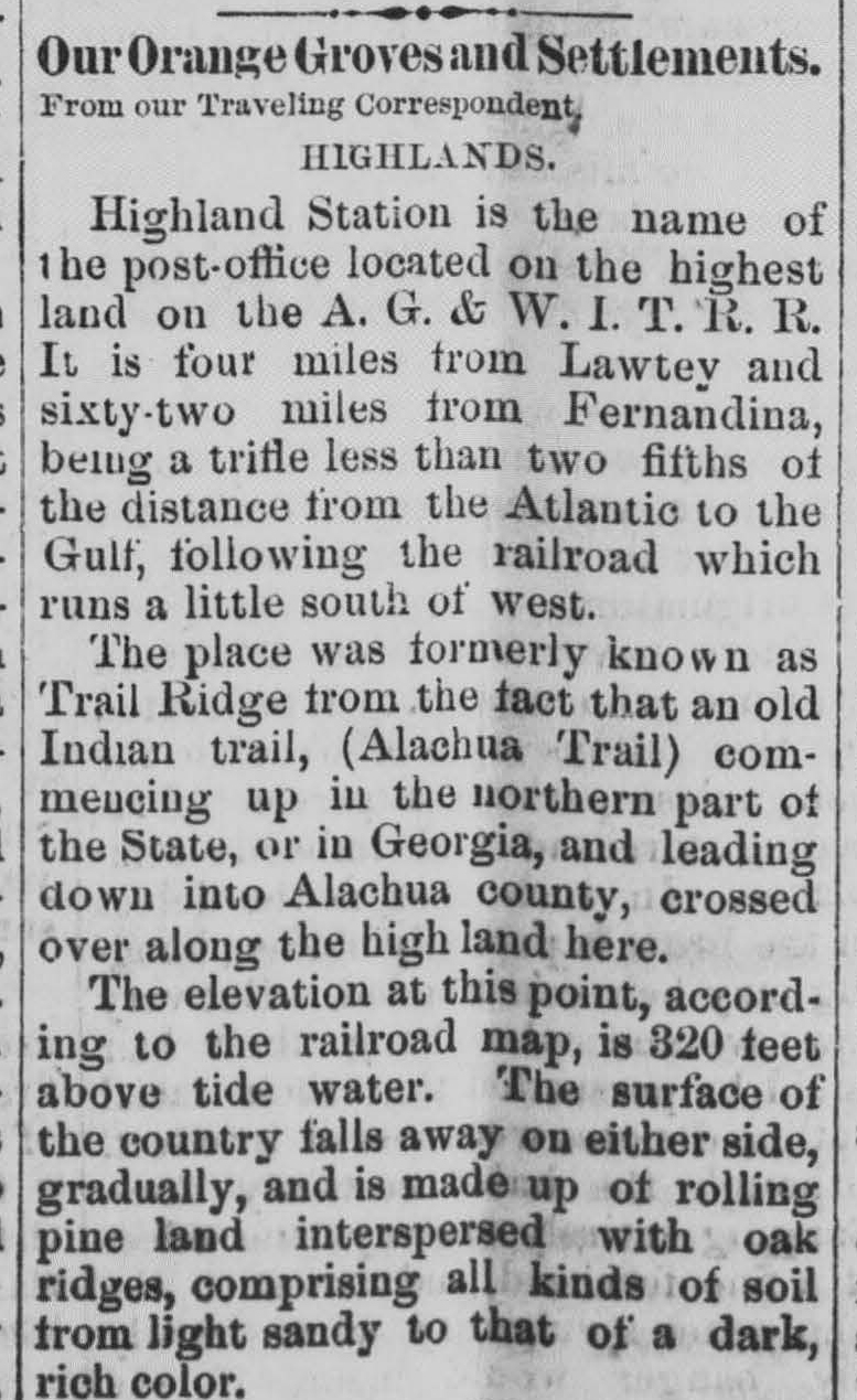 The Florida Agriculturist. November 19, 1879.
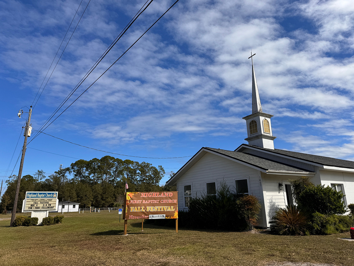 The Highland First Baptist Church on Highway 301
is one of the few reminders that Highland ever
existed. The trail likely crossed near here. P Marlin 2024
The Highland First Baptist Church on Highway 301
is one of the few reminders that Highland ever
existed. The trail likely crossed near here. P Marlin 2024
VANDERHILL: "After passing through the site of the village of Highland, which developed where east-west routes intersected with the Alachua-St. Marys Road, the trail bore south to Kingsleys Pond, roughly paralleling the Bradford-Clay county line. Little sign of the route along Trail Ridge can be seen today, although on several editions of the Lawtey Quadrangle, which shared a 1917 data base, most of it was still traceable."
"The Alachua Trail passed Kingsleys Pond at a distance of about one-half mile from its western shore, ravines discouraging a closer approach, then veered to the southwest. The long arc thus formed has been a durable landscape feature over the years, and not only appears on the earliest territorial maps of this part of Florida but is discernible on the latest aerial photo coverage. It is now a "jeep trail" within Camp Blanding, the Florida National Guard reserve."
"At a point along this curve of the Alachua Trail about two miles from Kingsleys Pond, where the Mrs. Monroe's of the Davis map was located, another ancient trail branched to the east. This led around the southern rim of Kingsleys Pond to Black Creek and the St. Johns River. Early settlers in the Alachua area found this route an attractive alternative to the long path to the St. Marys, and the military, after examining all possible routings, chose to develop the Camp Pinckney road along the Black Creek trail in preference to the Trail Ridge route."
---------------Navigating one sandy path to another, we traced the Alachua Trail through Trail Ridge. Traveling southeast on Highway 225 from Lawtey, we observed two trail crossings in Camp Blanding's Wildlife Management Area. These crossing points included Bessent Road on Highway 225 (photo 1 and 2) and the Lightning Strike Road crossing on Highway 16 (photos 3 and 4).
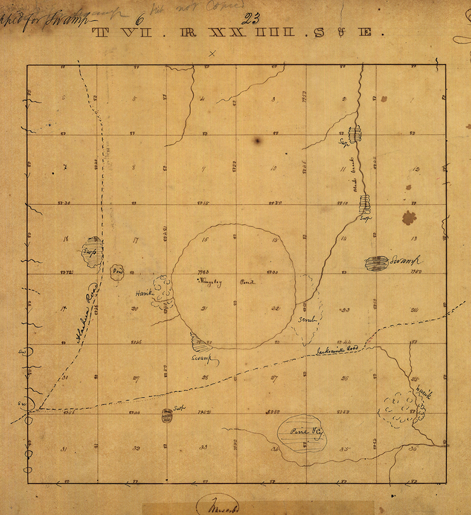 The Alachua Trail traverses sections 5, 6, 8, 17, 19, 20 and 30 of
Township 6 South Range 23 East on the Florida Survey map.
The Alachua Trail traverses sections 5, 6, 8, 17, 19, 20 and 30 of
Township 6 South Range 23 East on the Florida Survey map.
 This 2024 Randy Majors map features the same
region depicted in the preceding Florida Survey map,
along with designated photo stops. P Marlin 2024
This 2024 Randy Majors map features the same
region depicted in the preceding Florida Survey map,
along with designated photo stops. P Marlin 2024
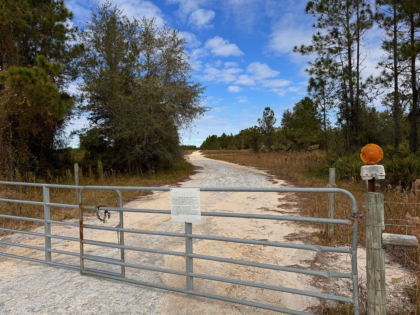 Photo 1: North of Highway 225, the Alachua Trail traverses
the Camp Blanding Wildlife Management Area, intersecting
with Bessent Road. P Marlin 2024
Photo 1: North of Highway 225, the Alachua Trail traverses
the Camp Blanding Wildlife Management Area, intersecting
with Bessent Road. P Marlin 2024
 Photo 2: The Alachua Trail continues on Bessent Road. P Marlin 2024
 Photo 3: The Alachua Trail becomes Lightning Strike Road north of
Highway 16. P Marlin 2024
Photo 3: The Alachua Trail becomes Lightning Strike Road north of
Highway 16. P Marlin 2024
 Photo 4: The Alachua Trail continues as
Lightning Strike Road. P Marlin 2024
Photo 4: The Alachua Trail continues as
Lightning Strike Road. P Marlin 2024
Continuing south on Highway 230 near Kingsley Lake, we came to a significant Alachua trail stop known as "Mrs. Monroe's." In the 19th century, Mrs. Ann Monroe owned a farm at the crossing of the Alachua Trail and the Jacksonville Road, also referred to as the Newnansville to Black Creek Road (see map). It's at this bustling intersection that Mrs. Monroe's farmhouse likely served as a rest stop for travelers. It is also within this vicinity that Fort Van Courtland, one of the numerous Seminole War forts established to safeguard settlers from Native American raids, was established.
Although little is known about Mrs. Monroe, her house is mentioned in various historical records, underscoring the significance of this particular location. Land assessment documents from 1837 verify that Mrs. Ann Monroe owned 40 acres of Section 30 of Township 6 South Range 23 East near today's Highway 230 (photos 5 and 6). In 1836, the Niles Weekly Register noted "The suffering and distresses of the inhabitants of East Florida are beyond description. The Indians have carried of Humphrey's negroes, burnt Sparkman's house, fired on the men, and stole all the cattle in that neighborhood. Mrs. Monroe's house is also burnt." Enduring adversity, Mrs. Monroe's was again listed on an 1864 and 1895 map, indicating that her house was rebuilt.
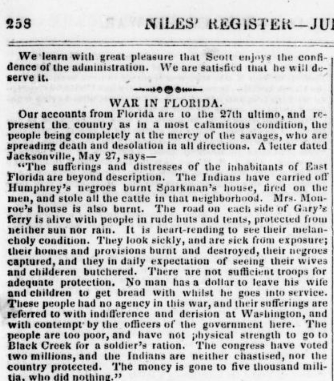 Niles Weekly Register Volume 50.
Archive.org
Niles Weekly Register Volume 50.
Archive.org
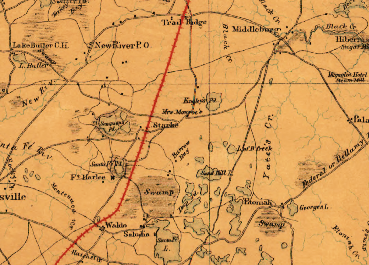 Mrs. Monroe's on the North Part of Florida map (1864).
Library of Congress
Mrs. Monroe's on the North Part of Florida map (1864).
Library of Congress
In 1844, a "Draft of an Act" aimed at delineating county borders, incorporated Mrs. Monroe's property and the Alachua Trail into Columbia County's borders, "From the passage of this act, the eastern boundary line of Columbia County shall be as follows: Beginning at the mouth of Deep Creek on the St. Mary's River, running upsaid creek to where the Jacksonville road crosses at Pagits; thence along the old Alachua Trail to Mrs. Monroe's place on the road from Black Creek to Fort Harlee; thence along said road west of Alligator Creek." In 1845, Mrs. Monroe's house is listed on Florida's certified election results (top of document - second line) and as late as 1895, Mrs. Monroe's was still a location on the US War Department map (see map).
 A Draft of an Act (1844) Florida Memory
 US War Department map (1895).
Dave Rumsey Maps
US War Department map (1895).
Dave Rumsey Maps
 Photo 5: The likely site of Mrs. Monroe's at the
intersection of the Alachua Trail and Jacksonville / Black Creek / Newnansville
Road on Highway 230. The Seminole war fort, Fort Van Courtland,
was likely in this vicinity as well. P Marlin 2024
Photo 5: The likely site of Mrs. Monroe's at the
intersection of the Alachua Trail and Jacksonville / Black Creek / Newnansville
Road on Highway 230. The Seminole war fort, Fort Van Courtland,
was likely in this vicinity as well. P Marlin 2024
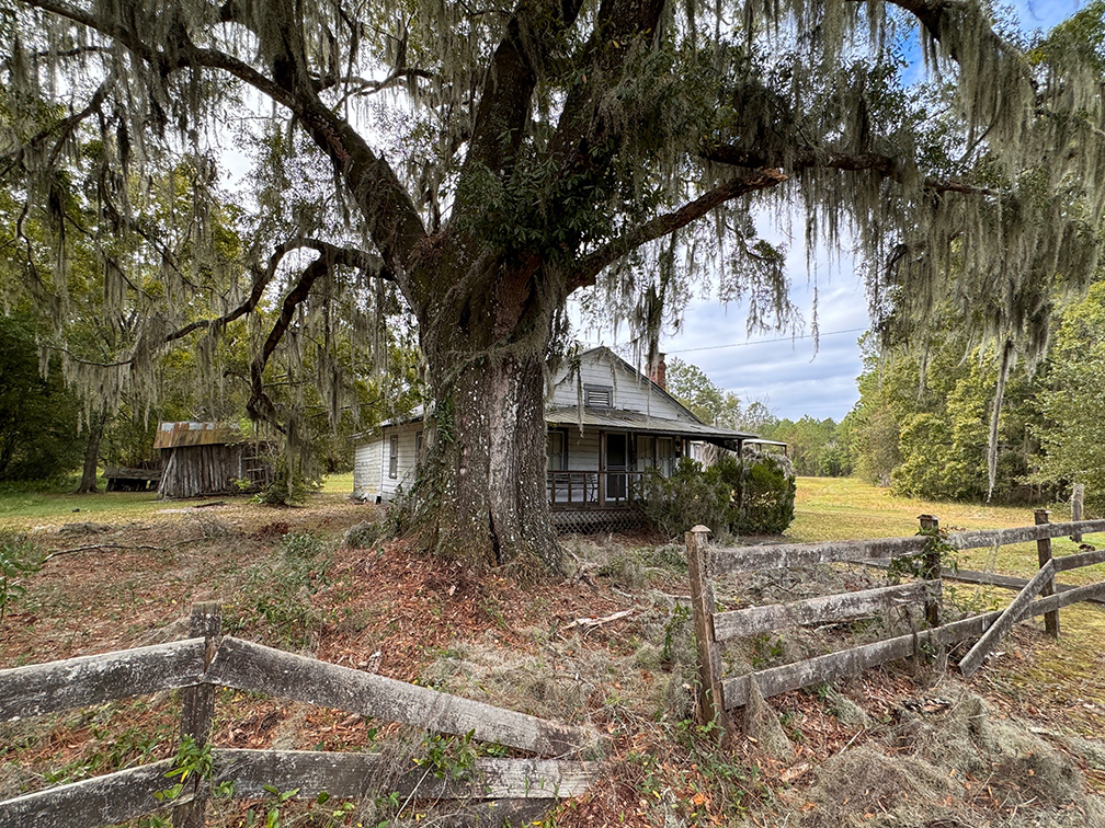 Photo 6: The Alachua Trail crosses Highway 230 and continues southward
alongside this abandoned house. P Marlin 2024
Photo 6: The Alachua Trail crosses Highway 230 and continues southward
alongside this abandoned house. P Marlin 2024
VANDERHILL: "The route of the Alachua Trail from Kingsleys Pond to its southern terminus is well documented. From late Spanish times until the end of the territorial period it was an important link between the Alachua settlements and the outside world, while its use as a segment of the military road gave it added significance. A short distance beyond the fork to Black Creek, the trail to Alachua crossed the upper reach of Alligator Creek. From this point it assumed a southwesterly direction upon a pelt of sandilands offering a relatively dry passageway through the central Florida terrain of lakes, swamps, and marshes. This sandy zone is structurally a terminal feature of Trail Ridge. The Santa Fe River was reached south of Hampton Lake, which on early maps was called Little Santa Fe Pond. The section of the route between the Alligator and the Santa Fe has long been abandoned. "
"From the Santa Fe crossing, near which Fort Harlee was established during the Indian wars, the Alachua Trail led south- ward and, two miles south of present-day Waldo, entered the great Arredondo Grant. The remainder of the route lay within its confines. Although the grant was privately surveyed, and these surveys did not take note of the old trail, the route was displayed prominently on most maps after American accession in Florida.""
---------------Departing Mrs. Monroe's location, we proceeded westward on Highway 230 toward Starke as the trail took a southwesterly direction toward Waldo. While the original Alachua Trail may have been abandoned with the advent of new settlers and roads, it's conceivable that the Newnansville / Black Creek Road traced the remnants of the original trail. Florida map Township 7 South Range 22 East (sections 34, 35 and 36) suggests that the route of the Newnansville Road / Alachua Trail closely aligned with today's SE County Road 221 as it intersected with today's Highway 301.
From Highway 301, we followed the Newnansville Road/Alachua Trail (a dirt road) westward for a brief stretch. Situated south of Hampton Lake (formerly Santa Fe Pond) and paralleling the Santa Fe River, the length of the original Newnansville Road / Alachua Trail route is now situated on private property. Upon its establishment, the original Newnansville Road provided access to the first county seat of Alachua, known as Newnansville (1828), and Fort Harllee, established during the Second Seminole War. It is probable, that for a time, the Newnansville Road, stretching westward, and the Alachua Trail, leading south, diverged near the vicinity of Fort Harllee.
Fort Harllee, named for Major William W. Harllee, the fort's first commander, was constructed in 1837 to provide Florida pioneers protection against Native American raids. Situated southwest of Santa Fe Pond (Hampton Lake) on the Santa Fe River, the fort likely became a significant trail crossing point when the military constructed a bridge across the river, called the Santa Fe Bridge. A report on the "theater of military operations in Florida" by T.B. Lieman, adjutant on the staff of General T.S. Jesup, indicates that "Fort Harlee is 27 miles north from Micconopa at the point where the road crosses the St. Fe river. This post has proved quite healthy."
Jacob R. Motte, an army surgeon during the Creek and Seminole Wars, wrote of Ft. Harllee in his book, Journey Into Wilderness, "This post was situated between Garey's ferry and Newnansville; 27 miles from the former, and 18 miles from the latter. It was situated on a branch of the Santa Fe River, where a bridge had been thrown across the stream, and designated as the Santa Fe bridge. Major Harllee of the South Carolina Volunteers, who was here the preceding winter, erected pickets with two block houses at diagonal corners after the fashion of Florida forts; and hence it was dubbed Fort Harllee. A log pine-flat extended around in all directions, and nothing interrupted the monotonous view of russet pine trucks but a few miserable shantees, hurriedly erected -- some of pine-bark only --and occupied by cracker families who had left their homes and resorted hither to be under the wing of our protection."
In 1975, divers exploring the Santa Fe River found the remains of large timbers where the bridge used to cross. It is believed that this bridge stands as the sole example of an Indian fort bridge in Florida. Due to Rayonier's leasing of the area for pulpwood operations, any remnants of Fort Harllee are likely destroyed.
Further reading on the history of Ft. Harllee is available at the Bradford County Telegraph (1979).
 A sketch of Fort Harllee and the Santa Fe River bridge.
Florida Memory
A sketch of Fort Harllee and the Santa Fe River bridge.
Florida Memory
 Sections 34, 35 and 26, of Township 7 Range 21 East of Florida
Survey map illustrates Fort Harllee along the Newnansville Road as
the Alachua Trail continued southward toward Alachua (illustrated
in the Arrendondo Grant map below).
Sections 34, 35 and 26, of Township 7 Range 21 East of Florida
Survey map illustrates Fort Harllee along the Newnansville Road as
the Alachua Trail continued southward toward Alachua (illustrated
in the Arrendondo Grant map below).
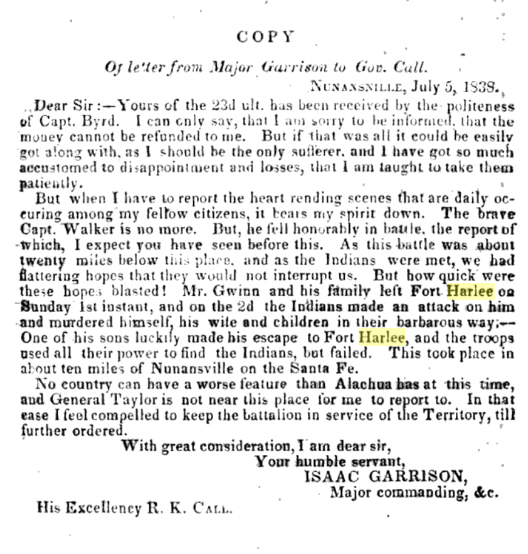 A Journal of the Proceedings of the Senate of the Territory of
Florida at its Third Session (1841). Letter from Major Isaac Garrison to Florida
Governor Richard Keith Call (1838). Google Books
A Journal of the Proceedings of the Senate of the Territory of
Florida at its Third Session (1841). Letter from Major Isaac Garrison to Florida
Governor Richard Keith Call (1838). Google Books
An 1885 Alachua County map indicates that the Alachua Trail ran south from Fort Harllee through Waldo before crossing Highway 301 southwestward. Following this map, we located the trail's approximate location on Highway 301 south of Waldo as it proceeded through pine forests toward NE State Road 26. Traveling west on NE State Road 26, we encountered the trail crossing at Country Road 234 which lies within the Arrendondo Grant. A stop at this junction revealed a sandy path heading north toward Fort Harllee (Waldo), and a paved road continuing south toward Windsor on Country Road 234, the best preserved portion of the original Alachua Trail in Florida.
 The Alachua Trail traverses sections 2, 11, and 14 of this 1885 Arrendondo Grant map
as it passes through Waldo.
The trail then continues through sections 26 and 34 before entering the Arrendondo Grant
at sections 3, 10, 11 and 14.
Library of Congress
The Alachua Trail traverses sections 2, 11, and 14 of this 1885 Arrendondo Grant map
as it passes through Waldo.
The trail then continues through sections 26 and 34 before entering the Arrendondo Grant
at sections 3, 10, 11 and 14.
Library of Congress
 This 2024 Randy Majors map features the same region depicted in the preceding Arredondo Grant map, along with designated photo stops. P Marlin 2024
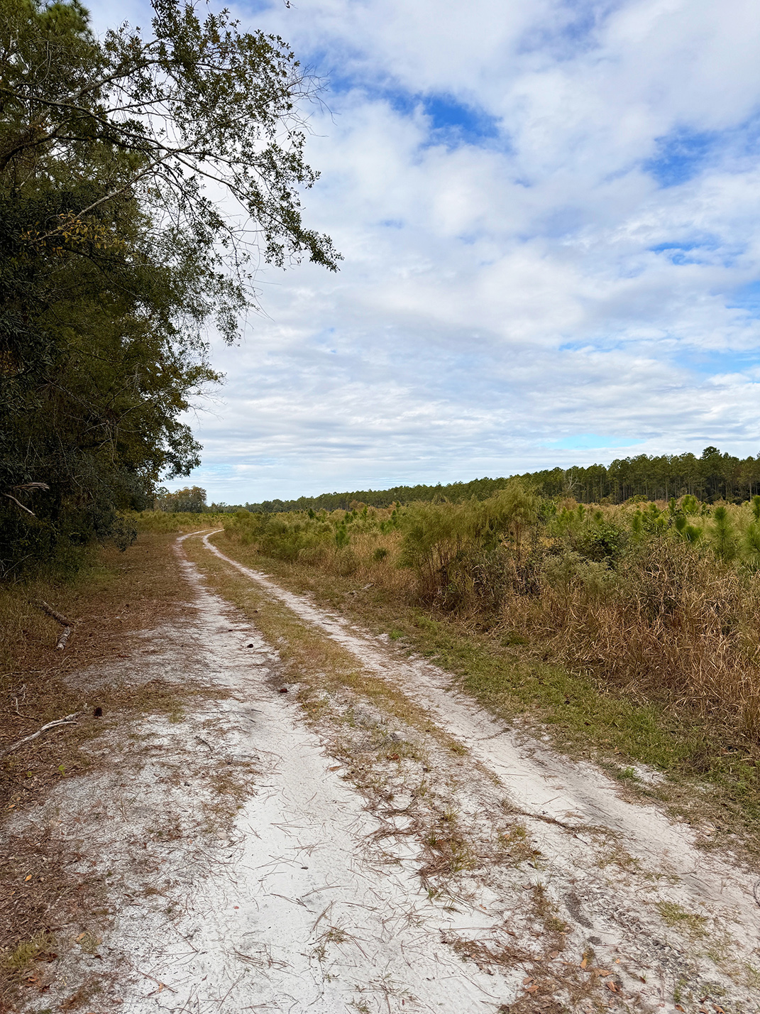 Photo 1: Heading west from Highway 301, the Old Newnansville Road runs along the shores of present-day Hampton Lake, once known as Santa Fe Pond, before reaching the former site of Fort Harllee, now on private property.. P Marlin 2024
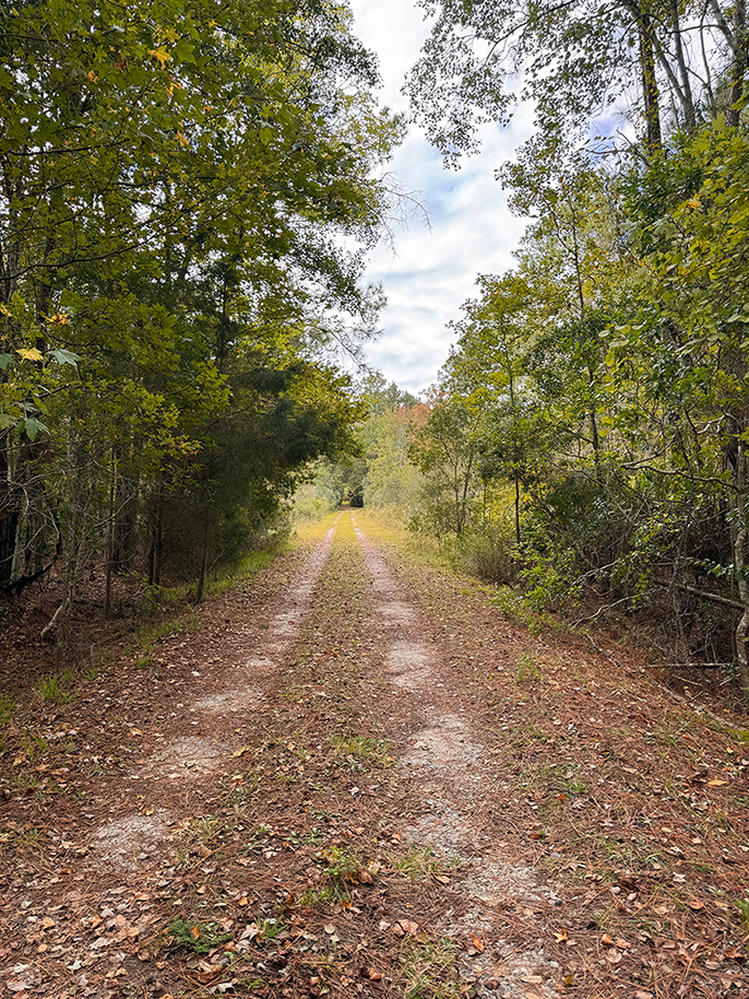 Photo 2: From Highway 301 south of Waldo, the Alachua Trail traverses a pine forest
before reaching the Arrendondo Grant and Country Road 234. P Marlin 2024
Photo 2: From Highway 301 south of Waldo, the Alachua Trail traverses a pine forest
before reaching the Arrendondo Grant and Country Road 234. P Marlin 2024
 Photo 3: This path is a continuation of the Alachua Trail as it crosses
Northeast State Road 26 to Country Road 234 from Waldo. P Marlin 2024
Photo 3: This path is a continuation of the Alachua Trail as it crosses
Northeast State Road 26 to Country Road 234 from Waldo. P Marlin 2024
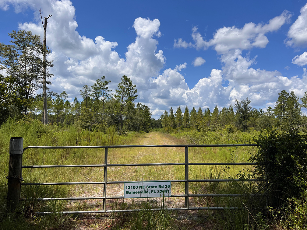 Photo 4: A closer view of photo 3. P Marlin 2024
VANDERHILL: "The Hunter map of 1885 is particularly useful, detailing the route from Fort Harlee to Micanopy. The trail led via Waldo to the east shore of Newnans Lake, formerly Lake Pithlacoochee. It remained upon the higher sandilands about a mile back from the low, swampy margin of the lake. Beyond the village of Windsor, it angled to the southwest through Fort Crane, from which developed Rochelle, then skirted the eastern edge of the Alachua savanna to reach Micanopy, three miles south of the prairie's rim. Here Wanton's store had been established on the north shore of Lake Tuscawilla in the heart of an ancient Indian area."
"Much of the route of the Alachua Trail south of the Santa Fe is in use today. U.S. Highway 301 either follows or closely parallels the old trail as far as Waldo. From the southern edge of Waldo, a woods road closed to the public leads south to intersect State Highway 26 northeast of Newnans Lake. State Highway 234 continues from this intersection through the relict communities of Windsor and Rochelle to terminate at Micanopy, adhering in a general way to the alignment of the Alachua Trail. Most of Rochelle lies off the present highway on an old loop of the Alachua route. Highway 234 enters Micanopy about one-half mile east of the old trail."
---------------Continuing our journey from NE State Road 26, we set off on the final leg of the Alachua Trail, traveling southward along Country Road 234 toward modern-day Windsor. Immersing ourselves in the Florida pioneer landscape from which our expedition derives its name, this best preserved segment of the Alachua Trail leads to Micanopy, the trail's terminus. Presenting a picturesque route along the southern edge of Newnans Lake (Lake Pithlachocco) where Native American canoes once glided along its shores, the road continues southwestward through abandoned cotton plantations, frontier churches, a Florida Senator's home, and the historic site of Colonel Daniel Newnan's encounter with the Seminoles in 1812.
Newnans Lake, situated near the Alachua Savanna, embraces the verdant presence of gum and bald cypress trees as it has since the early days of the Alachua Trail. Formerly named Lake Pithlachocco, a word derived from the Seminole meaning "place of long boats," the lake was later renamed for Colonel Daniel Newnan. In 2000, the discovery of 101 canoes along the northeast shore of the lake provided evidence of an indigenous presence dating back to the Archaic Period. Marking the largest collection of historic canoes ever uncovered, this archaeological find earned Lake Pithlachocco a place on the National Register of Historic Places. Moreover, this discovery suggests the utilization of the Alachua Trail pathway since prehistoric times. See Dugout Canoes-Discovering 101 Canoes at Newnans Lake.
During the British occupation of Florida, the diverse native tribes of Florida came to be known as "Seminoles," derived from the Spanish term "cimarron," meaning "runaway" or "wild one." Ahaya, a Lower Creek from Georgia, established the Seminole legacy by founding the Alachua territory, located at the southern edge of the Savanna, adjacent to Newnans Lake. (see stop 16). A journal, written by John Charles Richard, a plantation owner in Alachua in 1843, describes the Seminoles in the following excerpt published in the Bradford County Telegraph in 1979.
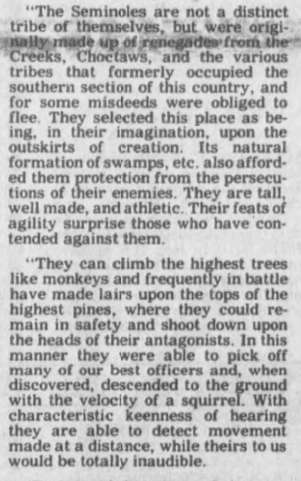 An excerpt from the journal of John Charles Richard, a plantation
owner in Alachua in 1843. The excerpt was printed in the
Bradford County Telegraph in 1979.
An excerpt from the journal of John Charles Richard, a plantation
owner in Alachua in 1843. The excerpt was printed in the
Bradford County Telegraph in 1979.
The influx of Europeans and Americans into Native American-controlled areas provoked heightened hostility among the Seminoles. Consequently, this led to Seminole raids on white settlements and plantations. Paul M. Pressley, author of Marronage, Freedom, and the Entangled Borders of Lowcountry Georgia and Spanish Florida states that "From the last quarter of the eighteenth century to the second decade of the nineteenth, the flow of black people from Georgia to the Seminoles was constant. They were also slaves who had been seized during periodic raids conducted by the Seminoles down the river systems of Georgia and in Florida, some of whom were held against their will but many of whom preferred this new way of life."
In 1812, Colonel Daniel Newnan led a contingent of Georgia Militia into Alachua territory, marking the initial significant clash between Seminole warriors and American forces. The precise motive behind this incursion remains ambiguous, but it appears to have been aimed at securing Spanish Florida for the United States, curbing Native American incursions along the Florida-Georgia border, and retrieving escaped slaves for American landowners. While en route from Ft. Picolata along the St. John's River to Payne's Town, a Seminole settlement in the Alachua territory, Newnan and his troops unexpectedly encountered a raiding party under Seminole chief King Payne along the Alachua Trail, near what is now Highway 20 on the southwest perimeter of Newnans Lake. Upon this encounter, both parties swiftly reacted; the Seminoles sought refuge in the nearby swamp, while Newnan and his men hastily erected a breastwork.
After nearly a week of engagement, the confrontation ended inconclusively. Though declaring victory, Newnan and his men narrowly managed to escape with their lives, while King Payne was fatally wounded during the encounter. Newnan later stated that "Accordingly a half an hour before sunset, having obtained a considerable reinforcement of negroes and Indians, from their towns, they commenced the most horrid yells imaginable, imitating the cries and noise of almost every animal of the forest, their chiefs advancing in front in a stopping serpentine manner, and making the most wild and frantic gestures, until they approached within two hundred yards of us."
In 1912, the Daughters of the American Revolution placed a concrete marker along the Alachua Trail commemorating the site of the conflict. Presently, the marker is largely obscured by overgrowth.
By 1855, the area's earliest white settlers, who were cotton planters, arrived in the area. These included Reverend Edward L. King, a Methodist clergyman and cotton planter, along with prominent figures like John Kennedy, Edward Lewis, and John Alexander Rosborough, who established their cotton plantations along the Alachua Trail (Country Road 234). From these cotton planters, the community of Windsor was established in 1884.
Today, the historical importance of this stretch of Country Road 234 has largely faded from memory. Cotton and citrus cultivation have given way to blueberry farming, and only a few 19th-century structures remain as a reminder of the first white settlers who displaced the remnants of an ancient Native American settlement.
 The Alachua Trail traverses southward
through sections 3, 11, 14, 23, 36, 35, 2, 10, 11, 15, and 21 within the Arrendondo Grant.
Library of Congress
The Alachua Trail traverses southward
through sections 3, 11, 14, 23, 36, 35, 2, 10, 11, 15, and 21 within the Arrendondo Grant.
Library of Congress
 This 2024 Randy Majors map features the same region depicted in the
preceding Arrendondo Grant map, along with designated photo stops. P Marlin 2024
This 2024 Randy Majors map features the same region depicted in the
preceding Arrendondo Grant map, along with designated photo stops. P Marlin 2024
 Photo 1: This segment of Country Road 234 closely aligns with
the original path of the Alachua Trail. P Marlin 2024
Photo 1: This segment of Country Road 234 closely aligns with
the original path of the Alachua Trail. P Marlin 2024
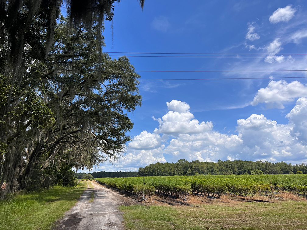 Photo 2: Blueberry farming has replaced cotton and citrus. P Marlin 2024
 Photo 3: Providence Methodist Church and Cemetery established in 1854. P Marlin 2024
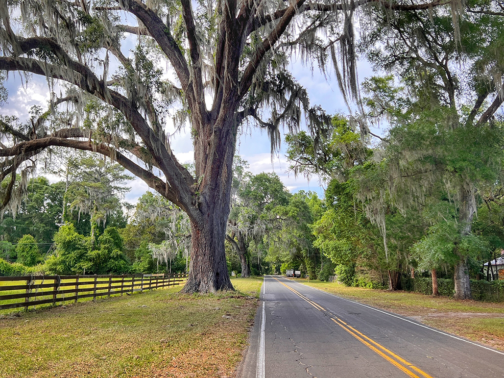 Photo 4: The trail through old oak trees. P Marlin 2024
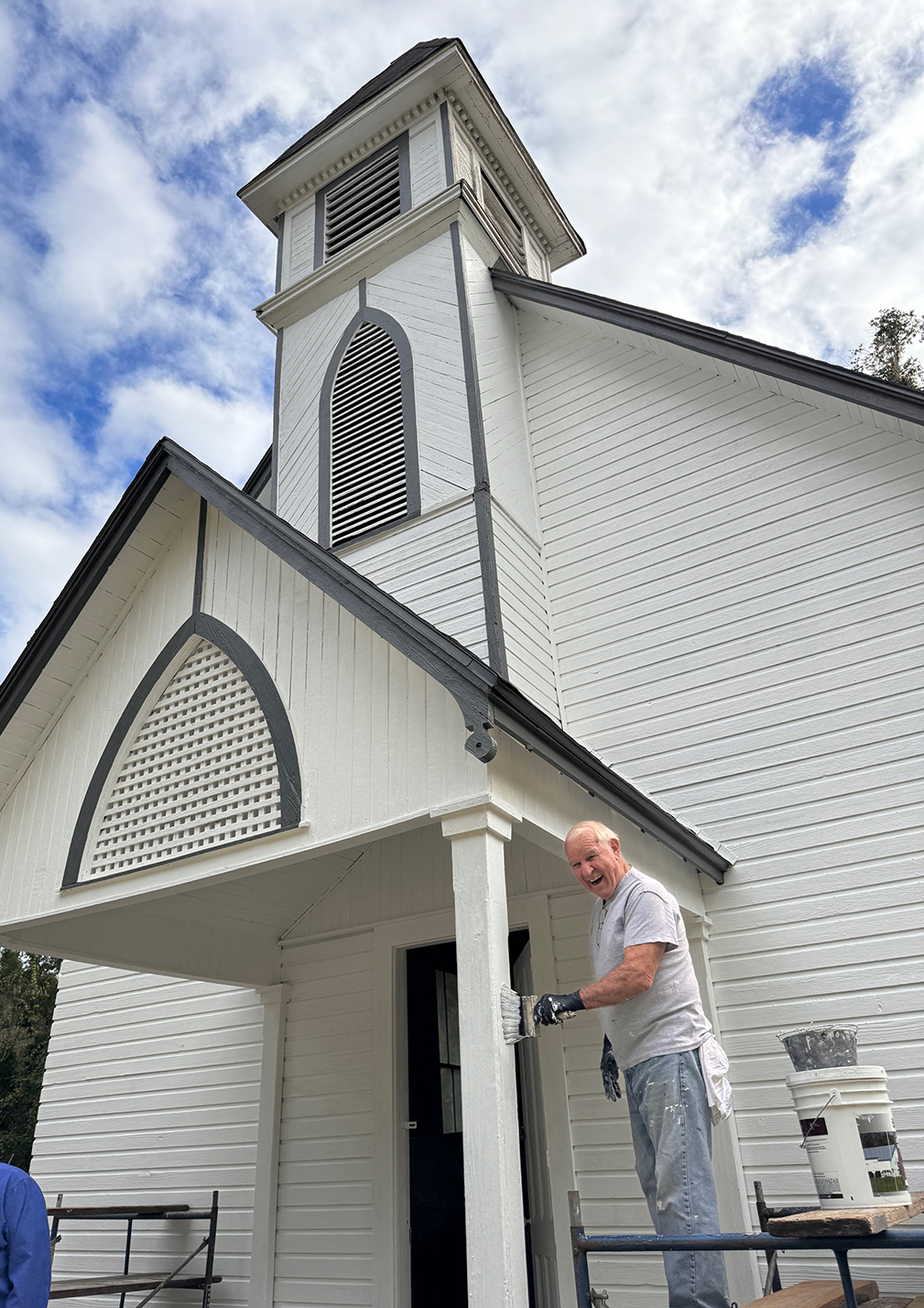 Photo 5: The Wesley Baptist Church established in the 1880s,
gets a sprucing up from its owner. P Marlin 2024
Photo 5: The Wesley Baptist Church established in the 1880s,
gets a sprucing up from its owner. P Marlin 2024
 Photo 5: Wesley Baptist Church, established in
the 1880s, prior to its exterior restoration. P Marlin 2019
Photo 5: Wesley Baptist Church, established in
the 1880s, prior to its exterior restoration. P Marlin 2019
 Photo 6: The former home of Florida Senator,
John Alexander Rosborough, along the former Alachua Trail. P Marlin 2024
Photo 6: The former home of Florida Senator,
John Alexander Rosborough, along the former Alachua Trail. P Marlin 2024
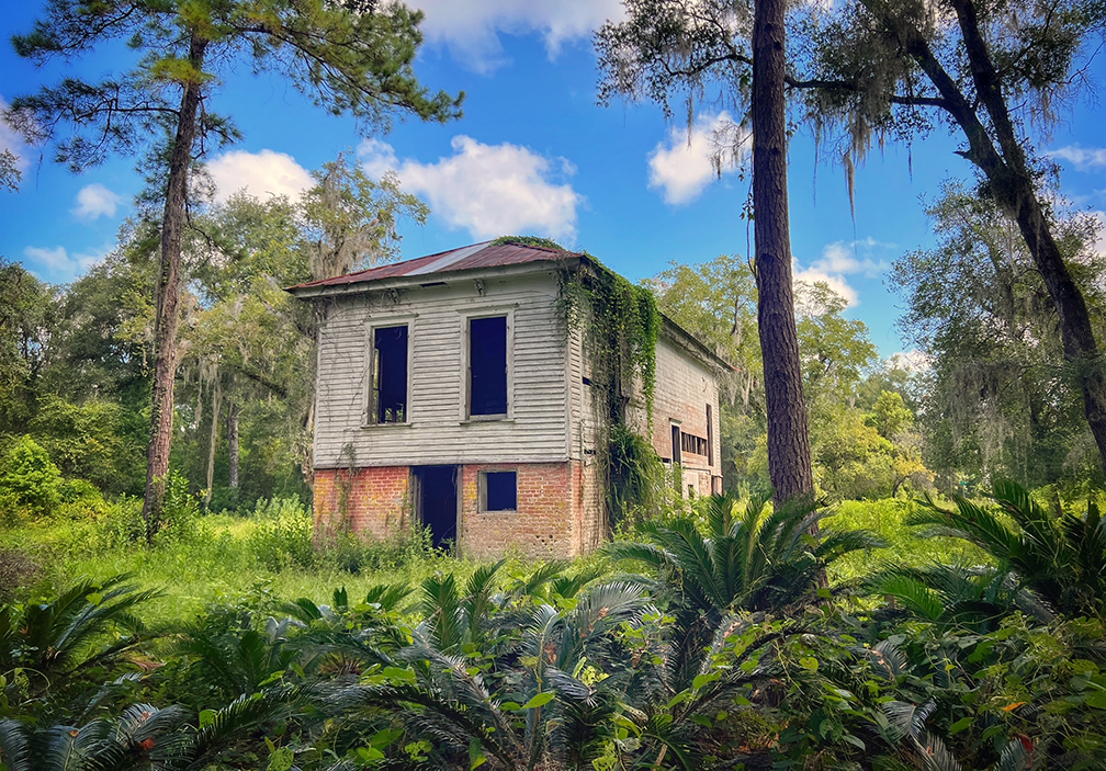 Photo 7: The ruins of the Edward Lewis plantation
home along the former Alachua Trail. P Marlin 2024
Photo 7: The ruins of the Edward Lewis plantation
home along the former Alachua Trail. P Marlin 2024
 Photo 8: A view of Newnans Lake at the Owen - Illinois Park. P Marlin 2024
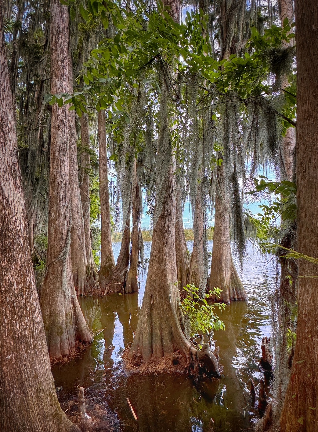 Photo 8: Bald Cypress on the edge of Newnans Lake at the Owen - Illinois Park. P Marlin 2024
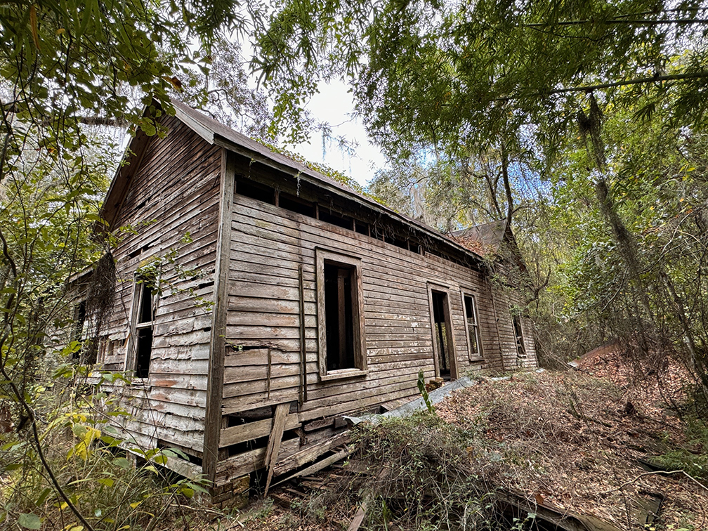 Photo 9: An abandoned homestead along the former Alachua trail
near the property of Florida pioneer cotton planter, John Kennedy. P Marlin 2024
Photo 9: An abandoned homestead along the former Alachua trail
near the property of Florida pioneer cotton planter, John Kennedy. P Marlin 2024
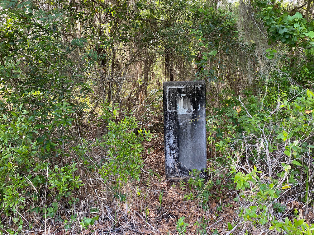 Photo 10: A concrete marker placed by the Daughters of the American
Revolution in 1912 memoralizes the site of Daniel Newnan's
encounter with King Payne and the Seminoles. P Marlin 2024
Photo 10: A concrete marker placed by the Daughters of the American
Revolution in 1912 memoralizes the site of Daniel Newnan's
encounter with King Payne and the Seminoles. P Marlin 2024
Continuing along Country Road 234, our journey led across Highway 20 (Hawthorne Road) toward present day Rochelle (formerly known as Gruelle and Perry). Upon reaching Rochelle, we continued on Country Road 234 as it aligned with SE County Road 2082 before turning south toward Micanopy. Diverging from County Road 234 near the community of Rochelle, the Alachua Trail continued in a southwestward direction near the vicinity of SE County Road 2082 and SE 92 Terrace. At this juncture, the trail traverses today's farmland as well as the original site of Fort Crane, a Seminole War fort, before intersecting with Country Road 234 again near the Oak Ridge Cemetery.
Constructed along the Alachua Trail during the Second Seminole War (1835), Fort Crane served as a protective outpost for settlers. Named after Lt. Colonel Ichabod Crane, it operated as a stockade manned by local militia. From the settlement of Fort Crane, the community of Rochelle grew. In the 1850s, Madison Starke Perry, a South Carolina cotton planter, relocated to this area, and in 1857, became Florida's fourth governor. As governor, Perry played a pivotal role in resolving a longstanding boundary dispute with Georgia and championed the development of railways, with Rochelle as a major railroad stop. When Governor Perry passed away in 1865, he was buried at the Oak Ridge Cemetery, located on Country Road 234 near the crossing point of the Alachua Trail. Lars Anderson, author of the book, Paynes Prairie, states that, "The original [Alachua] trail passed the back side of the cemetery, its rutted remains still visible from the back fence" (see photo 7).
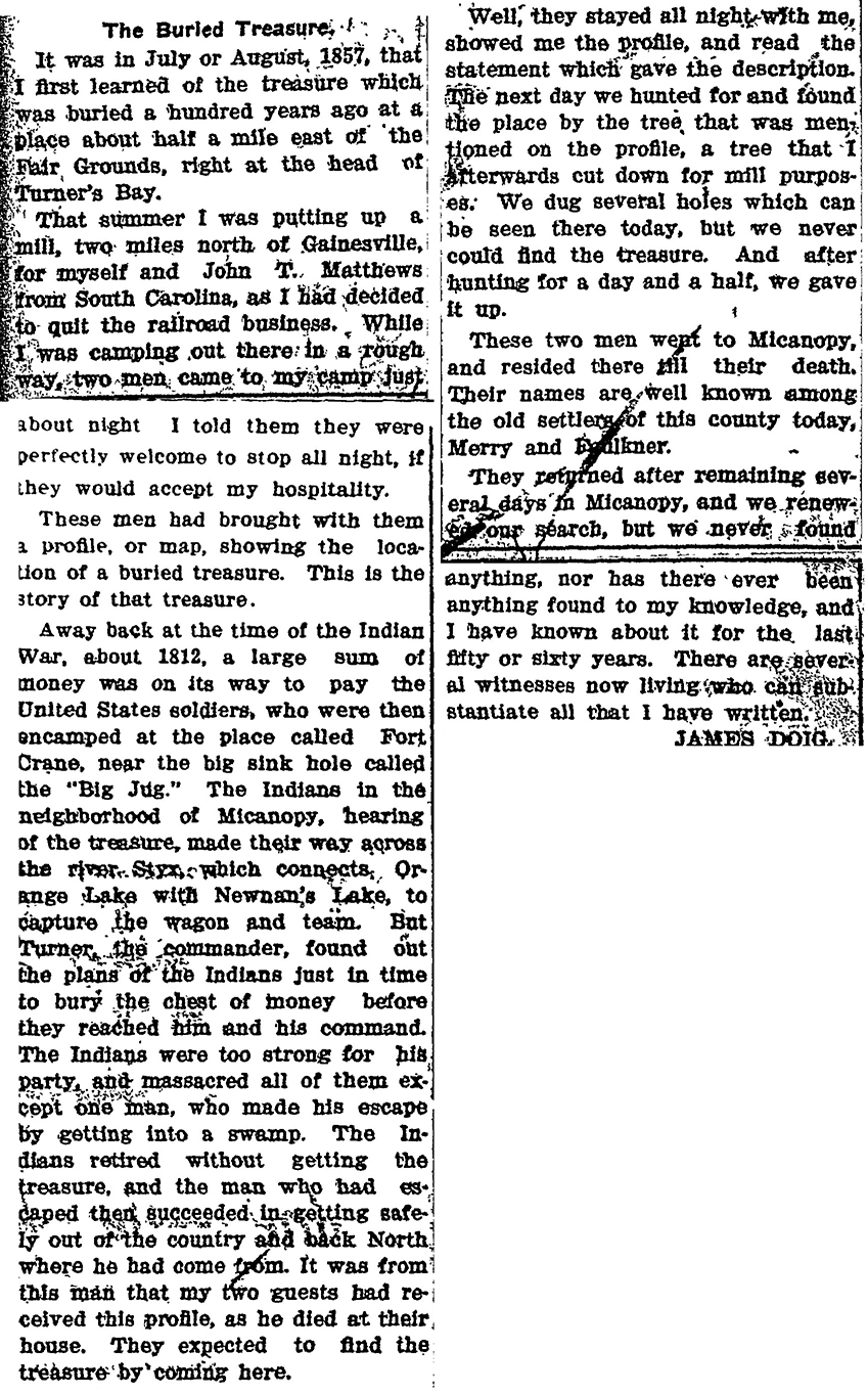
Presently, the original site of Fort Crane lies on private land adjacent to Swallowtail Farm. Attempts to reach the trail and former fort site via a backcountry road were hindered by impassable conditions, however, evidence of the trail's rutted remains can be observed behind Oak Ridge Cemetery, likely dating back to stagecoach era. In 1917, James Doig, a Gainesville resident, intrigued locals with his story of buried treasure near Fort Crane, as recounted in the Gainesville Daily Sun.
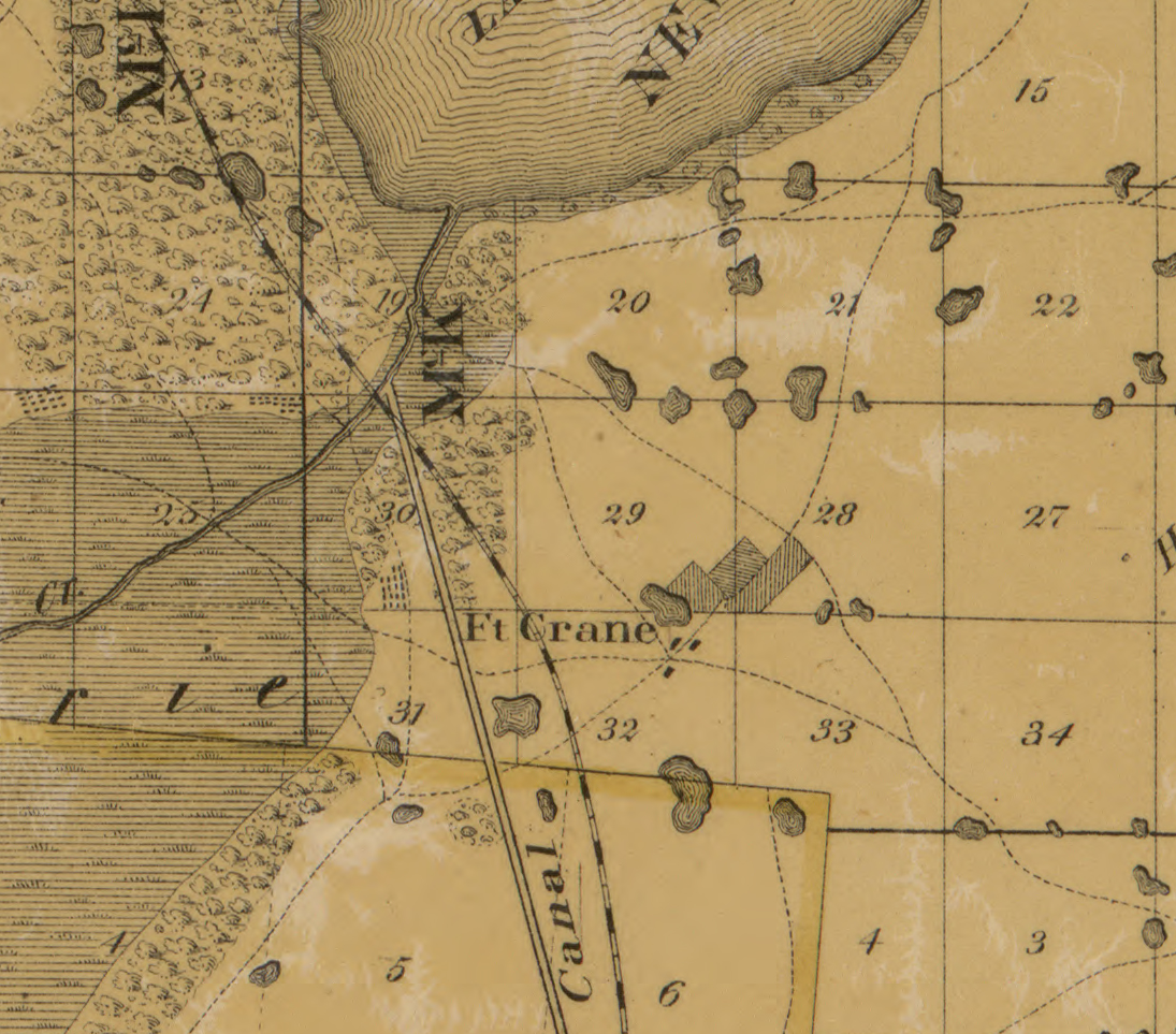 The Alachua trail traverses sections 21, 28, 32 and 5.
Library of Congress
The Alachua trail traverses sections 21, 28, 32 and 5.
Library of Congress
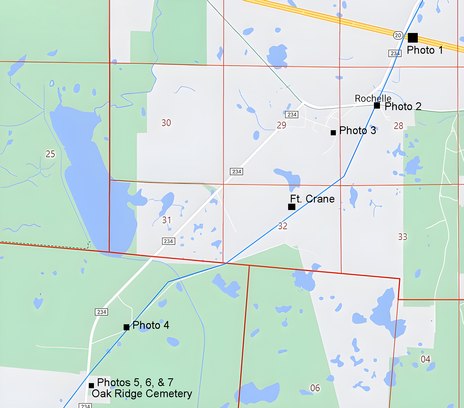 This 2024 Randy Majors map features the
same region depicted in the preceding Florida Survey map,
along with designated photo stops. P Marlin 2024
This 2024 Randy Majors map features the
same region depicted in the preceding Florida Survey map,
along with designated photo stops. P Marlin 2024
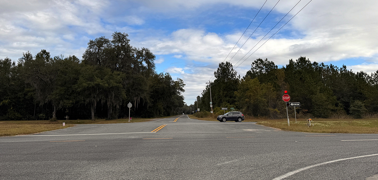 Photo 1: The Alachua Trail crossed the
intersection of Highway 20 and Country Road 234 as it continued
south to Rochelle. P Marlin 2024
Photo 1: The Alachua Trail crossed the
intersection of Highway 20 and Country Road 234 as it continued
south to Rochelle. P Marlin 2024
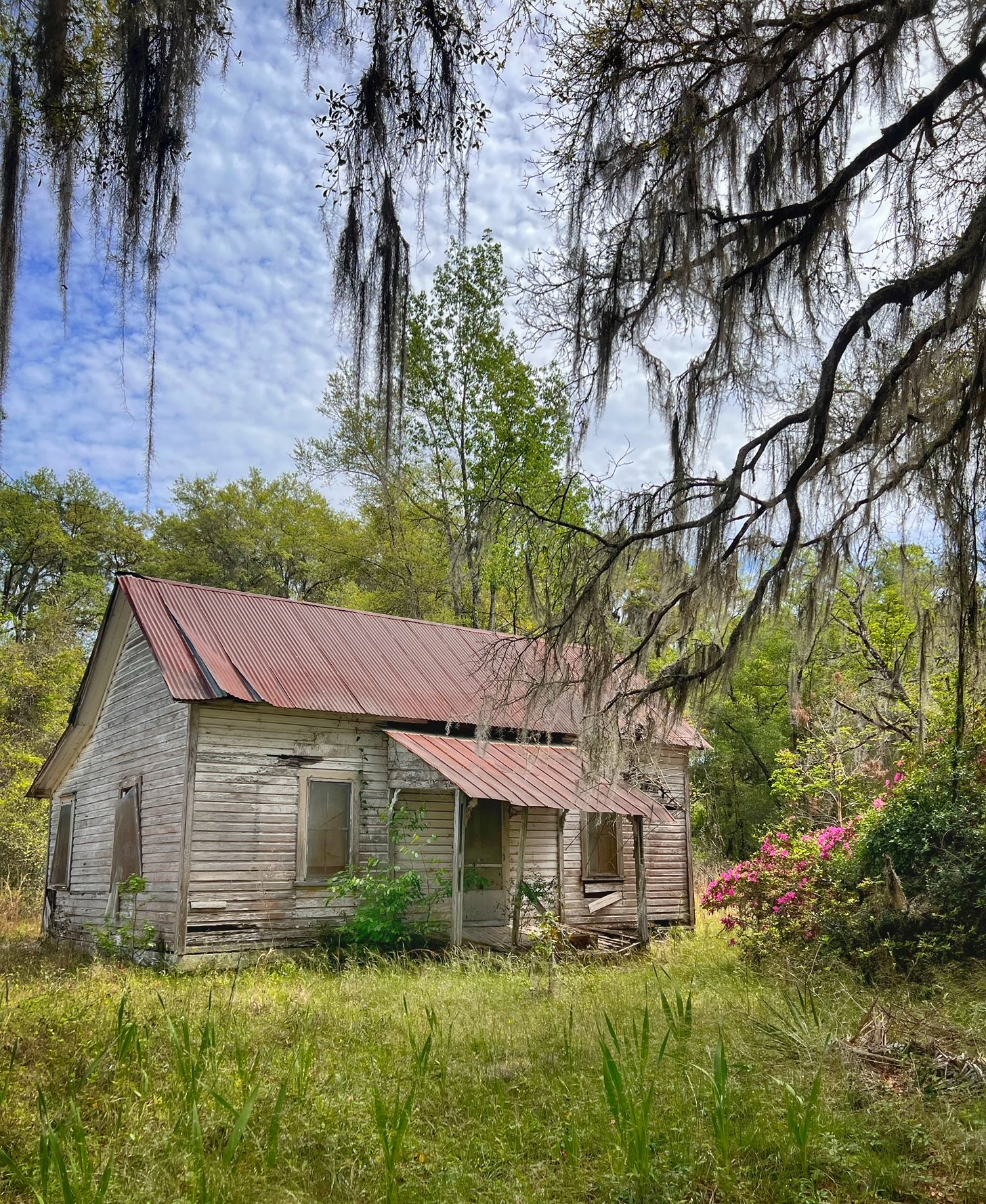 Photo 2: An abandoned home near the former Alachua Trail. P Marlin 2024
 Photo 3: When the Trinity M.E. Church,
South was established
in 1876, the trail passed to its east. This uniquely beautiful church
is still standing today. It is, however, located on private property. P Marlin 2024
Photo 3: When the Trinity M.E. Church,
South was established
in 1876, the trail passed to its east. This uniquely beautiful church
is still standing today. It is, however, located on private property. P Marlin 2024
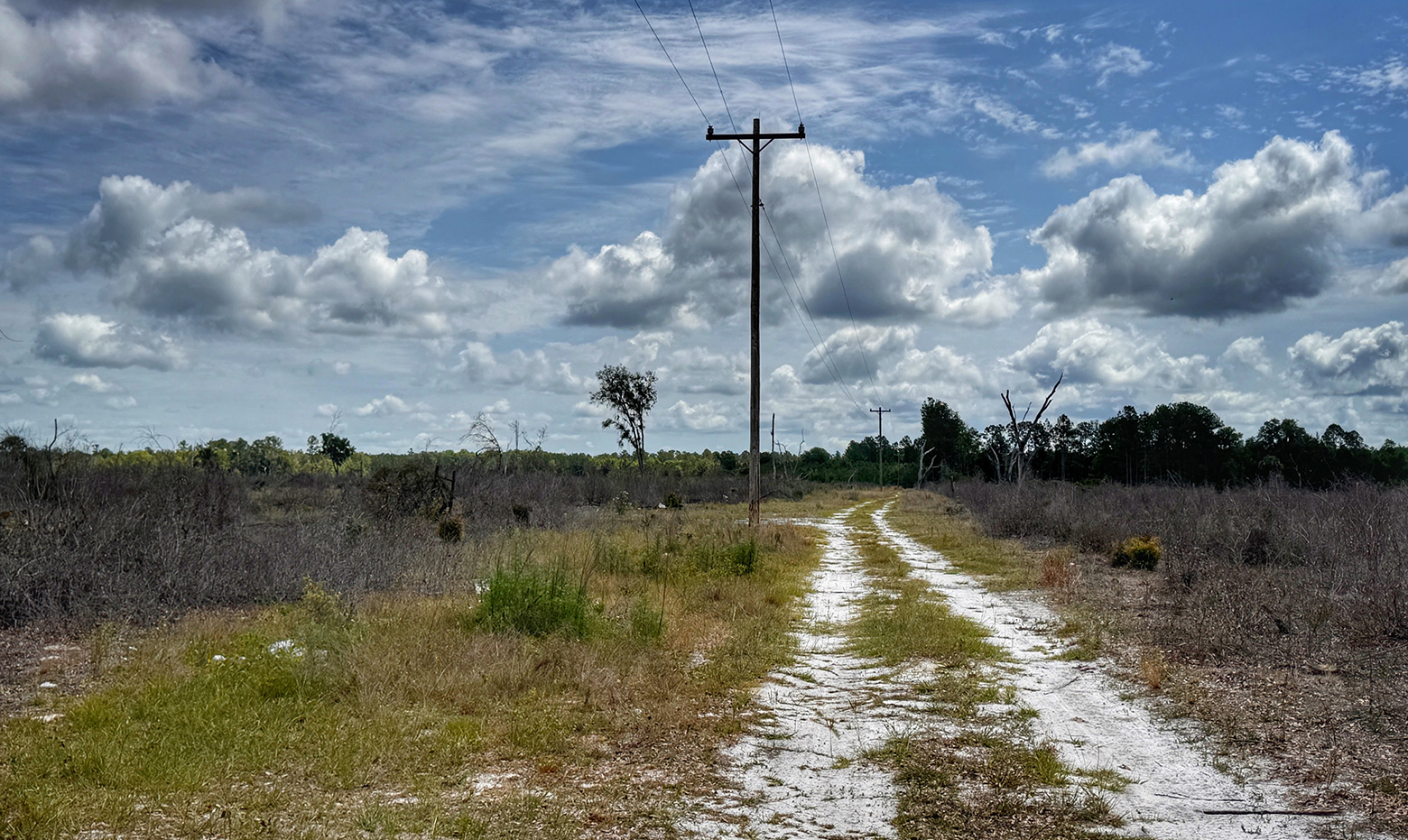 Photo 4: In search of Fort Crane. P Marlin 2024
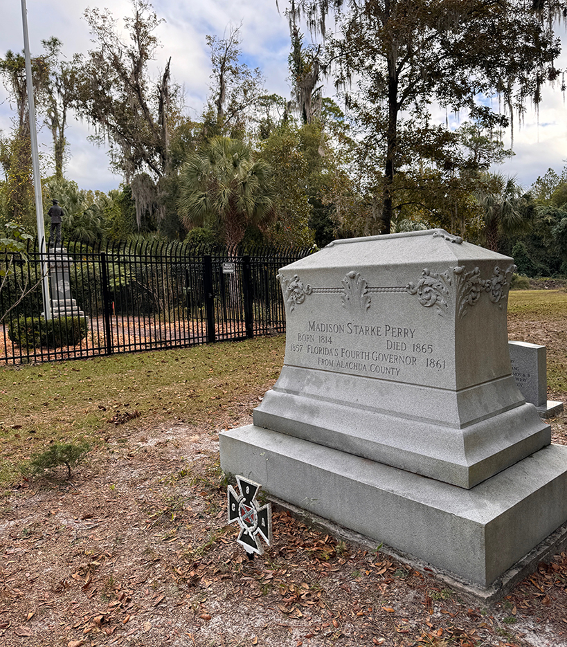 Photo 5: The burial site of Florida's fourth governor,
Madison Starke Perry at Oak Ridge Cemetery in Rochelle.
The confederate monument that once graced the grounds of
the
Alachua County Courthouse in Gainesville is located within the gated
enclosure. P Marlin 2024
Photo 5: The burial site of Florida's fourth governor,
Madison Starke Perry at Oak Ridge Cemetery in Rochelle.
The confederate monument that once graced the grounds of
the
Alachua County Courthouse in Gainesville is located within the gated
enclosure. P Marlin 2024
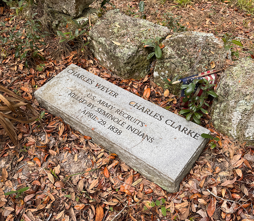 Photo 6: The Oak Ridge Cemetery near Rochelle. P Marlin 2024
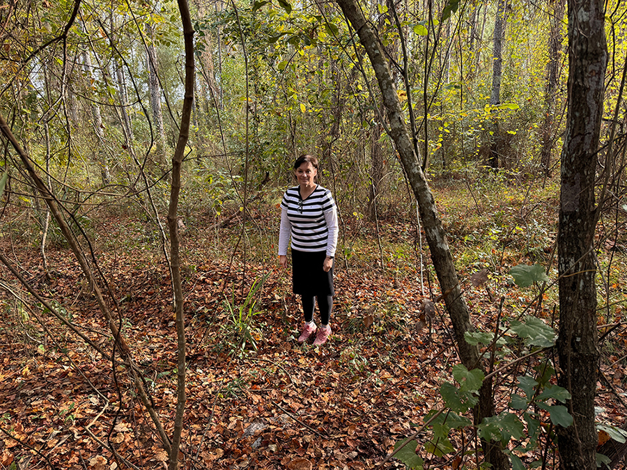 Photo 7: Alachua Trail ruts located
behind the Oak Ridge Cemetery. P Marlin 2024
Photo 7: Alachua Trail ruts located
behind the Oak Ridge Cemetery. P Marlin 2024
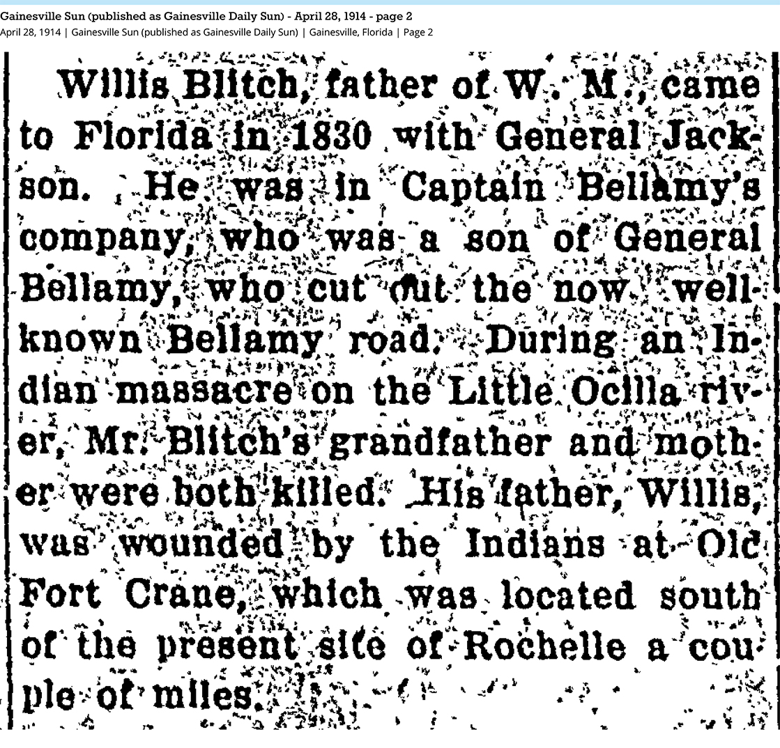
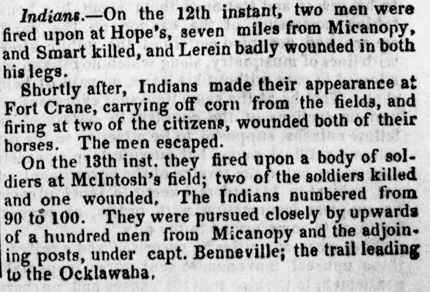 Niles' National Register. September 5, 1840.
"The experiences of the early settlers at Gainesville were fraught with great danger from the Indians, as the whites from Georgia had long been in the habit of entering this section over the Alachua trail and running off the Indians' cattle, which grazed principally on the great Payne's prairie."-Carl Webber, Eden of the South
From the Oak Ridge Cemetery, we continued south on Country Road 234 toward Micanopy, our final destination. This stretch of the Alachua Trail runs parallel to the southern rim of the Alachua Savanna, called Paynes Prairie (for Seminole chief King Payne). Paynes Prairie is an expansive terrain comprised of wetlands, grasslands, and sinkholes, the largest of which is known as the Alachua Sink. Occasionally, these sinkholes become clogged, transforming the prairie into a temporary lake. In the 1823 book titled, Observations upon the Floridas," author Charles Vignoles notes that, "The Great Alachua savanna is the most considerable, being but seldom entirely free of water. Many curious stories are circulated among the Indians respecting a whirlpool, where a subterraneous discharge of water is said to take place."
Throughout the centuries, a successive wave of indigenous peoples, as well as Spanish explorers, have called this region home, each group eager to utilize its fertile land. In 1774, naturalist William Bartram visited the Great Alachua Savanna and described it in his book, Travels through North and South Carolina, Georgia, East and West Florida, the Cherokee country, the extensive territories of the Muscogulges or Creek Confederacy, and the country of the Chactaws:
"The extensive Alachua savanna is a level green plain, above fifteen miles over, fifty miles in circumference, and scarcely a tree or bush of any kind to be seen on it. It is encircled with high, sloping hills, covered with wavering forests and fragrant Orange groves, rising from an exuberantly fertile soil. The towering magnolia grandiflora and transcendent Palm, stand conspicuous amongst them. At the same time are seen innumerable droves of cattle; the lordly bull, lowing cow, and sleek capricious heifer. Herds of sprightly deer, squadrons of the beautiful fleet Siminole horse, flocks of turkeys, civilized communities of the sonorous watchful crane, mix toether, appearing happy and contented in the enjoyment of peace, till disturbed and affrighted by the warrior man."
 William Bartram's drawing of the Great Alachua Savanna. Below is
a video capture of the Great Alachua Savanna (Paynes Prairie) in 2024.
William Bartram's drawing of the Great Alachua Savanna. Below is
a video capture of the Great Alachua Savanna (Paynes Prairie) in 2024.
In 1637, the Alachua Savanna became the site of one of the area's largest cattle ranches, known as the "Hacienda de la Chua" ("ranch of the sinkhole"). The ranch, called "La Chua," was operated by the Menendez Marquez family who were relatives of Pedro Menindez de Aviles, founder of St. Augustine. With its numerous cattle, the Hacienda de la Chua served as the main provider of beef to St. Augustine and other areas. The ranch also bore witness to harrowing episodes, including a French pirate assault, a Timucuan uprising, and a Creek attack that left the ranch in flames, likely marking its demise around 1705.
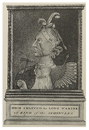 Image: William Bartram's drawing of Cowkeeper.
In the wake of the departure of the Spanish,
Ahaya, also known as "Cowkeeper," a leader of the Oconee people
from Georgia, embarked on a journey towards the vast plains of Alachua.
Amidst the abandoned La Chua ranch's cattle, he established a
settlement on the southern periphery of the Savanna and named it Alachua,
alternatively known as "Latchaway" or the "Alachuas." Later,
Cowkeeper relocated his village a few miles west of the prairie,
naming it "Cuscowilla," also known today as Micanopy.
In 1774, Bartram described Cowkeeper, "The chief is a tall well made man, very affable and cheerful, about 60 years of age, his eyes lively and full of of fire, his countenance manly and placid, yet ferocious, or what we call savage, his nose aquiline, his dress extremely simple, but his head trimmed and ornamented in the true Creek mode." Bartram continues, "The manners and customes of the Alachuas, and most of the lower Creeks or Siminoles, appear evidently tinctured with Spanish cilization."
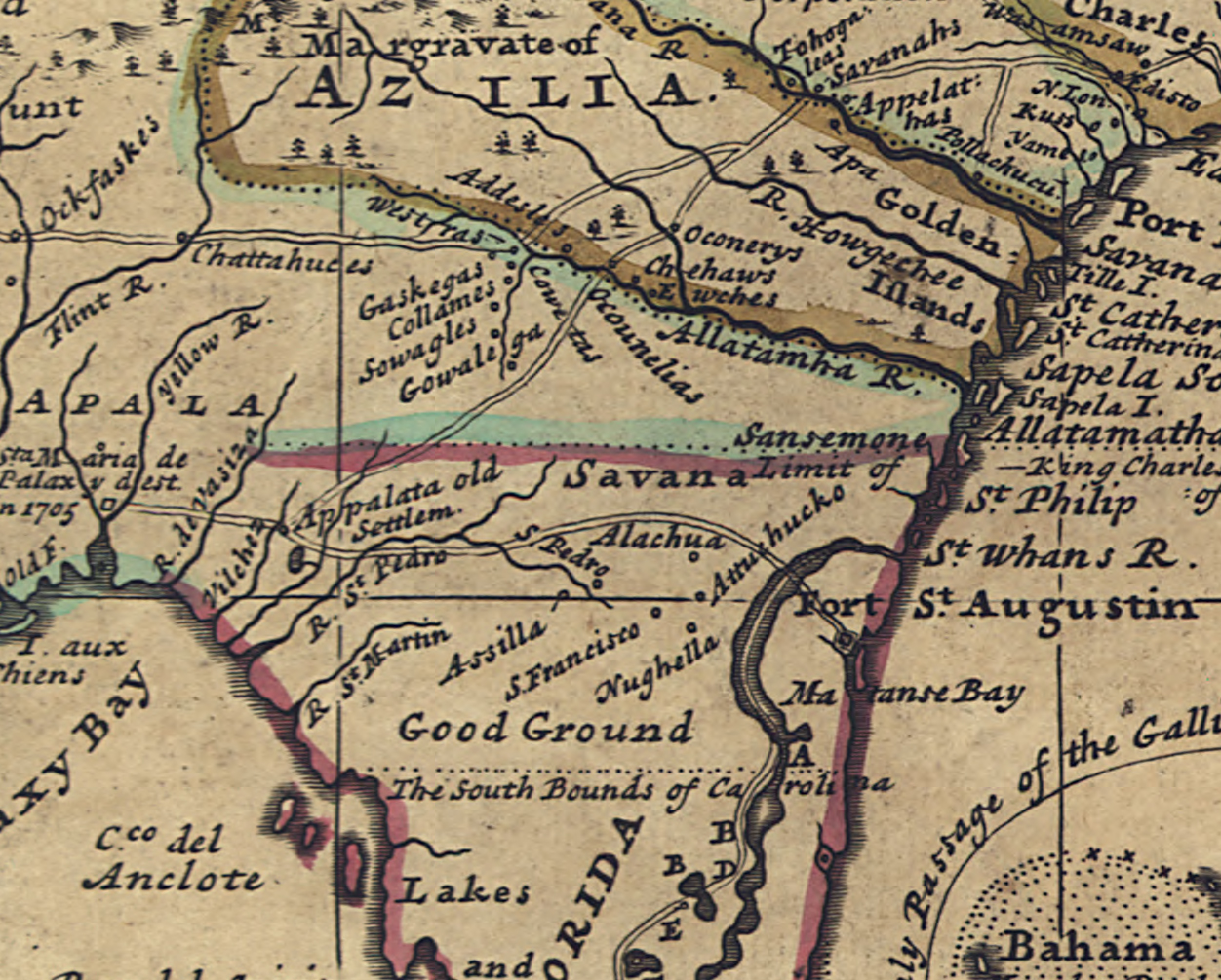 Alachua as depicted on the 1720 Henry Moll map.
Library of Congress
Alachua as depicted on the 1720 Henry Moll map.
Library of Congress
When Cowkeeper passed away in 1784, leadership of the Seminoles transitioned to King Payne. Around 1790, King Payne relocated the Seminole village closer to the Savanna, naming the new settlement Payne's Town. In this new locale, King Payne constructed a European style plantation house, showcasing the prosperity amassed from cattle management. At the height of his affluence, Payne owned a considerable number of slaves, as well as vast herds of cattle, horses, and sheep.
In 1793, King Payne, in his role as a respected leader of the Seminole band in Florida, was invited to meet with James Seagrove, the US ambassador to the Creek Nation, in Coleraine, Georgia. The meeting was designed to quell Native American incursions along the Florida - Georgia border and initiate peace. In the letter of correspondence, Seagrove addressed King Payne as "W. Payne, Head Chief of the Simanola of Creek Indians at Sotchaway." For this expedition, King Payne likely traversed the entirety of the Alachua Trail from Payne's Town to Coleraine, Georgia (see stop 7), reaching his destination on May 18, 1793.
Fatally injured during the confrontation with Colonel Newnan near Newnans Lake, King Payne succumbed to his injuries in 1812 (see stop 14). The following year, Tennessee militia returned to Alachua via the trail and razed Payne's Town. The grim realities of the confrontations between Native Americans and American troops during this time period are documented in the articles below.
In 1814, General Buckner Harris of Georgia established Fort Mitchell near the ruins of Paynes Town along the Alachua Trail. The fort featured a twenty-five-foot square, two-story blockhouse and was intended to serve as the capital of "The District of Elotchaway of the Republic of East Florida." However, the settlement was abandoned in May of the same year after Harris was ambushed and killed. Author James Cusick of The Other War of 1812 states that, "On May 5, a war party ambushed Harris while he was out exploring the countryside and killed and scalped him. They later turned in his scalp and a small pocketbook of maps and surveys to Governor Kindelan in order to receive the reward placed on his head."
In 1821, Spain ceded Florida to the United States. Following this event, Edward Wanton, having obtained permission from the Seminoles, established the first white trading post along the Alachua Trail near Cuscowilla. Known as "Wanton's," this trading post thrived in the frontier settlement to become the first inland settlement within the Florida territory, known as Micanopy.
During the Seminole Wars, Fort Defiance, likely located along the Alachua Trail, emerged as the primary fortification in Micanopy. In the initial phases of the Second Seminole War, a brief skirmish occurred between the Seminole Indians and U.S. Army soldiers stationed at the fort. This event became known as the Battle of Micanopy. Due to widespread illness, the fort was eventually burned down, later to be replaced by Fort Micanopy.
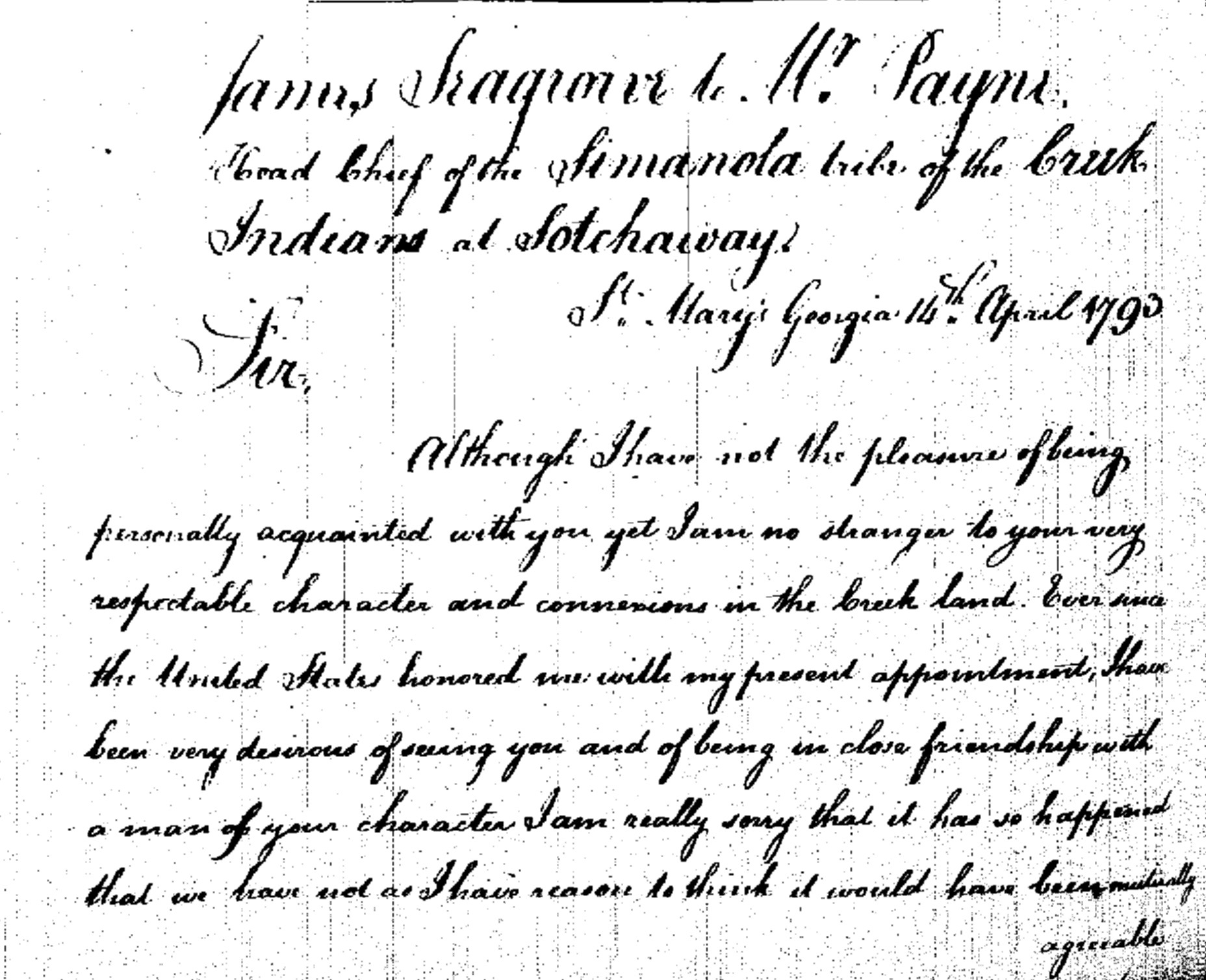 James Seagrove letter addressed to W. Payne, Head Chief of
the Simanola of Creek Indians at Sotchaway.
Papers of the War Department
James Seagrove letter addressed to W. Payne, Head Chief of
the Simanola of Creek Indians at Sotchaway.
Papers of the War Department
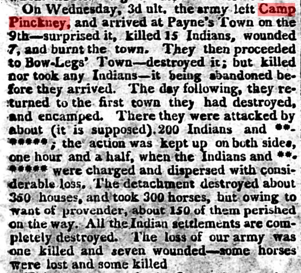 The Republican March from 1813. Georgia Historic Newspapers
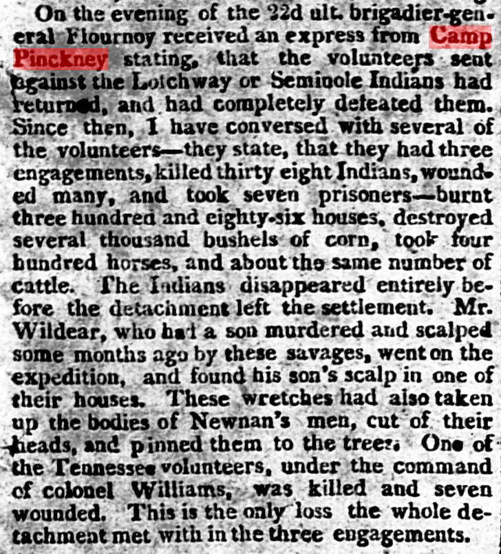 The Republican March from 1813. Georgia Historic Newspapers
Traversing the edge of the Alachua Savanna and Payne's Town, the original Alachua Trail re-aligns with today's Country Road 234 approximately two miles north of Micanopy. Within the confines of the Paynes Prairie Preserve State Park, the Chacala walking trail traverses the former site of King Payne's Seminole settlement, Payne's Town, just west of Country Road 234. In 2007, Jane Anne Blakney-Bailey, a graduate student from the University of Florida, embarked on an archaeological expedition to locate Payne's Town. Her findings and analysis were documented in her dissertation.
Today, the spirit of the Spanish "Hacienda de la Chua" can be revisited along the La Chua Trail, which winds its way along the northern edge of Paynes Prairie. This trail offers visitors a chance to witness the dynamic ecosystem of a Florida prairie up close, with opportunities to spot diverse bird species, alligators, and other native wildlife against the backdrop of expansive marshes and open skies.
In May 2024, Paynes Prairie State Park Preserve celebrated the 250th anniversary of William Bartram's exploration of the Alachua Savanna. As I finalized the writing of this Alachua Trail blog, I immersed myself in historical re-enactments and educational exhibits, gaining a firsthand glimpse into indigenous life on the Alachua Savanna. This commemoration marked the end of nearly nine months of research on the Alachua Trail.
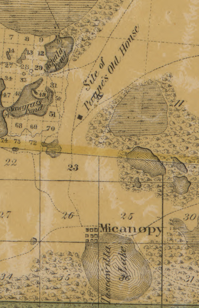 The Alachua Trail traverses sections 10, 11, 23 and 26, of the
1885 Arrendondo Grant map. Library of Congress
The Alachua Trail traverses sections 10, 11, 23 and 26, of the
1885 Arrendondo Grant map. Library of Congress
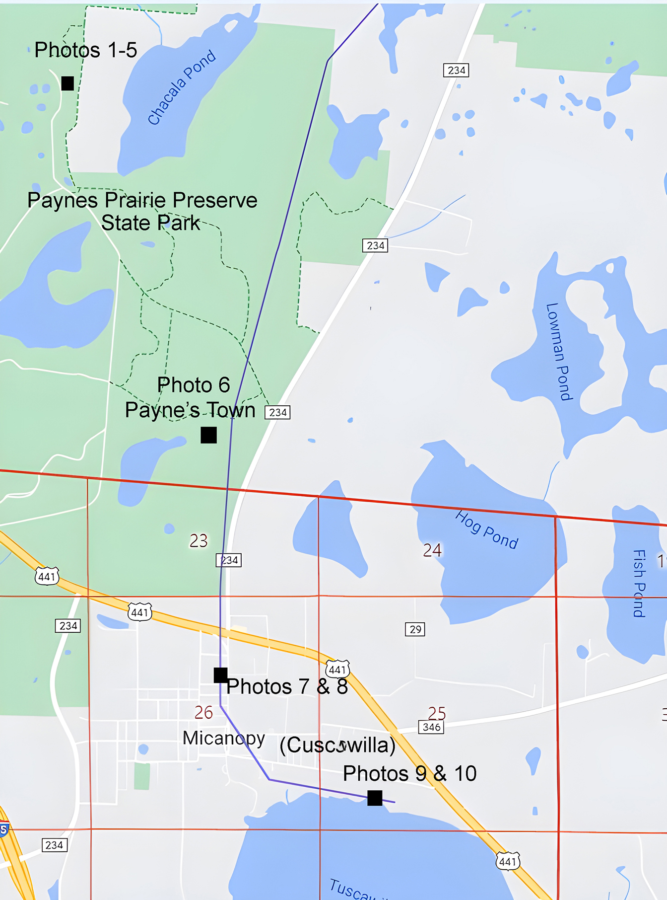 This 2024 Randy Majors map features the same region
depicted in the preceding Arredondo Grant map
along with designated photo stops. P Marlin 2024
This 2024 Randy Majors map features the same region
depicted in the preceding Arredondo Grant map
along with designated photo stops. P Marlin 2024
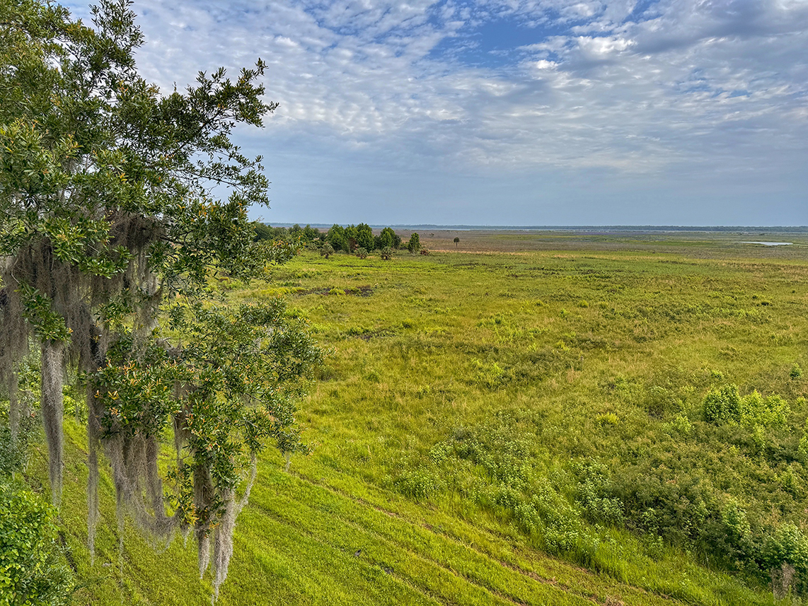 Photo 1: The Great Alachua Savanna from the Paynes
Prairie Preserve State Park observation tower.
P Marlin 2024
Photo 1: The Great Alachua Savanna from the Paynes
Prairie Preserve State Park observation tower.
P Marlin 2024
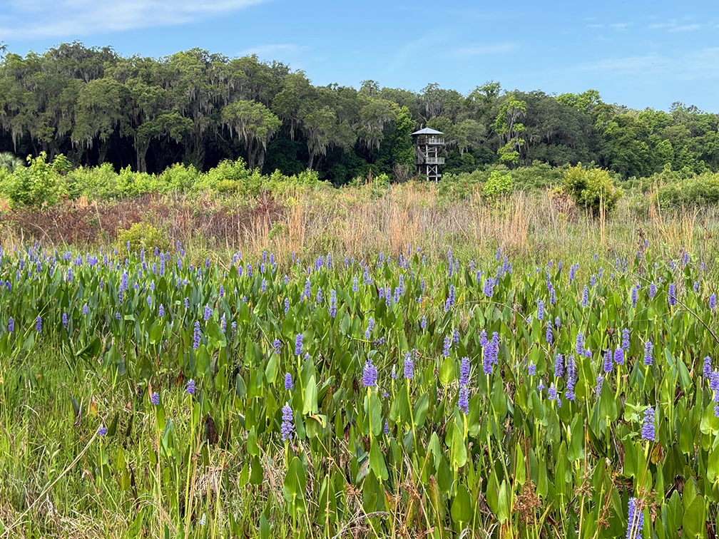 Photo 2: The Great Alachua Savanna
from the Paynes Prairie Preserve State Park observation tower.
P Marlin 2024
Photo 2: The Great Alachua Savanna
from the Paynes Prairie Preserve State Park observation tower.
P Marlin 2024
 Photo 3: "Ahaya at Alachua" The Paynes Prairie Preserve State Park celebrates the
250th Anniversary of William Bartram's visit to the prairie with
events and re-enactments. P Marlin 2024
Photo 3: "Ahaya at Alachua" The Paynes Prairie Preserve State Park celebrates the
250th Anniversary of William Bartram's visit to the prairie with
events and re-enactments. P Marlin 2024
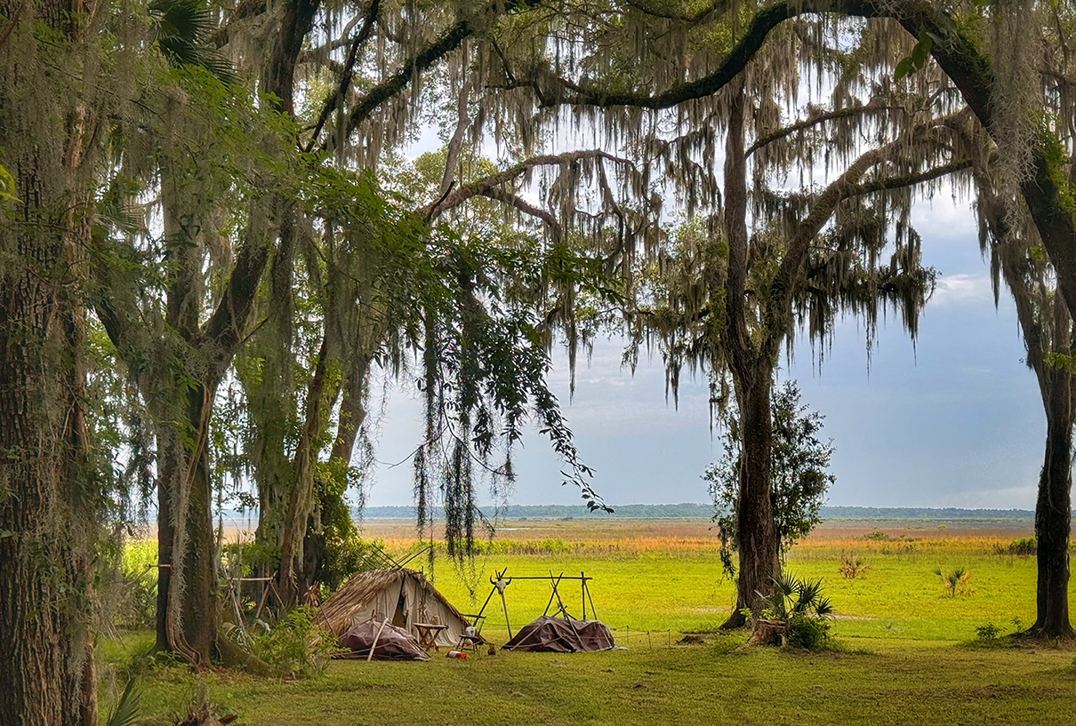 Photo 4: The Paynes Prairie Preserve State Park celebrates the
250th Anniversary of William Bartram's visit to the prairie with
events and re-enactments.
Photo 4: The Paynes Prairie Preserve State Park celebrates the
250th Anniversary of William Bartram's visit to the prairie with
events and re-enactments.
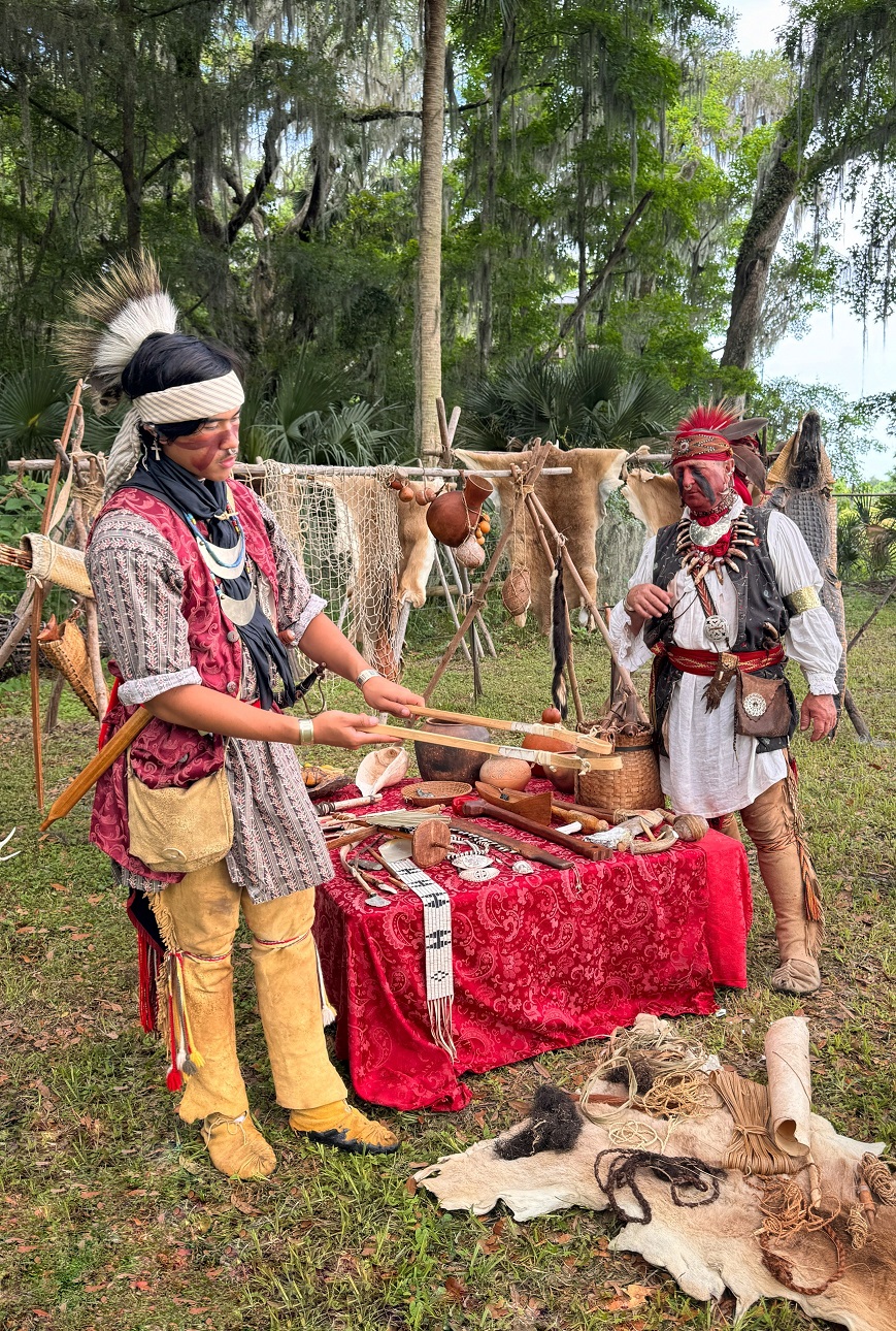 Photo 5: The Paynes Prairie Preserve State Park celebrates the
250th Anniversary of William Bartram's visit to the prairie with
events and re-enactments.
Photo 5: The Paynes Prairie Preserve State Park celebrates the
250th Anniversary of William Bartram's visit to the prairie with
events and re-enactments.
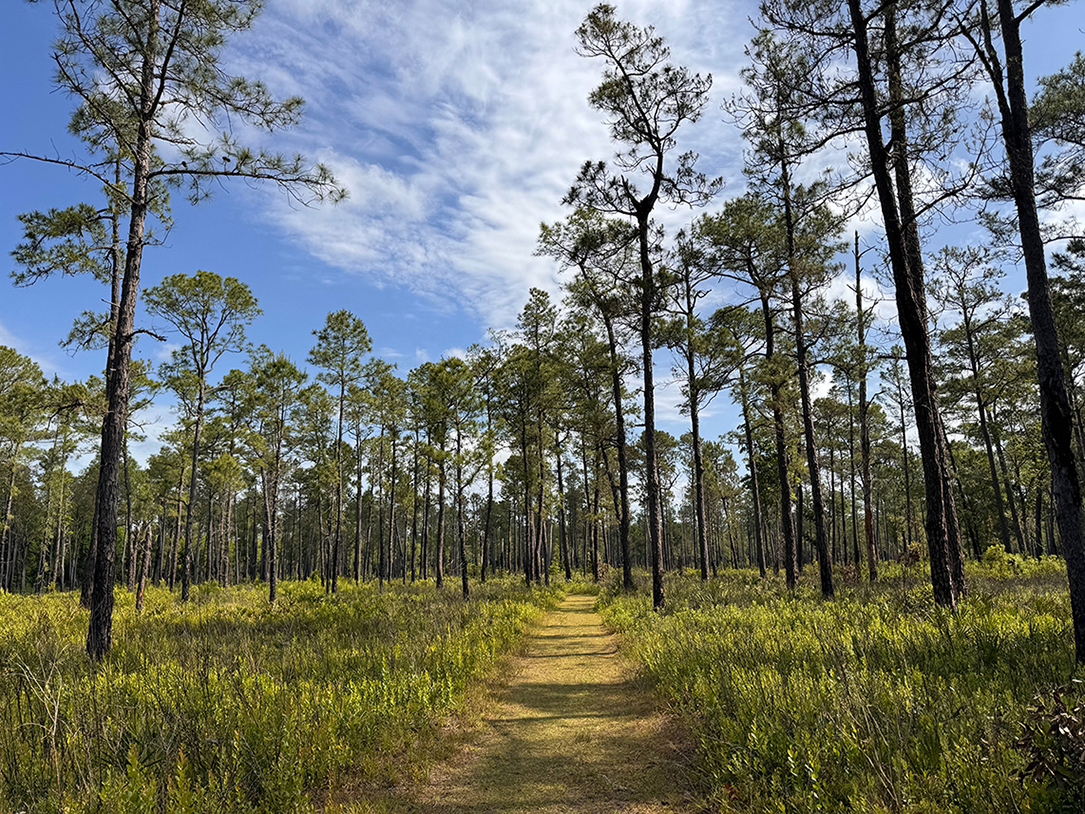 Photo 6: The Vicinity of Payne's Town along the Chacala Trail
in Paynes Prairie Preserve State Park. P Marlin 2024
Photo 6: The Vicinity of Payne's Town along the Chacala Trail
in Paynes Prairie Preserve State Park. P Marlin 2024
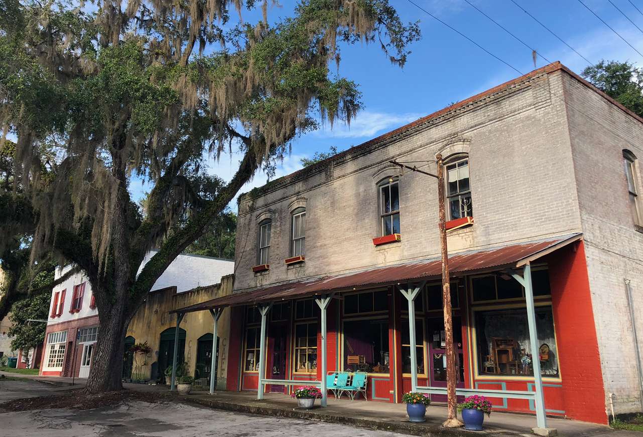 Photo 7: The Alachua Trail (NE Cholokka Boulevard) through Micanopy. P Marlin 2024
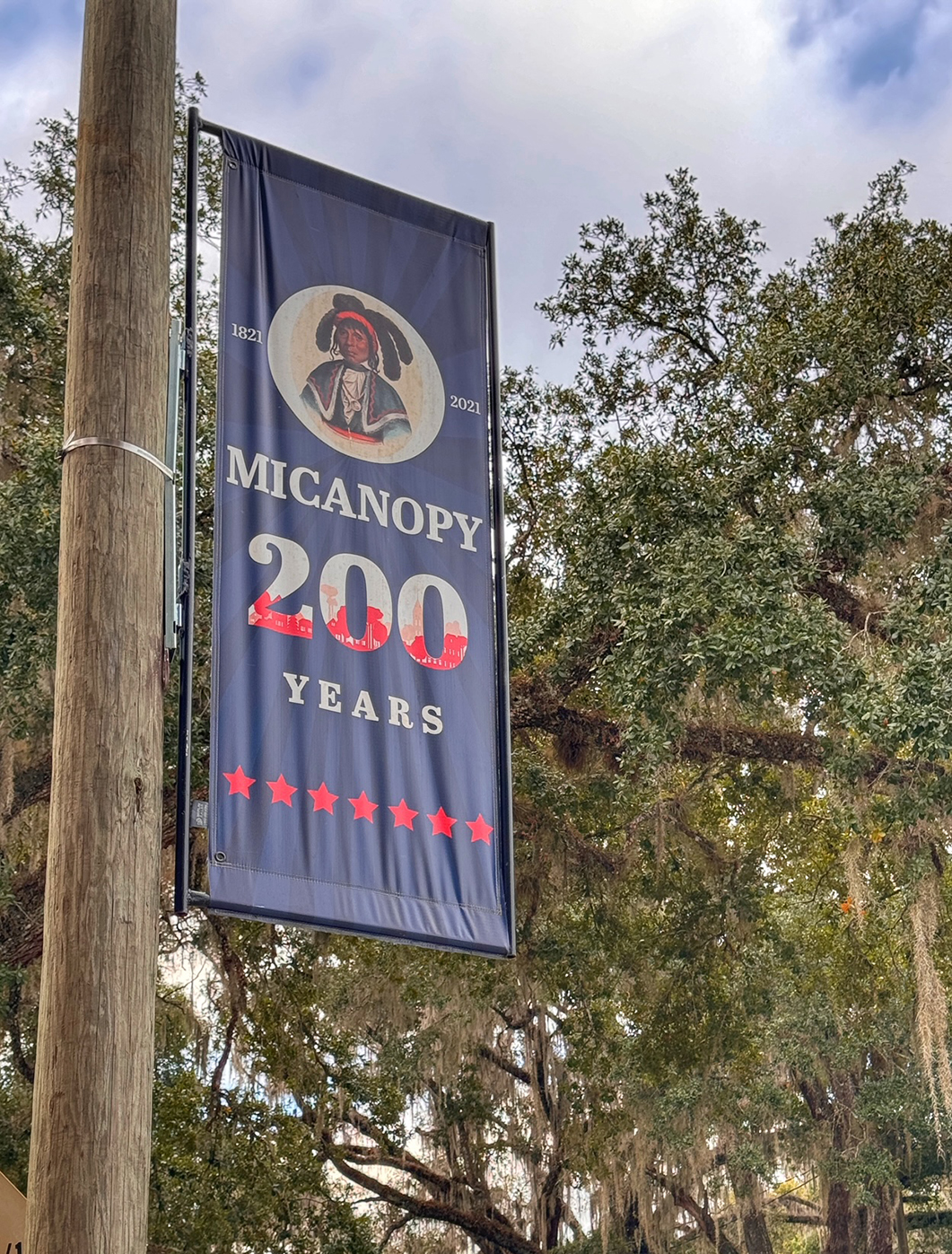 Photo 8: Micanopy. P Marlin 2024
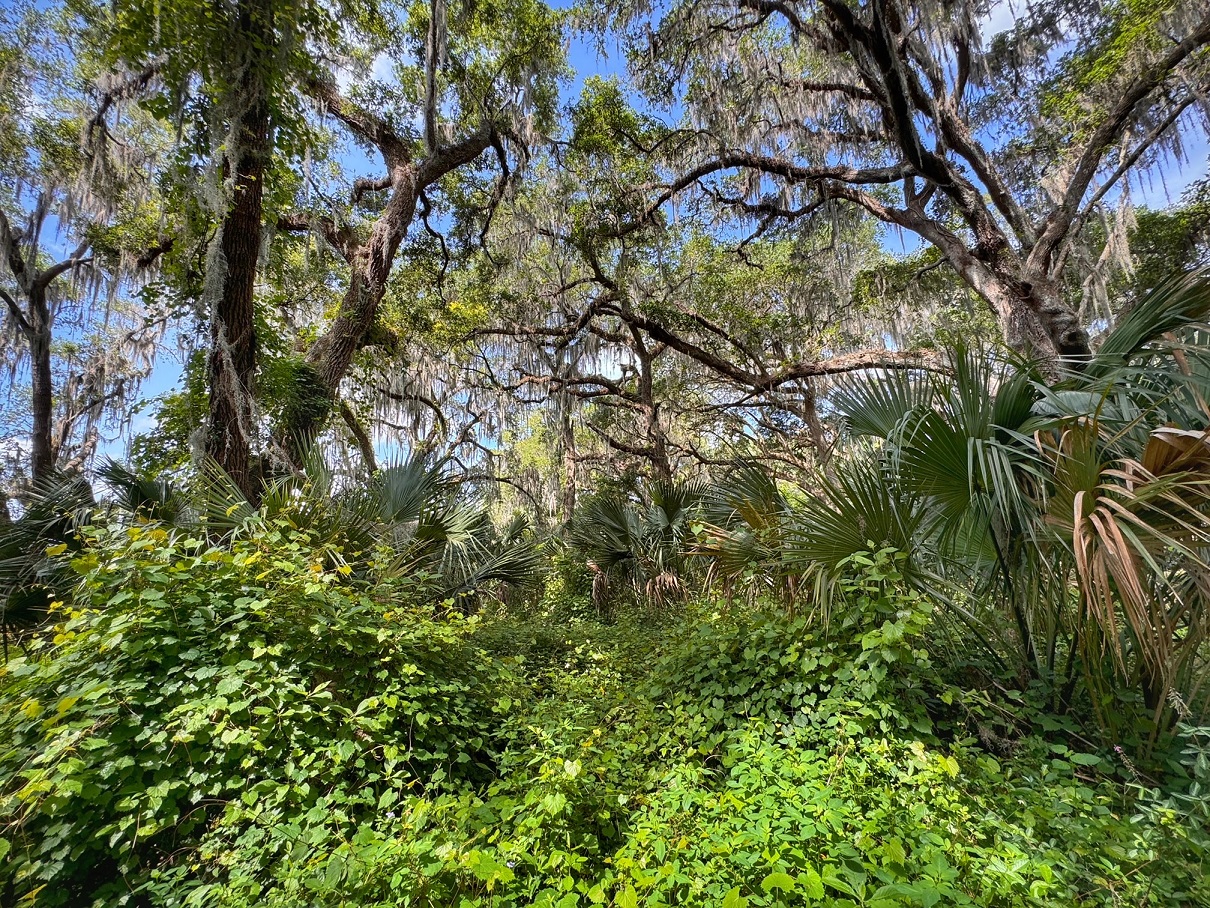 Photo 9: Mesic Hammocks located at
Lake Tuscawilla. In the February 16, 1839
edition of Niles' Weekly Register, Florida
Governor Richard Keith Call observed that the Seminole
"finds security, food, and shelter in every hammock and in every swamp."
P Marlin 2024
Photo 9: Mesic Hammocks located at
Lake Tuscawilla. In the February 16, 1839
edition of Niles' Weekly Register, Florida
Governor Richard Keith Call observed that the Seminole
"finds security, food, and shelter in every hammock and in every swamp."
P Marlin 2024
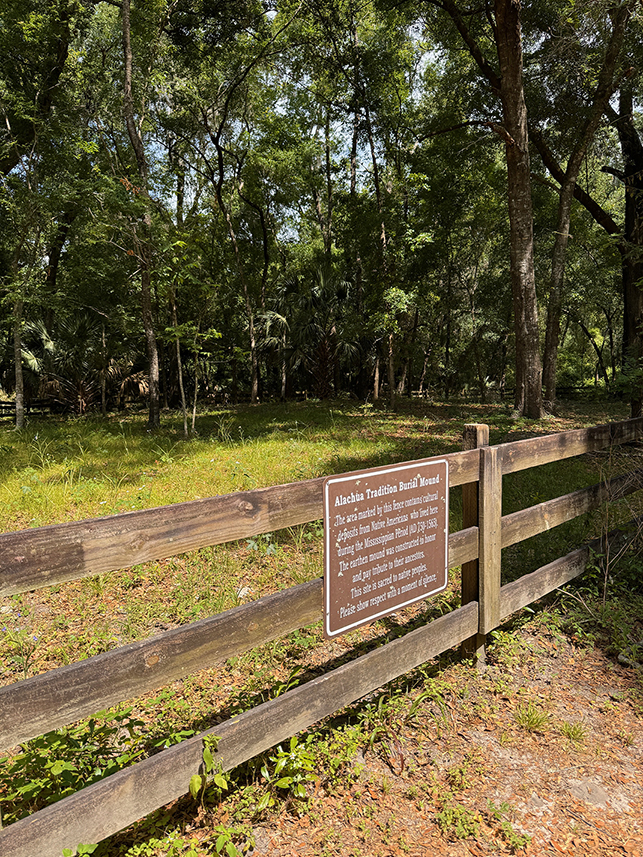 Photo 10: A Native American burial ground at Micanopy Native American Heritage Park.
Tuscawilla Preserve P Marlin 2024
Photo 10: A Native American burial ground at Micanopy Native American Heritage Park.
Tuscawilla Preserve P Marlin 2024
VANDERHILL: "The reconstruction of a trail abandoned or converted to other uses long ago proved to be difficult and time-consuming, for information was fragmentary, map coverage was highly disparate, and in situ evidences were inferential rather than direct. Careful analysis of diverse source materials, however, supplemented by field inspection, ultimately yielded an image of the Alachua Trail which, though imperfect, could be shown on a small scale map with considerable confidence.
Apparently perception of the trail as a continuous entity had faded before the close of the nineteenth century, although local recognition of route segments continued into the present century. It is remarkable, in view of the changing circulation patterns of recent times, that many stretches of the old Indian route are in some kind of use today. Further, it is worthy of note that certain features introduced along the route of the trail at various times, bridge points, townsites, and cemeteries, for example, remain fixed in the contemporary landscape. Numerous vestiges of the Alachua Trail route offer accessible sites which seem suitable for the erection of historical markers, and appropriate commemoration of this ancient Indian pathway is strongly recommended.
---------------In the 1970s, Burke Vanderhill lacked the invaluable aid of the internet to research the Alachua Trail. Instead, he likely spent countless hours in the Florida Archives in Tallahassee, searching through maps, periodicals, and various documents to gather information. Without Vanderhill's persistence, however, it's doubtful that the Alachua Trail would have been acknowledged or remembered in present day.
Embarking on the Alachua Trail was an unforgettable experience. The historical knowledge and insights gained from the journey proved to be immensely gratifying. Moreover, I delighted in exploring both antique and contemporary maps. Inspired by Vanderhill's suggestion, my goal is to see a historical landmark erected along Country Road 234 near Windsor. That endeavor aims to honor Vanderhill's dedication and the enduring legacy of the Alachua Trail.
This blog is dedicated to my first grandchild, Manny, who grew in the womb over the same period it took me to write this blog.
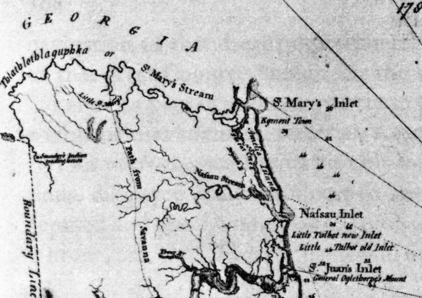 "Path from Savanna" on unresourced map.
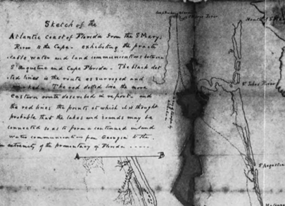 The 1825 Gadsden map of this area shows a bifurcation of the route
from Coleraine at a point near present-day Hilliard, the west leg
labeled "to Bay of Tampa by Alachua." This map originally accompanied
a letter from James Gadsden to General Jesup, August 20, 1825,
The 1825 Gadsden map of this area shows a bifurcation of the route
from Coleraine at a point near present-day Hilliard, the west leg
labeled "to Bay of Tampa by Alachua." This map originally accompanied
a letter from James Gadsden to General Jesup, August 20, 1825,
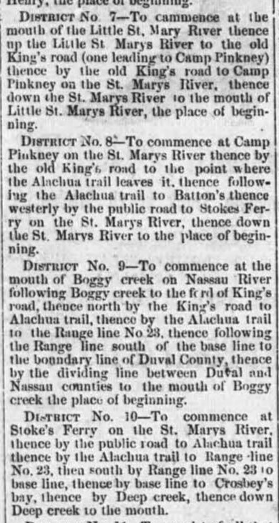 The Alachua Trail delineates electoral districts in Florida. The Fernandina Express October 30, 1880
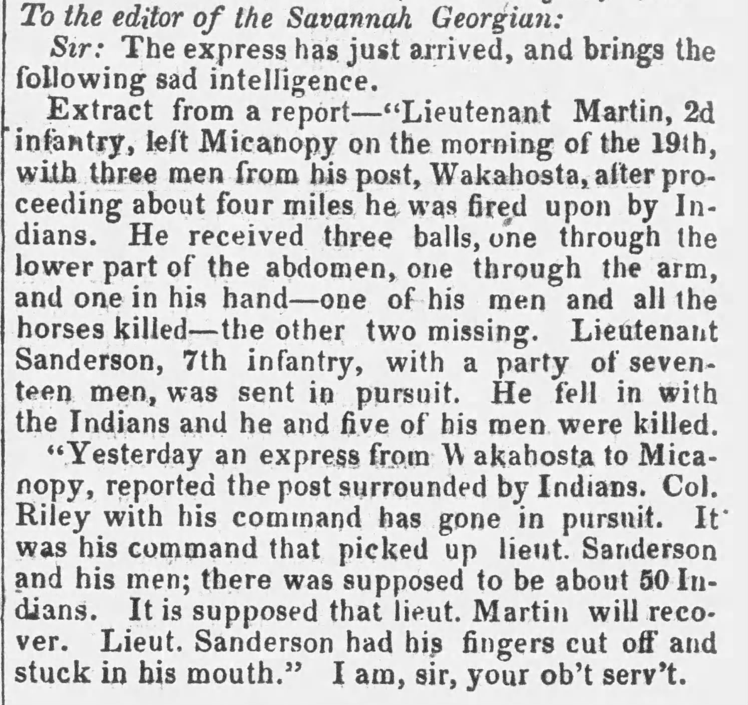 Niles' National Register June 6, 1840.
The following artwork and travel posters, based on the Alachua Trail and Paynes Prairie, are available for purchase and digital download at Savanna Blue Studio.
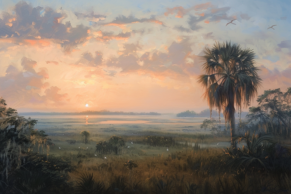 Paynes Prairie Sunrise. Available at
Savanna Blue Studio.
Paynes Prairie Sunrise. Available at
Savanna Blue Studio.
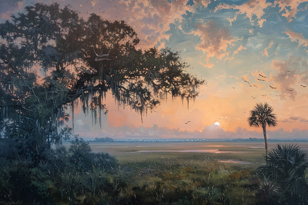 Paynes Prairie Twilight. Available at
Savanna Blue Studio.
Paynes Prairie Twilight. Available at
Savanna Blue Studio.
ALACHUA TRAIL POSTERS |
|
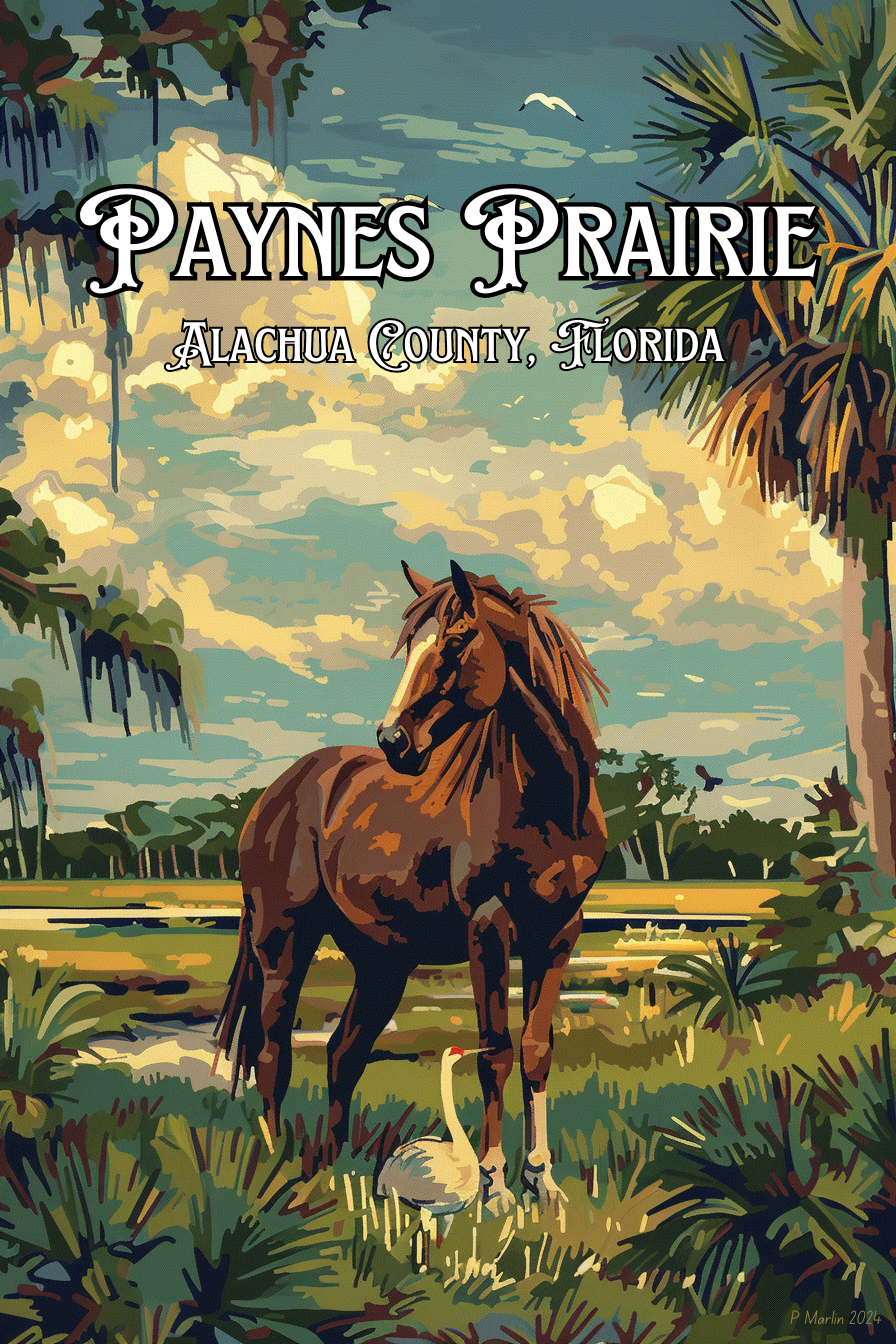 Paynes Prairie. Available at
Savanna Blue Studio
Paynes Prairie. Available at
Savanna Blue Studio |
 Paynes Prairie. Available at
Savanna Blue Studio
Paynes Prairie. Available at
Savanna Blue Studio |
 Paynes Prairie. Available at
Savanna Blue Studio
Paynes Prairie. Available at
Savanna Blue Studio |
 Paynes Prairie. Available at
Savanna Blue Studio
Paynes Prairie. Available at
Savanna Blue Studio |
 Alachua Trail Overlook. Available at
Savanna Blue Studio
Alachua Trail Overlook. Available at
Savanna Blue Studio |
 Alligator Newnans Lake. Available at
Savanna Blue Studio /i>
Alligator Newnans Lake. Available at
Savanna Blue Studio /i> |
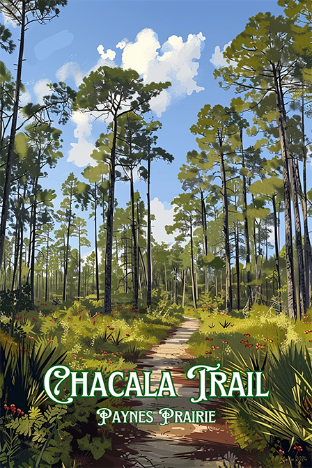 Chacala Trail. Available at
Savanna Blue Studio
Chacala Trail. Available at
Savanna Blue Studio |
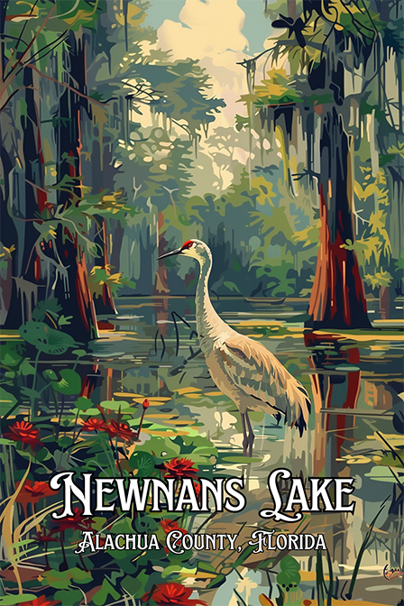 Sandhill Crane Newnans Lake. Available at
Savanna Blue Studio
Sandhill Crane Newnans Lake. Available at
Savanna Blue Studio |
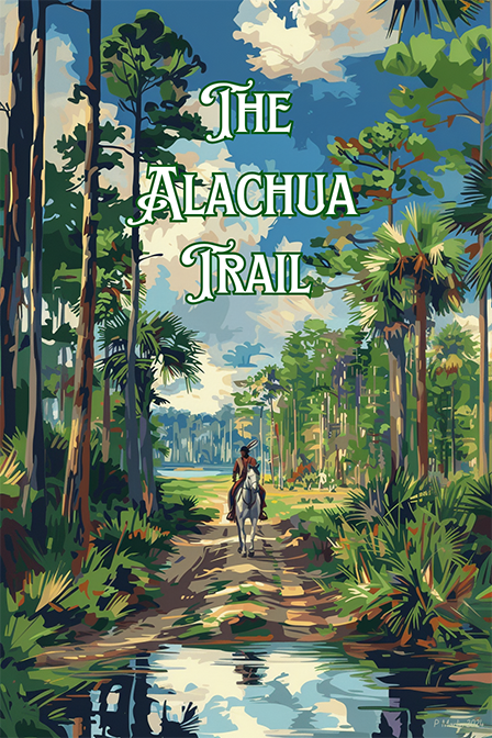 The Alachua Trail. Available at
Savanna Blue Studio
The Alachua Trail. Available at
Savanna Blue Studio
|
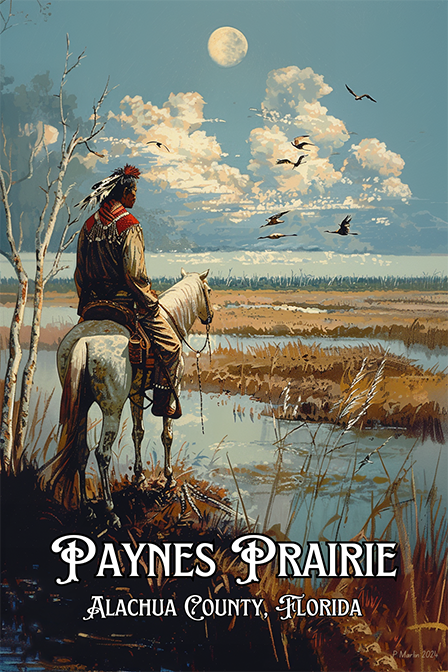 Paynes Prairie. Available at
Savanna Blue Studio
Paynes Prairie. Available at
Savanna Blue Studio |
Baker, Henry A. " Spanish Ranching and the Alachua Sink Site: A Preliminary Report." The Florida Anthropologist.
Blakney-Bailey, Jane Anne. 2007. An Analysis of Historic Creek and Seminole Settlement Patterns, Town Design, and Architecture: The Paynes Town Seminole Site, A Case Study.
Bushnell, Amy. 1978. The Menéndez Marquéz Cattle Barony at La Chua and the Determinants of Economic Expansion in Seventeenth- Century Florida." The Florida Historical Quarterly.
Covington, James. 1993 The Seminoles of Florida.
Cusick, James G. The Other War of 1812: The Patriot War and the American Invasion of Spanish East Florida. Gainesville: University Press of Florida, 2003.
Goff, John H. "Short Studies of Georgia Place Names." Georgia Mineral Newsletter VIII (1955): 23.
Gray, James M. Fort Harllee [Research File].
Hanna, Kathryn Abbey. 1948 Florida: A Land of Change 1948.
Location of Indian War Forts Described in Military History. The Tampa Tribune, July 19, 1953.
Highland in the newspaper. The Telegraph, January 21, 1968.
Marotti, Frank, Jr. Edward M. Wanton and the Settling of Micanopy.
Patrick, Rembert. Florida Fiasco: Rampant Rebels on the Georgia-Florida Border, 1810-1815. Athens: University of Georgia Press, 1954.
Porter, Kenneth W. The Cowkeeper Dynasty of the Seminole Nation. 1951.
Porter, Kenneth W. The Founder of the Seminole Nation Secoffee or Cowkeeper. The Florida Historical Quarterly 27, no. 4 (Apr. 1949): 362-384.
Pressly, Paul M. 2018. The Many Worlds of Titus: Marronage, Freedom, and the Entangled Borders of Lowcountry Georgia and Spanish Florida. The Journal of Southern History.
Patrick, Rembert. 1954. Florida Fiasco. The University of Georgia Press.
Vanderhill, Burke. The Alachua Trail: A Reconstruction. Florida Historic Quarterly, 1977.
Vanderhill, Burke. Road to St. Mary's. Florida Historic Quarterly.
Vignoles, Charles Blacker. Observations upon the Floridas.
Bartram, William. Travels of William Bartram. Edited by Mark Van Doren.