
Pam Hawley Marlin October 2024
The Lincoln Highway from Pine Bluffs, Wyoming to Kimball, Nebraska
The golden rays of the setting sun stretched across the open prairie as we drove east from Cheyenne, Wyoming, toward the small community of Pine Bluffs located along the Wyoming-Nebraska border. The ultimate destination was the Black Hills of South Dakota, but for the moment, we had the pleasure of driving a short stretch of the historic Lincoln Highway.
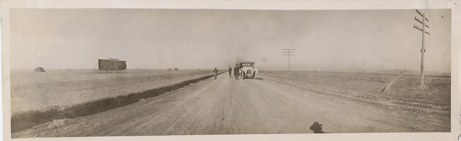 The Lincoln Highway in Cheyenne County, west of Bushnell, Nebraska
University of Michigan Digital Archives
The Lincoln Highway in Cheyenne County, west of Bushnell, Nebraska
University of Michigan Digital Archives
The Lincoln Highway, established in 1913, holds the distinction of being the first transcontinental highway in the United States. Stretching from Times Square in New York City to Lincoln Park in San Francisco, it spanned 13 states, connecting coast to coast. Although certain sections are better maintained, stretches of the highway remain visible between Pine Bluffs, Wyoming, and Kimball, Nebraska, offering a glimpse into its historic past.
 A short segment of the original Lincoln Highway map from Pine Bluff, Wyoming to Kimball, Nebraska.
This Lincoln Highway map reprents several generations of the original highway.
Lincoln Highway Association
A short segment of the original Lincoln Highway map from Pine Bluff, Wyoming to Kimball, Nebraska.
This Lincoln Highway map reprents several generations of the original highway.
Lincoln Highway Association
Using the Lincoln Highway map shown above, we joined the original Lincoln Highway at the I-80 service road also known as U.S. Highway 30 at Pine Bluffs, Wyoming. Heading east, our journey continued on Highway 30 until we reached Bushnell, Nebraska, where the Lincoln Highway briefly diverges onto 1st Street through town. After passing through Bushnell, we returned to Highway 30 and headed east to Kimball, Nebraska, and our final Lincoln Highway stops.
The following photos (including then and now perspectives) represent a twenty-two mile segment of the Lincoln Highway from Pine Bluffs, Wyoming to Kimball, Nebraska.
Our first stop along the original Lincoln Highway was Pine Bluffs, at the Wyoming-Nebraska border. Today, the border crossing is marked by abandoned buildings and gas pumps, remnants of a busier era. The once-proud "State Line" sign that marked the Lincoln Highway crossing is long gone.
Pine Bluffs, originally known as "Rock Ranch," began to take shape with the arrival of the Union Pacific Railroad in 1868. Cattle herds traveled along the Texas Trail, which passed through Pine Bluffs, and the town soon became the largest cattle shipping point on the Union Pacific Railroad.
 "Pete's Service since 1924" located along the original Lincoln Highway in Pine Bluffs, Wyoming. P. Marlin 2024
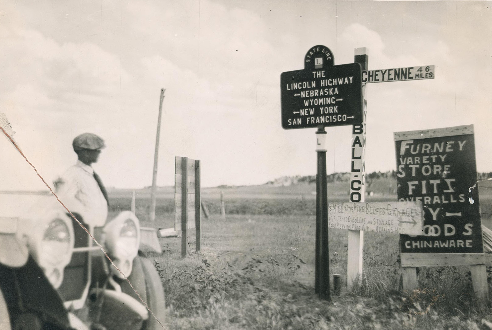 An original photo of the Lincoln Highway at the Wyoming - Nebraska border.
Notice the old sign that says, "1/2 mile to the Pine Bluff's Garage."
The "State Line" Lincoln Highway sign is no longer at this site.
University of Michigan Digital Archives
An original photo of the Lincoln Highway at the Wyoming - Nebraska border.
Notice the old sign that says, "1/2 mile to the Pine Bluff's Garage."
The "State Line" Lincoln Highway sign is no longer at this site.
University of Michigan Digital Archives
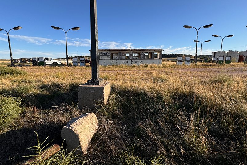 The Lincoln Highway at the Wyoming - Nebraska border in 2024. Abandoned
buildings and gas pumps mark a century of transitions.
P. Marlin 2024
The Lincoln Highway at the Wyoming - Nebraska border in 2024. Abandoned
buildings and gas pumps mark a century of transitions.
P. Marlin 2024
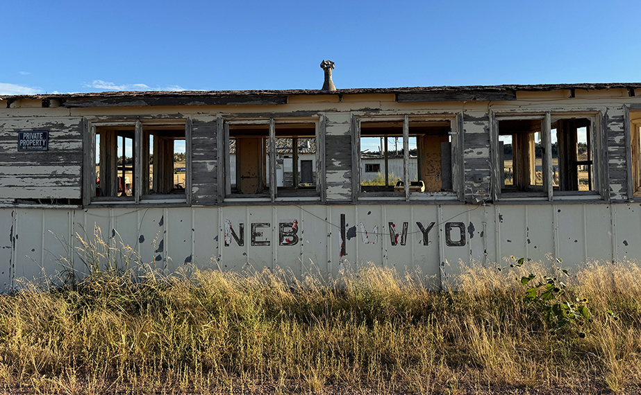 A close up of the building that straddles the Wyoming and Nebraska border.
P. Marlin 2024
A close up of the building that straddles the Wyoming and Nebraska border.
P. Marlin 2024
 A close up of abandoned buildings and gas pumps.
P. Marlin 2024
A close up of abandoned buildings and gas pumps.
P. Marlin 2024
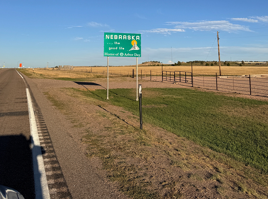 Entering Nebraska on the Lincoln Highway east of Pine Bluffs.
P. Marlin 2024
Entering Nebraska on the Lincoln Highway east of Pine Bluffs.
P. Marlin 2024
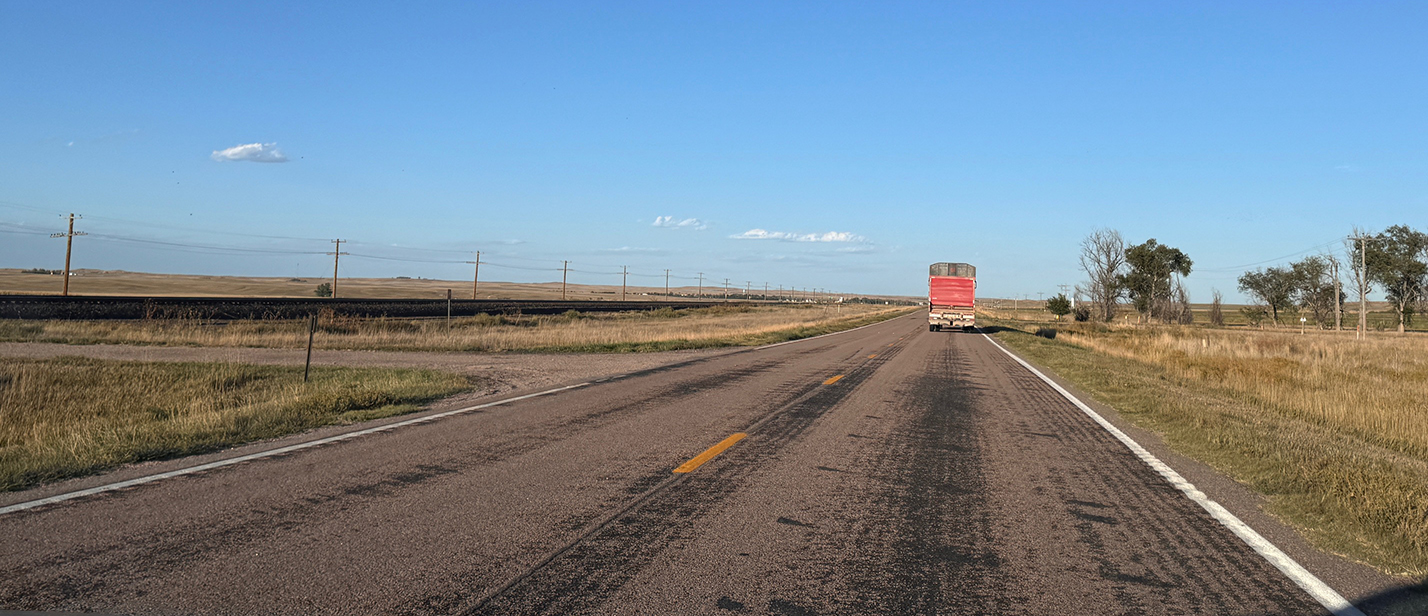 Highway 30 / Lincoln Highway parallels a railroad track east of Pine Bluffs, Wyoming.
P. Marlin 2024
Highway 30 / Lincoln Highway parallels a railroad track east of Pine Bluffs, Wyoming.
P. Marlin 2024
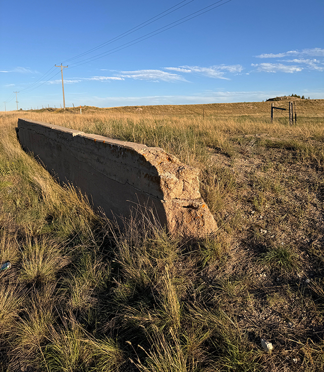 This may be the remnant of a
concrete spillway or Lincoln Highway bridge located between Pine Bluffs, Wyoming, and Bushnell, Nebraska
along Highway 30 / Lincoln Highway.
P. Marlin 2024
This may be the remnant of a
concrete spillway or Lincoln Highway bridge located between Pine Bluffs, Wyoming, and Bushnell, Nebraska
along Highway 30 / Lincoln Highway.
P. Marlin 2024
From Pine Bluffs, our journey continued east toward Bushnell, Nebraska, where the original Lincoln Highway diverges onto 1st Street through the town. Discovering remnants of the historic highway in Bushnell became easier thanks to a local resident who maintains an original Lincoln Highway bridge in the traditional colors of red, white, and blue, and the iconic "L."
Bushnell was founded in 1867, during the westward expansion of settlers and the growth of the railroad system. The village was named after Cornelius S. Bushnell, a prominent financier who helped fund the construction of the USS Monitor, an ironclad warship used by the Union during the American Civil War. The town’s establishment was closely linked to the development of the Union Pacific Railroad, which played a vital role in its growth.
From Bushnell, the original "first generation" Lincoln Highway headed east toward Kimball, running north of the railroad tracks and Highway 30. Today, that road no longer exists, as the original route now extends across private property.
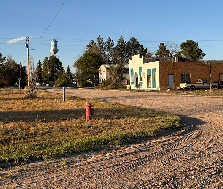 Bushnell, Nebraska photographed from the original Lincoln Highway
(1st Street).
P. Marlin 2024
Bushnell, Nebraska photographed from the original Lincoln Highway
(1st Street).
P. Marlin 2024
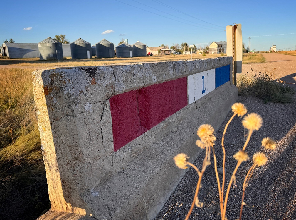 An original Lincoln Highway bridge (north side) on 1st street in Bushnell, Nebraska,
showcases its traditional colors of red, white, and blue and the iconic "L."
P. Marlin 2024
An original Lincoln Highway bridge (north side) on 1st street in Bushnell, Nebraska,
showcases its traditional colors of red, white, and blue and the iconic "L."
P. Marlin 2024
 An original Lincoln Highway bridge (south side) on 1st street in Bushnell, Nebraska,
showcases its traditional colors of red, white, and blue and the iconic "L."
Our rental car is on the original Lincoln Highway in the distance.
P. Marlin 2024
An original Lincoln Highway bridge (south side) on 1st street in Bushnell, Nebraska,
showcases its traditional colors of red, white, and blue and the iconic "L."
Our rental car is on the original Lincoln Highway in the distance.
P. Marlin 2024
 A photo of me standing on the original Lincoln Highway at the bridge
crossing in Bushnell, Nebraska. D. Marlin 2024
A photo of me standing on the original Lincoln Highway at the bridge
crossing in Bushnell, Nebraska. D. Marlin 2024
 A Lincoln Highway marker along 1st Street in Bushnell, Nebraska. P. Marlin 2024
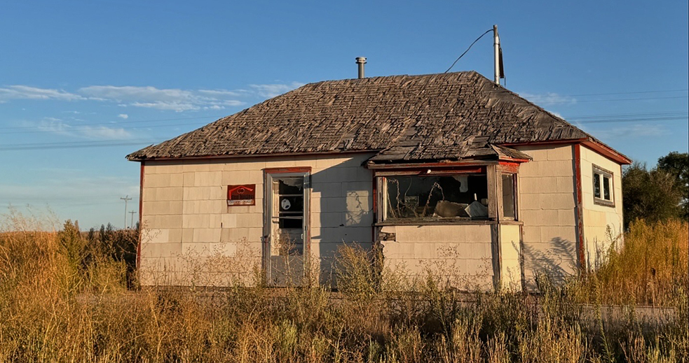 An abandoned building along the original Lincoln Highway (1st Street) in Bushnell, Nebraska.
P. Marlin 2024
An abandoned building along the original Lincoln Highway (1st Street) in Bushnell, Nebraska.
P. Marlin 2024
 An abandoned building along the original Lincoln Highway (1st Street) in Bushnell, Nebraska.
P. Marlin 2024
An abandoned building along the original Lincoln Highway (1st Street) in Bushnell, Nebraska.
P. Marlin 2024
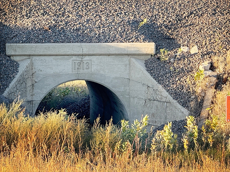 A culvert marked 1913 on the original highway.
P. Marlin 2024
A culvert marked 1913 on the original highway.
P. Marlin 2024
Leaving Bushnell, we traveled on Highway 30 toward Kimball as the original Lincoln Highway continued to our north. West of Kimball, the original Lincoln Highway transitions into what is now Flying W Road. Flying W Road then merges with Highway 30 at a train overpass just west of Kimball (photos below). At Kimball, the Lincoln Highway becomes W 1st Street until it reconnects with Highway 30 in downtown Kimball.
Established in 1870, Kimball was initially named "Antelopeville" due to the abundance of antelope in the area. In 1885, the town was renamed Kimball in honor of Thomas Lord Kimball, a Union Pacific Railroad official. The town's growth was closely tied to the expansion of the Union Pacific Railroad, which made Kimball a vital transportation and shipping point.
The arrival of the Lincoln Highway further boosted Kimball’s significance. The highway brought travelers, trade, and new opportunities for local businesses. The Wheat Growers Hotel, built in 1918 several blocks from the Lincoln Highway, was one of several landmarks that thrived during this period of increased traffic.
At Kimball, our journey turned north toward South Dakota, away from the Lincoln Highway.
 The original Lincoln Highway passes through a train underpass west of Kimball,
Nebraska. See today's view of the same location a century later in the photo below.
University of Michigan Digital Collections
The original Lincoln Highway passes through a train underpass west of Kimball,
Nebraska. See today's view of the same location a century later in the photo below.
University of Michigan Digital Collections
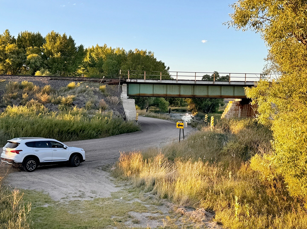 Today, the original Lincoln Highway passes through the train underpass
and heads toward today's Flying W Road west of Kimball, Nebraska, just as it did a century ago.
Originally, the route followed another path (still visible) leading to the underpass, but the road
has since shifted slightly, with a new bridge now spanning Lodgepole Creek (location of new photo perspective). P. Marlin 2024
Today, the original Lincoln Highway passes through the train underpass
and heads toward today's Flying W Road west of Kimball, Nebraska, just as it did a century ago.
Originally, the route followed another path (still visible) leading to the underpass, but the road
has since shifted slightly, with a new bridge now spanning Lodgepole Creek (location of new photo perspective). P. Marlin 2024
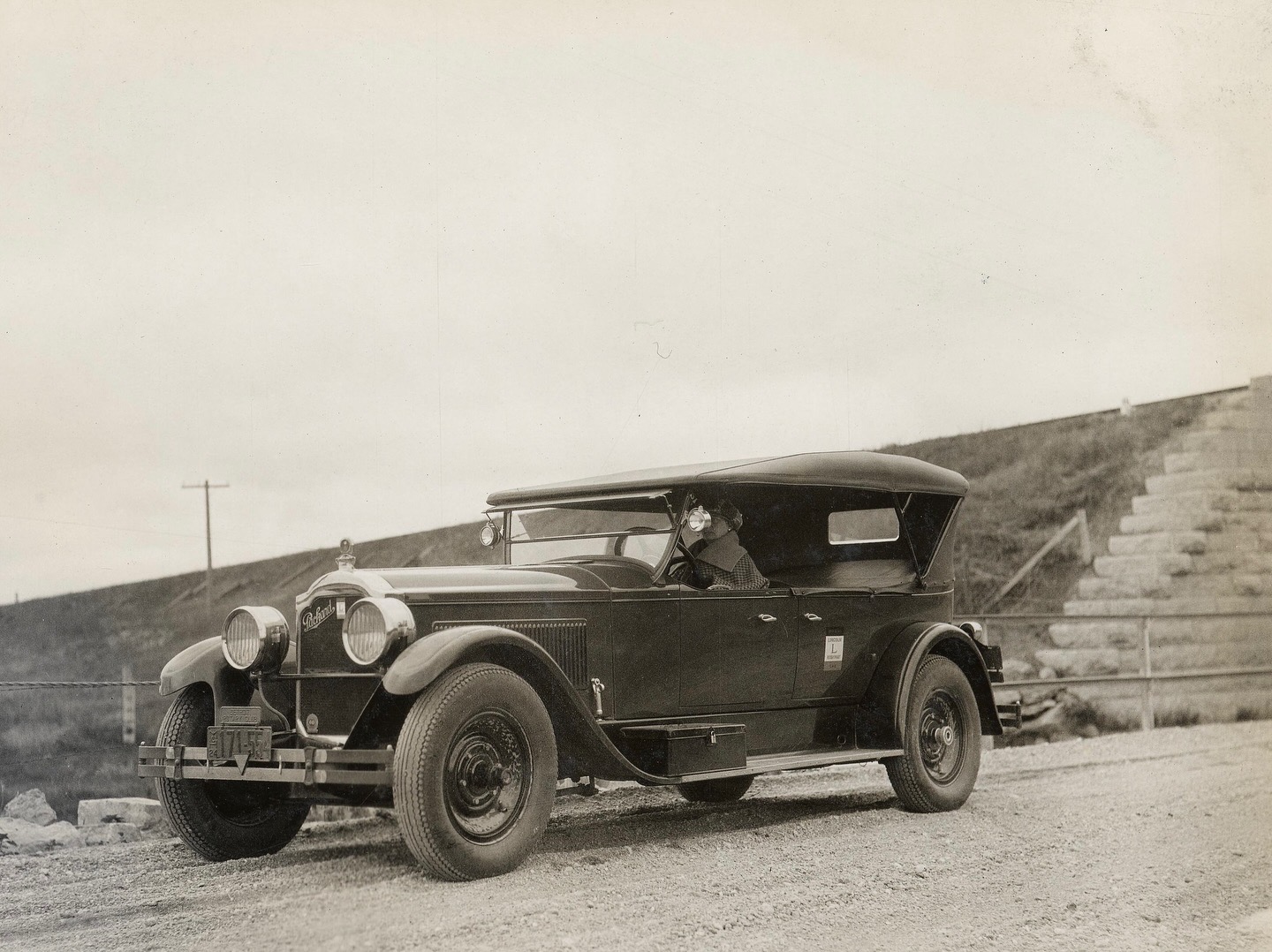 A Packard on the original Lincoln Highway at the same train underpass west of Kimball, Nebraska.
University of Michigan Digital Collections
A Packard on the original Lincoln Highway at the same train underpass west of Kimball, Nebraska.
University of Michigan Digital Collections
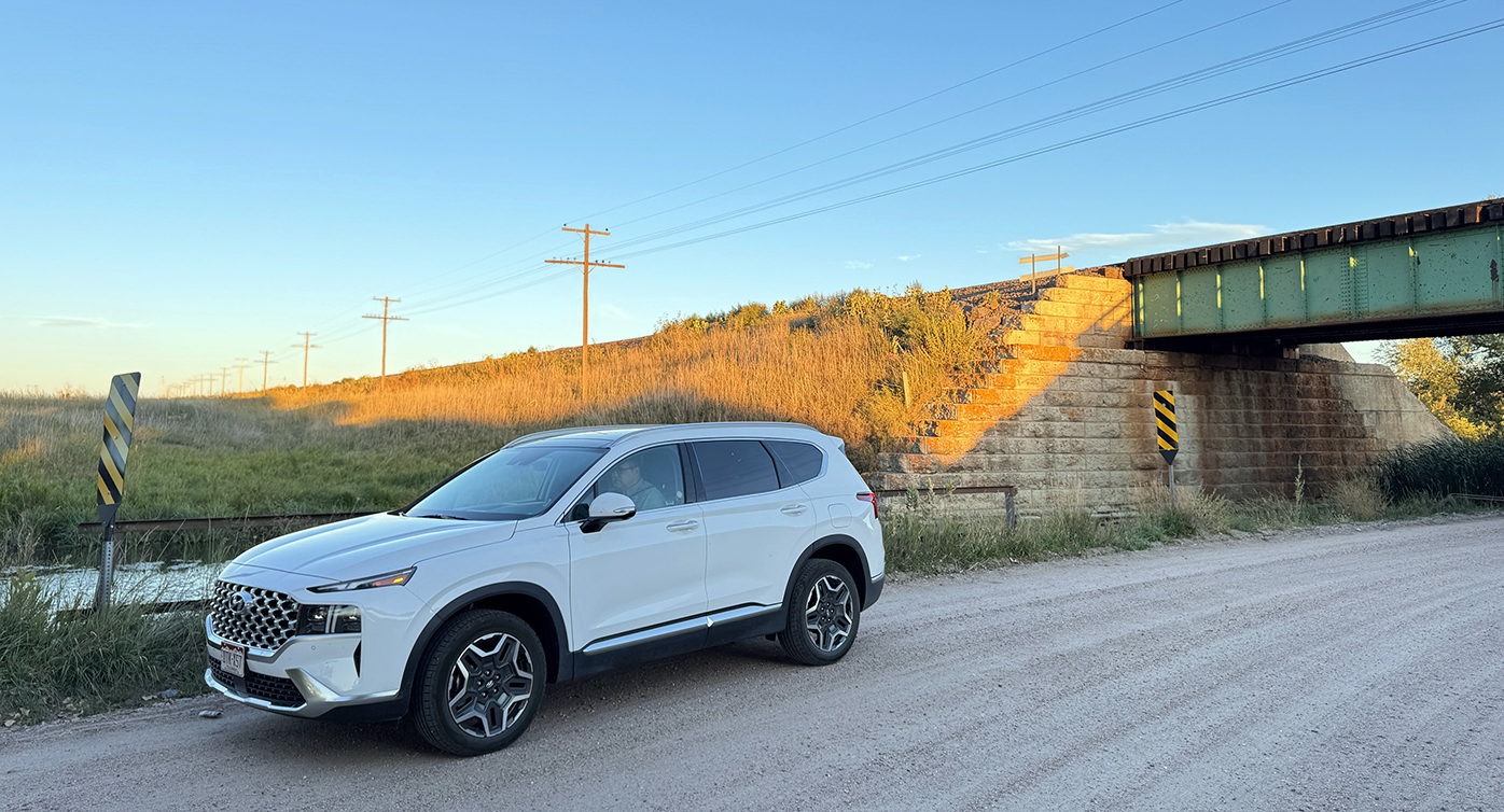 A modern day view of the original photo location above.
P. Marlin 2024
A modern day view of the original photo location above.
P. Marlin 2024
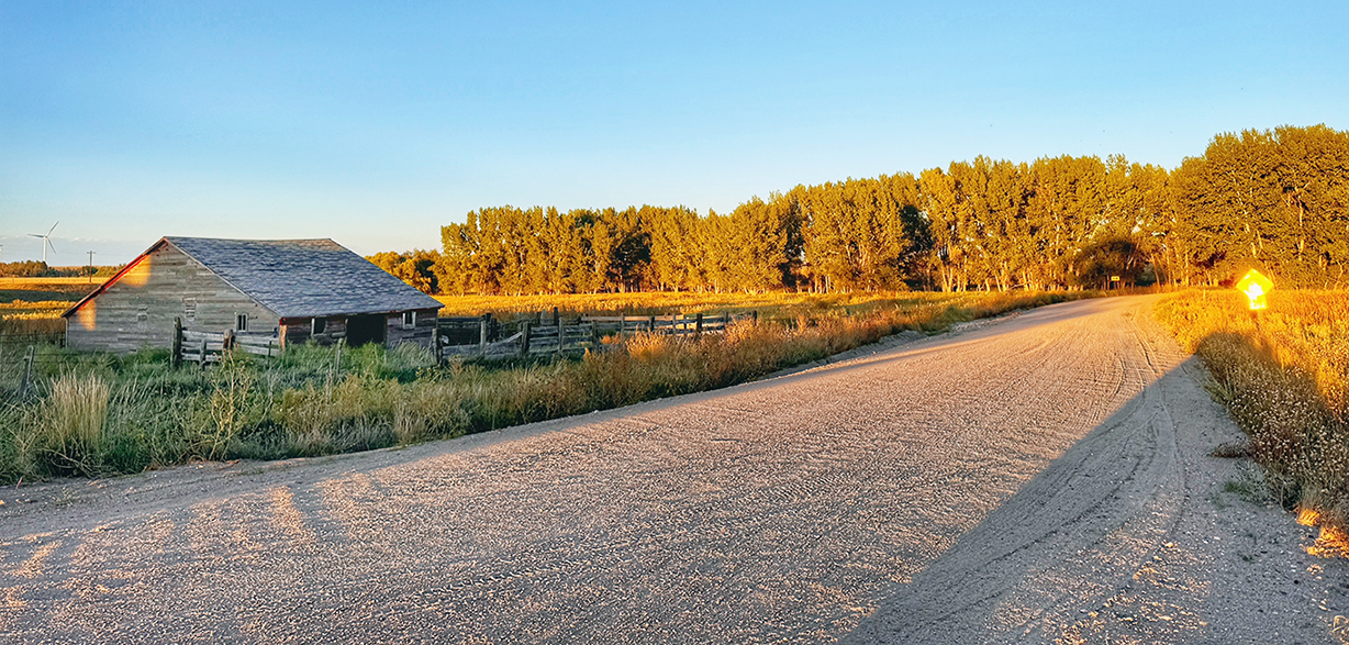 Flying W Road west of Kimball, Nebraska, continues west as the original Lincoln Highway. P. Marlin 2024
 The City Light and Power Plant building located on the Lincoln Highway in Kimball, Nebraska.
P. Marlin 2024
The City Light and Power Plant building located on the Lincoln Highway in Kimball, Nebraska.
P. Marlin 2024
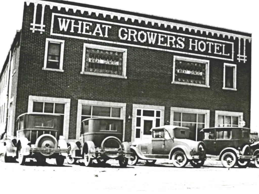 The Wheat Growers Hotel established in 1918. The Wheat Growers Hotel Photos
 The Wheat Growers Hotel in 2024. P Marlin 2024
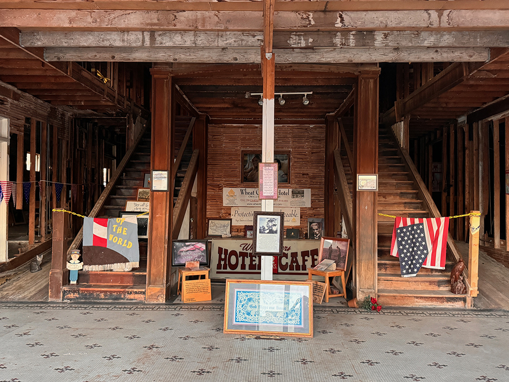 The Wheat Growers Hotel in 2024. P Marlin 2024
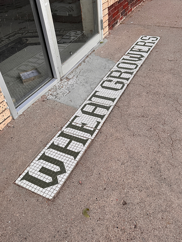 The Wheat Growers Hotel in 2024. P Marlin 2024